
A map of Homs in the 1960s, as remembered fifty years later by a Syrian living in Berlin. Click through the slideshow for translations. [Ayham Dalal]

“One of the very beautiful memories in my mind is the ticking sound of the Clock Tower at night. ... It had a sound like Big Ben. This is how we used to call it as kids. ... We heard it very clear; our house was less than 300 meters away.”
“Here was our barber. My dad used to give 25 Syrian pounds so he could cut the hair of the whole family the entire year. I still remember very clearly, how a police officer gave him a fine just for putting towels to dry outside in the street.”
“Here was a beautiful coffeehouse called The Beautiful View.”
“Here, I remember that there were small canals. We used to cross them over as kids.”
“The mayor removed the cemetery in front of the Khaled Ibn al-Waleed mosque and turned it into a beautiful garden. ... He was a good man.”
“Al-Dablan garden was a sports institute ... and 500 meters away there was Ramadan’s cannon. ... They used to stuff it with clothes. After they announced the breaking of the fast, we’d find the ground filled with scattered red clothes.”
“Sobhy Sho’aib [a famous art center] was an elementary school! I used to study there!”
“This was the house of Al-Droubi [an elite family] ... He was a communist; they killed him.”


“Homs was a very beautiful city,” said an older man, nicely dressed in a blazer and white shirt. He had left Syria for Berlin in the 1990s, two decades before I did. At tables around the room, my colleagues sat with others who had fled violence. As music by the Lebanese singer Fairuz played in the background, this man remembered the canals, the palm trees on Ghouta street, the rhythmic sound of the New Clock Tower, the cannon stuffed with clothes that announced the breaking of the fast in Ramadan. Memories poured forth, generating an image of the city that was recognizable, but different from the one I grew up in. I mapped the stories he told.
Memories poured forth, generating an image of the city different from the one I grew up in. I mapped the stories he told.
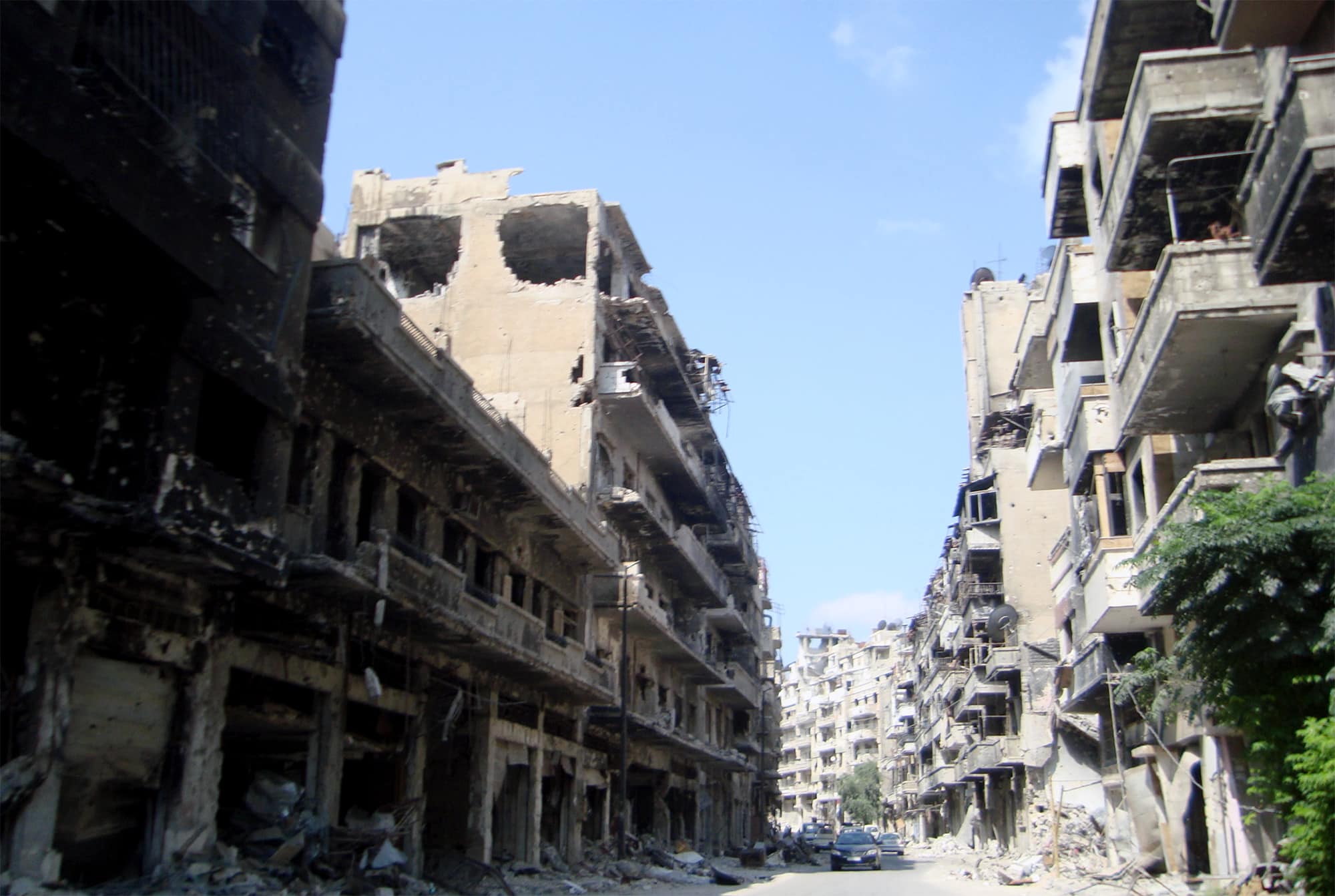
This was 2017, and the Syrian civil war was in its seventh year. Neither his Homs nor mine existed any longer. The last rebel neighborhood had been evacuated, and the city was controlled by Bashar al-Assad’s forces. Large areas had been leveled by mortar shells, and there were mass graves amid the rubble. In Berlin, I met with refugees to record memories of the city they had left behind. I wanted to understand how loss and trauma shaped their perceptions.
In 2024, the war ended abruptly with the collapse of al-Assad’s government. Transition leaders now talk of reconstruction. But whose Homs do they want to rebuild? As I listen to architects and planners imagine the future, I remember the lessons of that mapping workshop. Which spatial claims have power? Whose visions of the city will be realized? These questions form the foundation of urban studies, but in Syria for more than a half century they were not discussed.
Now we face the impossible challenge of reconstituting a country without understanding the different worldviews — indeed the different spatial realities — inhabited by the many sects and social groups. If we do not acknowledge these differences, we risk repeating the injustices that led to war in the first place.
Under the Assad regime (father and son) that ruled Syria starting in 1971, analysis of the social composition of cities was forbidden. Any research or documentary project would need official permission that could not be obtained. Simply asking the wrong questions could lead to imprisonment. Knowledge was something to be feared. The city grew rapidly during this period, and the population tripled, but many residents — new and old — did not have a strong sense of its cultural geography outside the borders of their own experience. We lived together, but we did not see the city through one another’s eyes.
Under the Assad regime, we lived together, but we did not see the city through one another’s eyes.
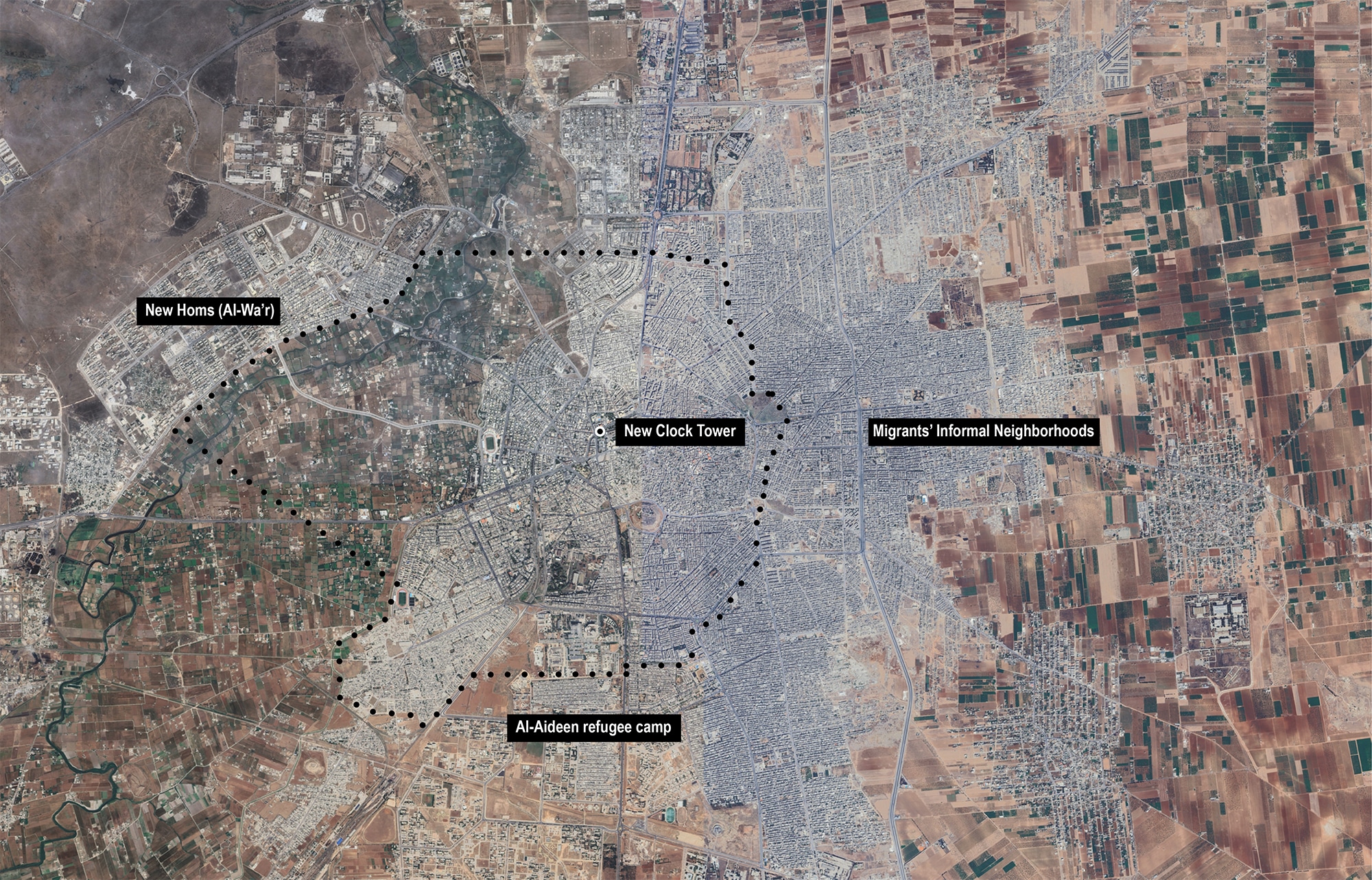
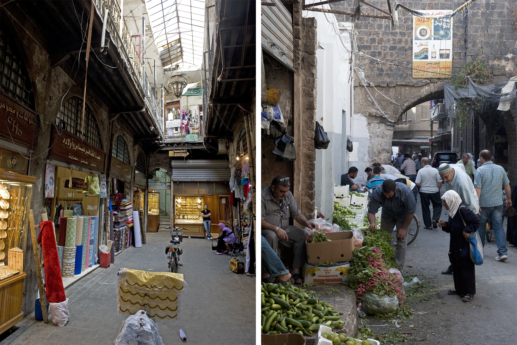
At the start of the war, Homs was the third largest city in Syria, home to about 800,000 people. In my mind’s map, 1 there is an Old City in the center inhabited by a Sunni majority and some Christians living near the covered market streets. To the west is an affluent district planned during the French Mandate after World War I, inhabited mostly by Sunni urban elites. And west of that is the wide valley of the Orontes River, where I grew up, in a neighborhood of apartment buildings established in the 1980s, with a mixed, working-class population. Directly north of the Old City, a public square connects the “Old Clock” at the edge of the market with the “New Clock,” donated by an expatriate who moved to Brazil. Known for its cubic form and white-and-black stone cladding — imitating the city’s traditional architecture — the New Clock is a widely recognized symbol of Homs, the center of our shared geography.


East of the center things get hazy. A 1943 map shows the urban development of east Homs contained to a one-kilometer band between the Old City and the historic mosque Khaled Ibn Al-Waleed. Sometime later in the century, under the Assad regime, the land around the villages of Zaidal and Fairuza filled in, sometimes haphazardly, with Alawaite migrants from the coast and Christians and Sunnis from rural areas. A United Nations report found twelve informal settlements occupying 59 percent of the city’s area. 2 The Sunni elites who lived west of the center did not have detailed knowledge of this new geography, but they understood the Alawites as a threat to their sovereignty — a sectarian division planned and enforced by the regime. 3
Leading up to the war, sectarian divisions materialized in an urban development project, ‘The Dream of Homs.’
In the years leading up to the war, and perhaps a precipitating cause of it, this threat materialized in the form of a neoliberal urban development project known as “The Dream of Homs.” In 2007, Mayor Eyad Ghazal announced his intention to spur economic growth through flagship architecture, similar to the reconstruction of Beirut’s Central District in the 1990s or Amman’s Abdali in the 2000s. 4 Eventually, the “Dream” morphed into a Haussmannian effort to beautify main streets and remake parts of the inner city without the involvement or consent of Sunni and Christian merchants, who would be evicted so that buildings could be demolished and the street plan rewritten. (As a recent graduate in architecture and urban planning, I joined a transnational office that worked on adjacent projects, including an ecotourism plan for Palmyra and public parks in Homs.)
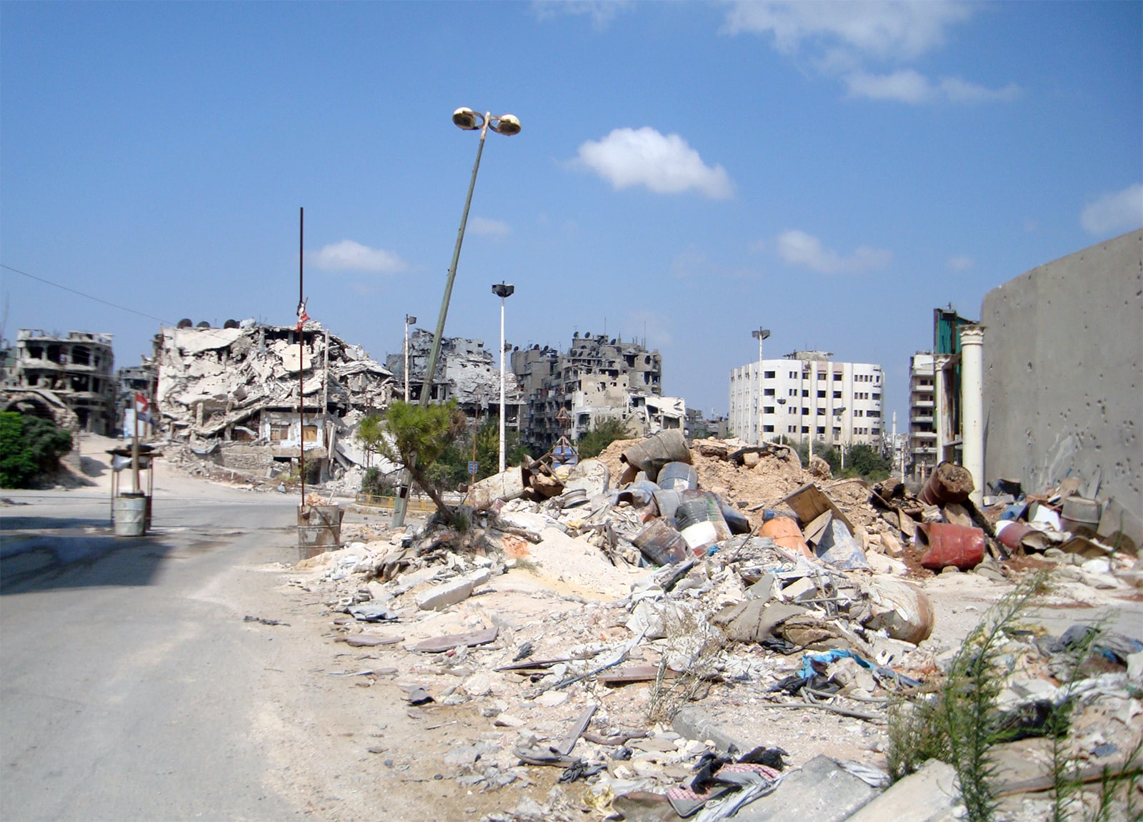
The few community meetings to discuss this plan did not allay the sense of injustice among people in the city center, and thousands gathered around the New Clock to call for an end to the Assad regime. 5 Later, when violence broke out, government forces targeted the urban poor in Sunni parts of Homs, leaving migrant neighborhoods alone. 6 Half of the city was destroyed and half of its people displaced. The plan to rewrite the streets of the Old City was unfinished, but the evacuation of its people was complete.
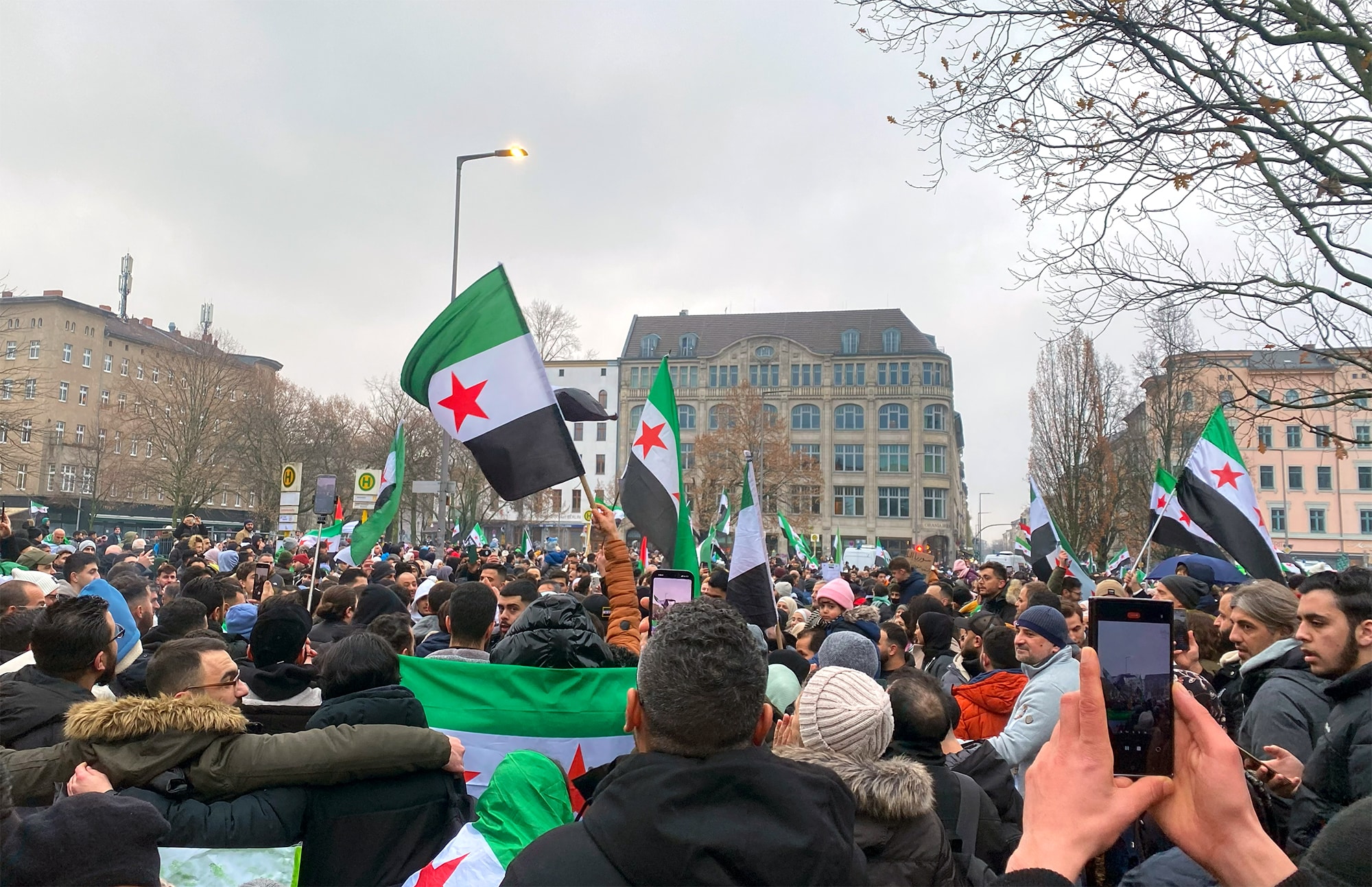
Over more than a decade of war, 14 million refugees fled the country or were internally displaced. By 2020, at least 800,000 Syrians were living in Germany, including about 60,000 in Berlin. 7
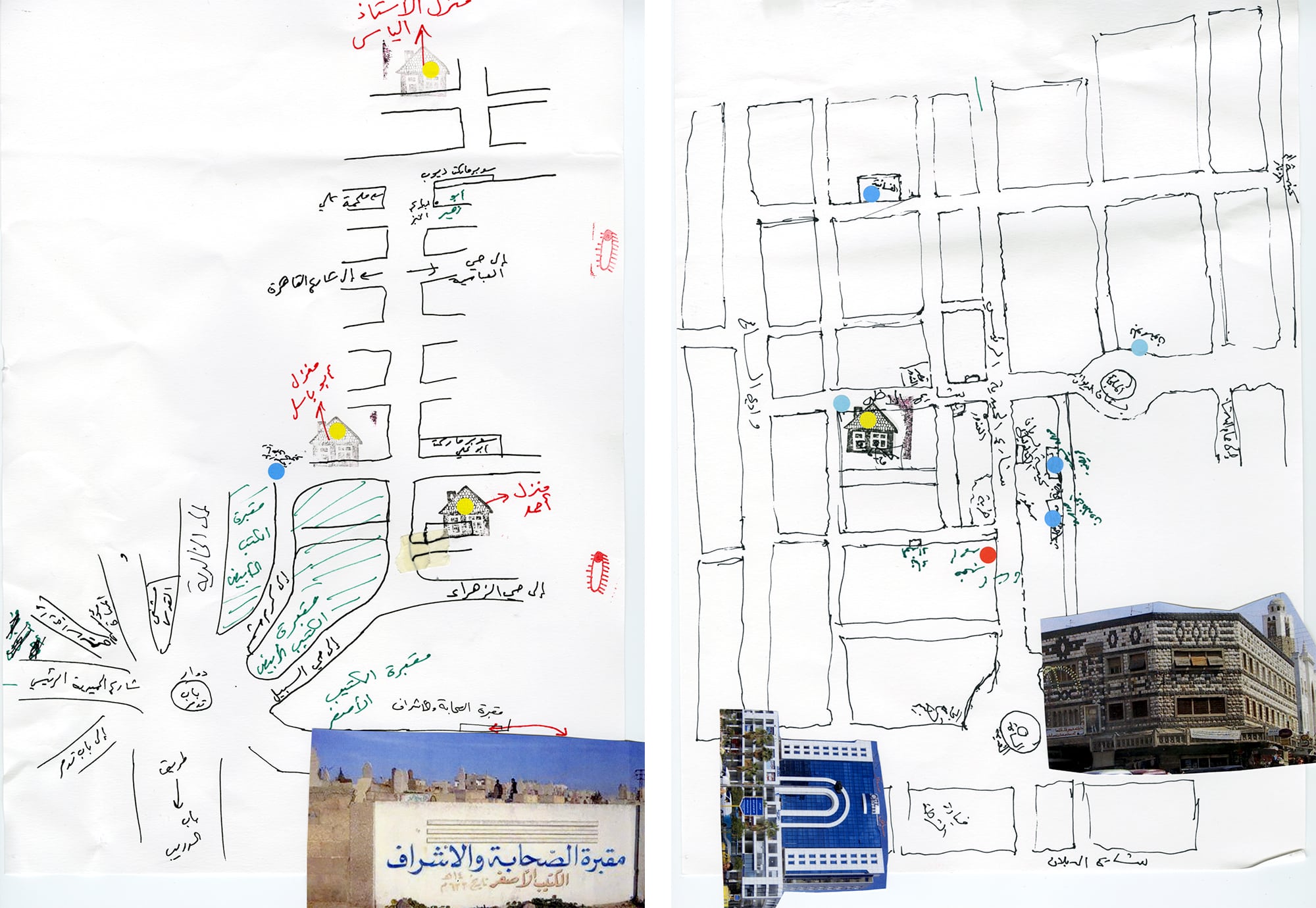
Sixteen men showed up to the Homs mapping workshop in 2017, the first in a series that I helped organize as a doctoral student. 8 We began by talking about prints of the city’s famous landmarks and spaces — the Old and New Clock Towers, the Citadel, the Khaled Ibn al-Waleed mosque, the City Center building, al-Hamediyyah Souq. We paired the participants by how close they had lived back home, and we found that most were Sunni from areas near the Old City or in west Homs. They did not know one another, or at least not well. We asked each pair to draw a map of their neighborhood as they remembered it, bridging the space between their two residences.
The plan to rewrite the streets of the Old City was unfinished, but the evacuation of its people was complete.
Later, these maps were shared with the larger group. One pair, an older and a younger man, with different generational perspectives, presented their work. A third man interrupted, eagerly: “So, where were the military checkpoints located?” It must have been liberating to discuss something we could not speak about openly in Syria. “Here!” came the answer. “I drew eyes on the Military Security Building because they are watching us!”
In another exercise, my colleagues and I spread out a blank writing surface, larger than one square meter. At the center we placed a drawing of the New Clock Tower. We asked the participants, “Starting from the Clock Tower, what do you remember of Homs? Can you re-draw the city from memory?” This was a difficult question to ask this group; some of the men were children when they left home. We encouraged everyone to draw and write freely, without holding back.
The center of the map was a contested place. Some participants argued about the location of features. “No, no, this was here.” “Are you sure?” Others confidently drew the corners of the city they knew best, adding personal memories. “I had my first kiss here.” “My father died with a missile here.” “From here they [the military] dragged me like a dog.”
Mapping Homs

A map of Homs collectively drawn by Syrian refugees, starting from the clock tower, 2017. [Ayham Dalal]
Detail of the area around the clock tower. [Ayham Dalal]
The memory-mapping workshop, drawn in 2023. [Veronika Zaripova and Ayham Dalal]
The memory-mapping workshop, drawn in 2023. [Veronika Zaripova and Ayham Dalal]
The memory-mapping workshop, drawn in 2023. [Veronika Zaripova and Ayham Dalal]
The memory-mapping workshop, drawn in 2023. [Veronika Zaripova and Ayham Dalal]


Syria is known for its mosaic of ethnic and religious groups, which makes its cities culturally rich but also challenging to govern. During the workshop, I asked a colleague to draw a map of the sectarian composition of Homs neighborhoods. A few days later she sent a map marked up with colored hatches but no legend. Her voicemail was nonsensical: “Red is us, you know. Yellow is them. Blue are our friends,” and so on. I struggled to decode it, even as somebody who grew up there.
Nobody had intimate knowledge of the informal settlements that made up the majority of the city’s land, and they left those areas unmapped.
The strategy of the Assad regime was to prohibit the expression of social identities, and to use urban planning to enforce the domination, control, or marginalization of certain groups, before and during the war. 9 People were allowed to say what sect they belonged to or where they lived, but they did not discuss how their identities impacted urban space and the built environment. 10 So this workshop was the first time many of the participants had compared their experiences or perceptions with others. Nobody had intimate knowledge of the informal settlements that made up the majority of the city’s land, and they left those areas unmapped.
Toward the end of the day, we gathered around a satellite image of Homs, one that included those settlements, and we asked participants to place colored stickers indicating their emotions. One man added many dots to an area in the far west that seemed empty, so I asked him about it. “There is a Shi’a village here,” he said, “and they helped al-Assad in the war, so they deserve a black dot.” Although he was wrong about the location of the village, his anger was an undeniable fact.
Resentments like this contradict the false ideal of national unity that was enforced in the old Syria, and that is too easily assumed as officials plan its reconstruction. “One, one, one. We are all one,” I heard protestors chanting in Berlin, on the day the Assad regime collapsed. Even architects and planners — people deeply attuned to the built environment — do not recognize the fractures in the pluralist city. They are trained to ignore those fractures, perhaps believing that doing so serves a greater good. But the sectarian divisions are real.
Even architects and planners — people deeply attuned to the built environment — do not recognize the fractures in the pluralist city.
I remember a Sunni friend feeling afraid as we entered a restaurant in an Alawite area in east Homs. “Who are these people, and why are they dressed like that?” he said. The rest of us laughed at his discomfort, but now I see in this memory a warning of the violence that would overtake the country.
In Beirut, I interviewed a middle-aged Alawite man, who told me, “Of course I remember Homs. … Our dad used to take us to the souq in the Old City. When we’d walk there, people would laugh at us and treat us badly. They always considered us outsiders and villagers. They would say, Who are these people who are coming to our city?”
Scars like these need to be addressed before Homs can be rebuilt, which means the reconstruction cannot be led by designers alone. We will need the involvement of historians, sociologists, anthropologists, political scientists, ecologists, and tradespeople and homemakers of every kind. We will need to make space for memorials and reconciliation efforts that recognize the places where people were oppressed, mistreated, and stigmatized.

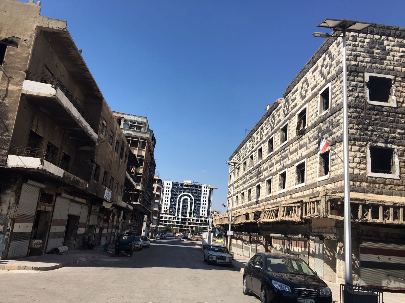
In June 2025, a billboard went up in the center of Homs, promising a grand urban reconstruction project, “The Boulevard of Victory.” It appeared to be a residential complex on destroyed land. 11 But who owned that space? And who had the right to reinscribe it? Public spaces, infrastructures, and cultural landmarks do not belong to one group alone. They are interwoven with the lives and losses of Sunnis, Alawites, Christians, Shi’a, Druze, Kurds, Ismailis, Yazidis, Palestinians, Bedouins, and others who built and inhabited the city across generations and were part of the city-making processes. A just and inclusive reconstruction must confront the sectarian and class-based ruptures that the old urban form helped conceal.
A just and inclusive reconstruction must confront the ruptures that the old urban form helped conceal.
A few weeks ago, the Boulevard project was cancelled — a hopeful sign for the future. 12 Rebuilding in a way that is just and inclusive will be a slow process that starts with sharing our memories and perceptions of the city and the way we lived within it. This is not compatible with a neoliberal planning model that recognizes only economic growth. 13 We have to learn to see the city in the ways that others see it, drawing maps and inviting others to draw with us, starting from the places we know best and filling in the spaces between, through careful negotiation. The physical rebuilding cannot go at a faster pace than the social reconciliation, or we will be hardening lines that lead to further violence and grief.


.jpg)
If you would like to comment on this article, or anything else on Places Journal, visit our Facebook page or send us a message on Twitter.