
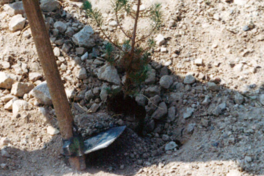
My wife and I, as relative newcomers to Massachusetts, decided to immerse ourselves more firmly in local history, and an internet search brought us to a website about Moswetuset Hummock. The next day, we drove to the South Boston shore, parked in a small lot, and walked up the hill. Heavily wooded, the hummock faces the Atlantic, backing into a tidal flat at the mouth of the Neponset River. It is not particularly tall, but despite ongoing efforts to drain the surrounding marsh, it dominates the landscape. Beside the trail stands a stone marker stating that this was the “home of the Moswetuset after whom the Commonwealth of Massachusetts is named.”
These streets and parks and post offices may seem neutral or benign, but they help to shape popular civic understandings of Native American history.
It is obvious that the state’s name is Native American, but I had never heard of Moswetuset Hummock or of the Moswetuset — now more properly known as the Massachuseuk. 1 Not even my sons, who went to school here, knew of it or them. Yet the official seal of the Commonwealth features a sachem dressed in deerskin. This is an updated version of the first seal of Massachusetts Bay Colony, in use from 1629 to 1691, that showed a nude man with a bush covering his groin and a scroll extending from his mouth bearing the plea “Come over and help us” — adapting a message supposed to have been registered by St. Paul in a dream about the Macedonians, and highlighting, at least theoretically, the Puritans’ evangelizing mission. 2 The figure looks more like a conventional 17th-century portrayal of a Caribbean than a Massachuseuk, indicative of limited knowledge on the part of the colony’s founders-to-be regarding the people they intended to convert. After all, the seal was designed in England, before the Puritans set sail. Though the figure was later “corrected” in terms of clothing, it remained a fiction that has served for centuries to represent the Commonwealth, with the sachem holding an arrow pointing down, indicating his acceptance of colonial morality and authority. 3


All the American colonies have inscribed within their official histories some form of “encounter narrative.” But, in Massachusetts, the strategies of political and territorial dispossession that shaped these encounters are embedded to an unusual degree in the images and nomenclatures by which the state continues to represent itself to its citizens — including its Native American citizens. In regard to the seal itself, Elizabeth James-Perry, an Aquinnah Wampanoag activist, observes that “as an indigenous person and visual artist, the seal is deeply offensive in its imagery and has been for countless generations of tribal members,” to which she adds that the solution is not to remove the image of the sachem, but to reimagine it in consultation with the Native American community:
Yes, the state flag should include Wampanoag imagery — and that can be designed in concert with Tribal Historic Preservation Officers, who can work with our tribal artisans to create concepts and work with the state … the imagery should reflect our dignity, humanity, rights and equality. 4
The pressure points of formal representation and their associated, necessary activisms are profound triggers to thought. Yet the issue I would like to discuss revolves less around such official symbolism and more around sites that may be easier to understand as neutral or benign — sites that nevertheless play an important though rarely acknowledged role in the popular civic understanding of Native American history. These sites belong largely to a history that has little to do with the 17th century, but rather spans from the middle of the 19th century to the middle of the 20th. For already in the mid 19th century, New England intelligentsia and state officials had begun to embrace ideas and images of Native Americans, more enthusiastically than was then common in other parts of the country. The names and alleged likenesses of Massachuseuk, Algonquin, and Wampanoag sachems came to be memorialized in parks, streets, and public murals across the state. These efforts were often supported by patriotic societies like The Improved Order of Red Men, established in 1834 by and for White men. In Lowell in 1899, for example, the Order erected a statue of Passaconaway, Sachem of the Penacooks (who had lived to the northwest of Boston). Not far from where I live is Sagamore Park, built in the late 1890s, named after Sagamore John of the Pawtucket Confederation, whose real name was Wonohaquaham. Even closer is Pequossette Park, established in 1928 and named after a tribe that lived along the Charles River. Moswetuset Hummock is also part of this “Indianization” of the landscape. It became a park in 1930 as part of the celebration of the 300th anniversary of the Massachusetts Bay Colony, a celebration involving “2,000 separate events … in 250 municipalities, attended by 11 million citizens.” 5
The inclusion of Native American names and places in local citizen geography was designed to obscure more than to acknowledge.
There can be no doubt that the inclusion of Native American names and places in local citizen geography was designed to obscure more than to acknowledge. At the most rudimentary level, such names memorialize “Indians” as the proverbial “friends of the White Man.” Recently, when the statue of Passaconaway was restored by the still extant Improved Order of Red Men, the Order’s president was quoted stating that “Passaconaway was friendly to all the settlers … His tribe, the Penacooks, protected the settlers from the Mohawks.” 6 Less obvious agendas are also at play in this settler-colonial “inclusion,” given that in the 19th century this practice was, among other things, a way to counter stresses in the local cultural order having to do with the arrival of Irish immigrants in the 1850s, followed by Polish and Italian Catholics and Central European Jews in the 1890s. The efforts at “Indianization” thus veiled a cultural anxiety about modernity, which despite — or because of — its claims for universality, equality, and legality, resisted the very multiculturalism it produced. 7 The neocolonialists of New England sought to immerse an increasingly diverse public in an historically thickened landscape in which colonial imaginaries were to become the unalterable bedrock of local identity. “Indianization” was the necessary subtext, adding drama to stories of colonists’ hardship and perseverance. These interventions were designed to create the still-operative illusion that the history of Native Americans in Massachusetts came to an end with the transition from the colonial to the national era. And yet, as the website of The Massachusett tribe states:
We against all odds have survived as the descendants of the first people of Massachusetts. We continue to survive as Massachusett people because we have retained the oral tradition of storytelling just as our ancestors did. This tradition passes on the Massachusett view of how our world works, our relationship with all of nature and why things are the way they are. 8
Indeed, the Commonwealth remains home to a vibrant Native American community. Founded in 1970 by Mildred “Millie” Noble and other activists, the Boston Indian Council (now the North American Indian Center of Boston), for example, has consistently fought for acknowledgment of Indigenous presence in the greater Boston area. Native American communities are active across the state.


What, then, do places like Moswetuset Hummock, Pequossette Park, or Sachem Road mean for my citizenship as a non–Native American and as a relative newcomer to Massachusetts wanting to learn about the history of the Commonwealth? The question speaks to the heart of the relationship between citizenship and what one might call an operative citizenship-landscape. Conventional citizenship theory is of little use in answering this question, since it centers on bodies in the immediate political arena, and rarely takes up the experience of citizenship in an already-historicized landscape — in this case, one that was custom-designed a hundred or so years ago with the intention of normalizing vexed and often violent relationships between past and place. 9 The issue here is more profound than asking how history or memory are activated in public spaces. In her book on Northeastern Native invisibility, Firsting and Lasting: Writing Indians out of Existence in New England (2010), Ojibwe scholar Jean M. O’Brien points out that, beginning in the mid-1600s, self-appointed amateur historians were already curating an origin story for their burgeoning society that required tales of native people being helpful on one hand but conquered on the other. 10 O’Brien charts the complex history by which such settler-colonial mythologies asserted themselves in history writing and place naming. Here I am asking how the late 19th-century “Indianization” of the citizenship landscape functions within the framework of these erasures, since this “secondary” history is often mis-recognized by the general public as neutral and authoritative. In reality, the apparent factuality of these historical signifiers in the landscape obscures not just their former ideological roles, but also the ongoing nature of the settler-colonial project. Furthermore, since I am an architect and historian, there is an added dimension to these inquiries: Can an interrogation of the citizenship landscape translate into critical architectural or landscape practices? 11
In pre-contact periods, the Massachuseuk dominated a roughly fifteen-mile shoreline from Quinobequin, or Winding Water (now the Charles River) to Patuxet (now Plymouth). 12 Led by the sachem Chickataubut (House of Fire), they were centered at Cohasset, near modern Scituate, with a base at Passonagessit hill, some two miles south of Moswetuset Hummock. The Massachuseuk derived their name, however, from the sacred hill Massa-adchu-es-et, which lies about seven miles inland from the Atlantic. 13 Massa means “large,” adchu means “hill,” es is a diminutive suffix, and et a locative suffix or identifier of place. So the word translates roughly as “large hill place,” or “at the great hill.” The volcanic formation in question is five miles long, trending east-west, with a spring at the western end that is the source of the Naponset River, a waterway that was the central axis of the Massachuseuk world. The mouth of the river, where the Hummock is located, was called Messatsoosec, “the great hill’s mouth,” and was known for its mollusks. 14 The area between the hills and the shore, in what is now Dorchester, was a corn-growing zone. On the southern edge of the Massa-adchu-es-et is a pond called Ponkapoag, a word thought to mean “sweet water” or “a spring that bubbles from red soil.” 15 This area, protected from northern winds, served as the group’s winter residence. Together, the Moswetuset Hummock, Passonagessit, the Neponset River, the Massa-adchu-es-et, and Ponkapoag Pond were key elements in the extended cultural landscape of the Massachuseuk.
Moswetuset Hummock, Passonagessit, the Neponset River, the Massa-adchu-es-et, and Ponkapoag Pond were key in the cultural landscape of the Massachuseuk.
Diseases brought by coastal traders at the end of the 16th century took their toll on this community. The year 1619 was particularly bad, prompting Chickataubut to abandon Passonagessit and move the healthy members of his group, about 600 or so, to the more isolated Hummock. 16 Two years later, when a party led by the Englishman Thomas Morton set up camp at Passonagessit (which they renamed Merrymount), Morton wrote in his journal: “the bones and skulls upon the severall places of their habitations made such a spectacle after my coming into those partes, that, as I travailed in that Forrest nere the Massachussets, it seemed to mee a new found Golgatha.” 17 Chickataubut lived on the Hummock until 1633, when he too was struck down by smallpox. 18 Though the Hummock now boasts its stone marker, Passonagessit, ancestral home of the Massachuseuk, is currently the location of Merrymount Elementary School and its football field.


As for Massa-adchu-es-et, the settlers named it Blue Hill. Through the 18th and 19th centuries, its slopes were used by Bostonians mostly as a source of firewood and stone. But in 1885, Blue Hill Meteorological Observatory was founded at the peak, a facility that (according to the National Historic Landmarks commission) “took a leading role in the newly emerging science of meteorology and was the scene of many of the first scientific measurements of upper atmosphere weather conditions.” 19 In 1893, the state’s Metropolitan Parks Commission purchased the hills and neighboring forests to establish a wilderness park — an innovation in its time. The Commission’s goal was to “acquire, hold, protect and administer, for the benefit of the public, beautiful and historical places.” 20 In 1936, a few miles from the Observatory, Ponkapoag Golf Course was laid out, proudly advertising itself as the country’s first public golf course; in the 1940s, a public ski area was created on the hills’ northern flank.
The Blue Hills Reservation was designed as a setting where city dwellers could take pleasure in nature and release themselves from quotidian cares. At a deeper level, it was (and remains) a park where elite activities like golfing and skiing are made available at modest cost; in a contemporary world that is more and more privatized, such ideals of egalitarian participation, even in leisure, appear increasingly valuable. And yet there can be no doubt that here, as at so many other similar sites, the instrumentalization of Western Enlightenment humanism — in this case revolving around the ideals of science, citizenship, and equality — has produced relationships “structured, from the very beginning, in favour of certain outcomes,” as Dipesh Chakrabarty has phrased it. 21 And so, in order to truly connect to this location, one must see past the metaphysics of operative citizenship and acknowledge Boston and its environs as a landscape where one history and its claims were violently eradicated, and another history and set of claims put in their place.
The history of this transformation starts before the colonists even arrived, with a map made in 1616 by John Smith, the English soldier who played an important role in establishing the colony at Jamestown and later became colonial governor and Admiral of New England. Sailing up the coast, he made the first detailed European map recording place names in Algonquian, the language spoken by coastal populations. But when Smith sent this document back to England, the fifteen-year-old crown prince Charles — later Charles I — asked him to change local names to English ones. The map thus came to show nonexistent “towns” called Cambridge, Dartmouth, Ipswich, and Oxford, most located at extant Native American sites. Maswetuset Hummock was christened London, and the Massa-adchu-es-et became the Cheviot Hills, after a range straddling the Anglo-Scottish border in Northumberland (presumably in deference to Charles’s Scottish ancestry). Some of Smith’s names faded, but many stuck, including Cambridge, the Charles River, and Plimouth or Plymouth. In 1620, when the Pilgrims who set off from Plymouth, England, landed on the Cape instead of at the mouth of the Hudson River as they had intended, they must have been delighted to find that Smith’s map, which they used as a guide, showed a “Plimouth” nearby. As Michael Blanding puts it, with the establishment of the Plymouth colony, the first of Smith’s “fictitious cities … became a reality, and New England began to exist on land as well as on Smith’s audacious piece of paper.” 22
John Smith’s map of 1616 was the first move toward a settler-colonial teleology of erasure in New England.
Smith’s map was the first move toward the settler-colonial teleology of erasure in New England. But it also casts into relief the paradox of “inclusion” that became fundamental to the identity of the Commonwealth. For back in London, in 1629, the future settlers of Boston not only depicted an imagined sachem on their seal; they also adopted the name “Massachusetts.” 23 Chickataubut must have thought it strange when, in 1630, Englishmen arrived at his wigwam on the Hummock calling themselves the “Massachusetts” Bay Colony. 24


By that time, Chickataubut had his hands full. In 1622, the Weymouth colony — named after an English coastal town — had been founded in Wessagusset, four miles south of the Hummock. Thomas Morton’s Merrymount at Passonagessit was nearby; and in 1630 a third group settled two miles north of the Hummock in the area soon renamed Dorchester. The Dorchester group was primarily interested in profit from the sale of salted cod. The Weymouth colony was famously incompetent and arrogant, while the Englishmen at Merrymount, though often drunk, were good traders and mostly friendly. By contrast, folk at Plymouth were well organized, and learned to pit the Massachuseuk against the Pokanoket, whose chief, Massasoit, had closer dealings with the colonists. The situation worsened after the Wessagusset Massacre in 1623 when Myles Standish — the brutish military officer hired by the Pilgrims as their protector — invited the Massachuseuk war chiefs Pecksuit and Wittawamut, along with several more of Chickataubut’s most powerful warriors, to a summit at Wessagusset, where he ambushed and murdered them. Standish displayed Wittawamut’s head on a pole outside the Plymouth walls, and the Massachuseuk gave the Pilgrims a new name, wotawquenange — cutthroats. 25 In 1631, Chickataubut, surrounded by settlers and with only a few hundred warriors left, had no choice but to submit to Massasoit, and on March 23 of that year he came to Boston to meet the Puritan governor, John Winthrop. The sachem presented the governor with a barrel of corn and drank at his table “as soberly as an Englishman,” in order to position himself favorably with the people who had taken not only his lands but his name as their own. 26
These naming gestures mark the fact that the sachems ‘sold’ their land to the colonialists.
In the 1890s, when the Blue Hill park was laid out, a peak was named after Chickataubut. Promontories and paths were also named after Kutchamakin (the sachem’s brother), Wompatuck (Chickataubut’s son), and Squamaug (his grandson). And in 1930, as part of those celebrations marking the 300th anniversary of the Massachusetts Bay Colony, a viewing tower was built on Chickataubut Hill. 27 These gestures mark the fact that the sachems in question “sold” their land to the colonialists. 28 In 1630, Kutchamakin sold parcels around the Neponset River, including deeding what is now the town of Milton to Richard Callicott, a fur trader. In 1684, Squamaug ratified a deed for what became Dorchester. Even a recent article in a Quincy newspaper states that Kutchamakin “and members of the Wompanoag tribe who he associated with transferred the land of present-day Hingham to the town in 1665.” 29

This is not factually inaccurate. But the underlying message — from the Bostonian point of view — was (and continues to be) that these transactions were legal. The issue was not without import for the arriving Puritans, as they were opposed to the arbitrariness of the feudal system back home in England. Yet the actual circumstances of these transfers, with their associated histories of displacement, are practically irrelevant in land-purchase narratives. Indeed, by the 19th century, such stories had been magnified into what William J. Miller (writing in 1881 about the history of Bristol, Rhode Island), called “the beginning of American diplomacy.” 30 Land-purchase narratives set the stage not just for the claim of governmental legitimacy, but also for a myth of agriculturalization that continued to be celebrated well into the 20th century. A 1938 mural in the Arlington post office titled Purchase of Land and Modern Tilling of the Soil, by William C. Palmer, shows a soldier (perhaps Standish) giving two silver coins and a box of blankets to a sachem (presumably Kutchamakin). To one side, a young European couple is already planting crops.
The “Indianized” landscape around Boston has thus been designed not only to highlight the presumed legality of the land transfers, but also to further the image that this is a Protestantized landscape. Most of the local sachems were influenced directly or indirectly by the efforts of John Eliot, Puritan minister at The First Church in Roxbury, just south of Boston. At the Massachusetts State House, a visitor who climbs the grand stairs to the upper chamber passes under a mural dating from 1903 by Henry Oliver Walker that shows Eliot preaching the gospel to the local Native Americans. Of course, the relation was not as genial as the mural indicates.
‘Indianizing’ highlights the presumed legality of land transfers, and furthers the image that this is a Protestantized landscape.
When Eliot began his mission in 1646, the colony of Boston had three frontiers, north, west, and south, and he launched evangelizing missions in each direction. To the north, Passaconaway (Child of the Bear) subjected himself to the authority of the Massachusetts Bay Colony in 1644, and the English required him to turn over his guns. 31 To the west, upstream along the Charles, was the Saltonstall Plantation (now Watertown), settled in 1630 and soon boasting a population almost equal to that of the young city of Boston. These colonialists were not planters for the most part, but stockbreeders who needed vast amounts of land for cattle, horses, and sheep. In the course of their expansions, they encountered Waban (Wind, or Spirit), who led a remnant group of about 100 based at Nonantum Hill, in what is today the town of Newton, just across the river from Watertown. Eliot undertook Waban’s conversion, and subsequently convinced him to move his people up the Charles River to Natick (“place of the hills,” or “place of searching”), then a wooded area on the “frontier.” The idea was that the “Praying Indians,” as the converts were called, would be better protected there from settler encroachment. But such planned villages, supervised by the colonialists, also served strategic interests. Not only was the vacated land free for development, but the villages served as buffers against unconverted “savage” populations farther west. By 1690, there were 1,100 “Praying Indians” in fourteen such concentrated villages, and the Pilgrims began to use their newly Christianized neighbors as scouts, warriors, spies, and executioners. 32


To the south and southwest of Boston — in the direction of the Blue Hills — the situation in the late 17th and 18th centuries was still more fraught. 33 Dorchester in the 1650s was still largely “Indian country”; Kutchamakin was sometimes called the “Dorchester Sachem.” At this settlement’s center was Mattapan (“a good place to be” or “a good place to sit”). Just to the south was a place called Unquity-Quisset (“where the headwaters meet the tidewaters of the bay”), and it was here, following the death of Chickataubut in 1633, that Kutchamakin had his wigwam on a rise above the Neponset, two miles inland from Moswetuset Hummock.
Despite the setbacks of disease, the 25-mile stretch between Unquity-Quisset and Rhode Island remained in the control of Native Americans from the 1640s through the next decades. But it was also in a state of cultural disarray. Fur trading privileged some groups over others; smallpox hit this or that group and not others. The same was true for the introduction of muskets; a yellow fever outbreak in 1647; and even a series of unusually bitter winters that shortened planting seasons. The collapse of the fur trade in the 1650s (the beavers had been killed off) and settlers’ emergent needs for pasture played key roles in the drama, as did contested territorial claims between the colonies at Boston, Plymouth, Rhode Island, and their scattered frontier offshoots, tensions that made stable allegiances almost impossible. Whatever advantages a given native group might create through exchange, trade, and diplomacy were offset by dispossession, coercion, confusion, and violence. 34
The Massachuseuk were particularly vulnerable. Some lived in scattered enclaves between colonialist farmsteads, others around the Hummock, and still others near Kutchamakin’s wigwam. When Eliot came to Unquity-Quisset to begin the sachem’s conversion, he asked Kutchamakin to move his group to Ponkapoag — just as Waban was asked to move from Nonantum Hill to Natick. Once again, safety was the proximate but hardly the main concern. After all, the area near Kutchamakin’s wigwam was barely 100 feet from a new bridge across the Neponset, the site of a recently built grist mill and an expanding cluster of English houses. The settlers wanted Kutchamakin out of the way, but he resisted giving up this last portion of ancient sacred land. After his death in 1654, the Massachuseuk, led now by Wompatuck (Kutchamakin’s nephew and Chickataubut’s son), had no choice but to sell the coastal territory that now comprises Quincy, Braintree, Holbrook, and Randolph, and move the group to Ponkapoag. 35 A marker installed in 1930 on Churchill’s Lane in Milton indicates the route of Womaptuck’s exodus along the “Indian Trail” to the pond.
When his group arrived, they found themselves on land that was no longer theirs. Even today, the Dedham town website claims that the “Praying Indians” of Ponkapoag “squatted on Dedham land.” Eventually a 6,000-acre parcel was set aside for them, but it was not long before this was reduced by the town council to 3,000 acres. The move also meant that Wompatuck’s people had to adopt English ways of life and dress. The Massachuseuk were not without political clout; after an intrusion by the Mohawks in 1665, Wompatuck organized a retaliatory expedition against their capital Gandaouaguè some 170 miles to the west (near present Auriesville in New York state) that involved several tribes and as many as 700 warriors. But as he was returning home, his column was ambushed by pursuing Mohawks, and Wompatuck was killed.
King Philip’s War could be termed the Second Puritan Conquest, as its consequence was the end of political power for native communities in New England.
These regional tensions eventually boiled over into what has come to be called King Philip’s War, named after Massasoit’s son Metacomet, known to settlers as King Philip. 36 Metacomet was sachem of the Wampanoag, who emerged in the 17th century as a confederation of several tribes in the southern part of Massachusetts and Rhode Island. From his seat at Mt. Hope in Rhode Island, he remained a holdout against religious conversion and saw military action as the only alternative to ongoing colonial expansion. 37 His efforts failed, and when it was all over, the governor of the Massachusetts Bay Colony brought the tribal leaders of the war to Boston and had them executed. The refugees — hundreds of men, women, and children, including those who were Christianized — were shipped out to islands in Boston harbor, mainly Deer Island, where they were left to perish from disease, starvation, and cold. Others were sold as slaves to Bermuda. According to some schools of thought, King Philip’s War should be termed the Second Puritan Conquest, as its consequence was the end of political power for native communities in New England. 38


The community at Ponkapoag was not a party to King Philip’s War. Nevertheless, the Bostonians, nervous about their loyalty, had moved the group temporarily, first to Long Island in Boston Harbor and then to Brush Hill in Milton, before permitting them to return to their homes. 39 By 1760, after more than a century of depopulation and piecemeal sales, only 710 acres of the Ponkapoag land grant was left. And yet when Mary Burr, the last official “Ponkapoag Indian,” died in 1852, there were approximately 3,000 Native Americans still living in the Commonwealth. Most subsisted on small state-owned holdings. 40
As to King Philip’s War, one historian has noted that it “goes almost unacknowledged on the cultural landscape of Boston.” 41 Indeed one must remember that the “Indianized” landscape consists not just in what we see, but what we do not as see. For the Native American community, however, the legacy of the war remains crucial. As Jean-Luc Pierite, current president of the North American Indian Center of Boston, or NAICOB, explained to me, the war dismembered and disenfranchised the local Native American community, and displaced local tribes to other parts of the country, some west of the Mississippi. This displacement is even international in scope, given the descendants of those communities who were sold into slavery. As Pierite notes:
NAICOB is responsive to the legacy of displacement through wars, epidemics, and settlement by colonists or citizens. Taking into consideration historical, revived, and extant confederacies, questions of how citizens navigate civic engagement with public institutions dip into national and international affairs. From my personal experience as president of NAICOB, such a scope is not often in the consciousness of either citizens or elected officials. … We need citizens and elected officials who are versed in matters of tribal consultation who can make well-informed public-works decisions. 42
Pierite’s plea for tribal consultation in regard to public works emphasizes the problem of how we come to terms with the invisible parts of the “Indianized” landscape and their lingering legacies. Here another event looms large, one with direct bearing on narratives of local history. This is the Massachusetts Act of Enfranchisement of 1869, which stated that Native Americans were “entitled to all the rights, privileges, and immunities, and subject to all the duties and liabilities” of citizenship. “All Indians,” the act decreed, “shall hereafter have the same rights as other citizens to take, hold, convey and transmit real estate.” 43 What this really meant was that there was no longer any such thing as tribal territorial control in Massachusetts. To become a citizen of the state, the newly minted “Native American” had to become complicit in governmental structures that unraveled ancient bonds of community. 44 The Act of Enfranchisement was nothing less than the culminating act of detribalization.
The teleology of cultural and political erasure begun by Smith’s map was later disguised in terms of civic inclusion.
With this act, the teleology of cultural and political erasure begun by Smith’s map came to be disguised in terms of civic inclusion. And once Native Americans no longer had sovereign land claims and were official citizens of the Commonwealth (though they were not yet federal citizens and could not yet vote), they disappeared into the broad mix of the Commonwealth’s constituencies where they were reduced to a tiny minority — mostly, initially at least, without taxable property and so largely ignored in legal and juridical terms. As scholars researching the act have observed, “given the long commitment of Massachusetts’ white residents … to the abolitionist agendas of the antebellum and Civil War eras, it is perhaps surprising to find that the state’s own Indian descendants lived in a legal no-man’s land.” 45
All this means that when designers of the Blue Hills Reservation and other such places attached the names of sachems to peaks, trails, and the like, they were interested in more than painting a picture of the presumed legality of earlier land acquisitions. Because the Massachusetts Act of Enfranchisement had created a world where there was no such thing as a “noncitizen” in Massachusetts, the names came to represent the nation’s proto-citizen, belonging to an imagined premodern, pre-national condition.


There can be no doubt that the disappearance of the Native American into the fold of citizenship helped to clear the way for the free reign of “Indianization.” The late-19th-century erasure of Native Americans as a distinct political community is linked to their paradoxical “inclusion” in the Commonwealth’s self-mythologizing narratives. Establishment of the Blue Hills Reservation was just a small part of this process. In 1865, Newton, for example, adopted for its town seal an image of Eliot “preaching to the Indians” at Nonantum — but if visitors today go to Nonantum Hill, they will not realize that it was named after a woolen mill that no longer exists, the Nonantum Worsted Company, or that it is a mile-and-half to the west of the hill that once was home to Waban and his people. That hill, the original Nonantum Hill, remains unmarked and is built up with expensive homes. Waban’s wigwam, which was located at the hill’s base, would be near the 15th hole of a golf course; the sacred spring on which it fronted is now a water hazard. As to Wessagusset, it was leveled for landfill at the end of the 19th century. Nevertheless, when nearby streets were laid out in the following decades, they received names like Squanto Road, Pilgrim Road, Massasoit Road, Pequot Road, Wessagusett Road, and so on — even a Standish Street. The wooded site of Kuchamakin’s wigwam along the Neponset River (which had come to be known as Vose’s Grove), was sold to a developer in 1881, a transaction facilitated by the Massachusetts Act of Enfranchisement. That area, now known as the Butler Street neighborhood, is described on Wikipedia without any reference to its ancient history as having been “still empty land in the 1870s.”
The original Nonantum Hill remains unmarked. Waban’s wigwam, once located at the hill’s base, would be near the 15th hole of a golf course.
The settler-colonial blending of exclusionary practices with “inclusive” and revisionist ones is neatly illustrated in the attempt, in 1894, to create a less generic figure on the state’s Great Seal. A White man named William M. Olin, who held the post of Native American Secretary of the Commonwealth, consulted various ethnologists, who found a suitably handsome chief of the Ojibwe (local to southern Canada and northern Michigan) to serve as a model. His name was Es-ence (Little Shell), and his likeness on the seal was drawn not from life but from a photograph furnished by the Bureau of Ethnology, which had been established by act of Congress in 1879. A historian at the time explained, “Little Shell’s picture was selected not only because he was a fine specimen of an Indian, but also because his tribe, the Ojibwes, belong to the great Algonquin family of which the Massachusetts were also members.” 46


The ambiguities that haunt the image on the seal — part stereotypical, part real; part historically demeaning, part revisionistically honorific — intensify when we take into consideration artifacts like the mural in the Natick Post Office. Titled John Eliot Speaks to the Natick Indians, it was painted by Hollis Howard Holbrook in 1937. Despite the surrounding clutter of boxes and advertisements, it remains a powerful image, showing the deportation of defeated warriors and their families to Boston and Deer Island in the aftermath of King Philip’s War. The captives are being addressed by none other than John Eliot, who thrusts a bible toward them; according to contemporary accounts, he admonished deportees in the best Puritan manner: “You will learn that through much tribulations you are to enter into the kingdom of heaven.” 47 The sachem standing next to Eliot is meant to represent Waban. Wearing a ceremonial bearskin over English trousers, he stares out at the viewer, the only person in the mural to do so. His physiognomy is clearly modelled on the face of Es-ence. To see this figure, in other words, is not to see the portrait of a particular historical leader, but the cypher of an “Indian,” a “Good Indian,” a “Protestant Indian,” a “proto-citizen,” or even a “citizen of Massachusetts” — who, in this last guise, also represents me in pacified acquiescence to authority.
The sites that I have mentioned (and many that I did not) together constitute a warp within the ontology of citizenship. And — as I have tried to stress — this holds true not just for the Native American but for the non-Native American as well. The problem is not exclusive to one or the other constituency; it lies at the heart of what it means to be a citizen of the Commonwealth, if only because the fateful trajectory of inclusional representation has been at the core of Massachusetts’s political identity since 1629.


Admittedly, the long history of settler-colonial control over that narrative has recently given way to more progressive conversations. In 1998, as part of a settlement with protesters, the town of Plymouth amended a 1921 statue of Massasoit by installing a plaque acknowledging the National Day of Mourning observed by native activists on Thanksgiving Day. 48 In 2004, Boston officially repealed the Indian Imprisonment Act of 1675, passed in the wake of King Phillip’s War, which prohibited native persons having business in Boston from entering the city without an escort of “two musketeers.” 49 Joanne Dunn, who at the time of the repeal was executive director of the Boston Native American Center (later NAICOB), acknowledged that the decision was meaningful: “you come into the City of Boston and it crosses your mind that you’re not welcome here. For us indigenous people [the repeal] brings some closure.” 50 Also recently, the Muhheconnew National Confederacy and the City of Boston partnered to host a commemoration of the internment on Deer Island; every October, tribal descendants hold a ceremony there. New legislation cosponsored by state representative Lindsay Sabadosa (D-Northampton) and state senator Jo Comerford (D-Northampton) proposes to rethink the state seal’s design. 51 Even the weathervane atop the library at Dartmouth College, which depicts college founder Eleazar Wheelock sitting before a Native American smoking a long pipe, attracted protest and has now been removed. Just this year the Plimoth Plantation, a living history museum that was founded in 1947, was renamed Plimoth Patuxet. In Newton, the mayor has convened a working group to reassess the design of the town’s seal. 52
But the long history of settler-colonial control over landscape narratives has recently given way to more progressive conversations.
In the broader phenomenon of the “Indianized” landscape, a huge amount of cultural work still needs to be done. Emotions are high in some places: A late 19th-century memorial to the Puritan Hannah Duston, who killed the Pennacook raiders who took her captive in 1697, was recently splattered with red paint. 53 But most sites in the “Indianized” landscape are out of the limelight. People play ball in Pequossette Park, enjoy the serenity of Moswetuset Hummock, play golf at the Ponkapoag Golf Course, live on Wessagusett Road, hike up Chickatawbut Hill, and buy stamps in the Natick Post Office. This means that deeper interpretations of these sites are necessary. As Elizabeth James-Perry and Jean-Luc Pierite have pointed out, the issue is not as simple as removing a monument or updating signage. We should see the “Indianized” landscape as needing to be reimagined, extended, and enhanced to reflect the shared nature of our citizenship-obligation in a living history. What kind of learning processes and conversations would have to be established in order to approach this? How might designers be part of the process? What would we do to modify the tower on Chickatawbut Hill? How would we redesign the Blue Hill Observatory or Ponkapoag Golf Course, or reimagine our uses of Moswetuset Hummock? What would the memorial at Deer Island look like? And so on. The aim is not to make one or another constituent happy, but to emphasize the ambiguity and incompletion of these locations so as to allow us, perhaps, to imagine a new form of citizen landscape altogether.


_by_Domingo_Mora_-_bas-reliefs,_Congregational_House,_Boston,_MA_-_DSC04687.JPG)
If you would like to comment on this article, or anything else on Places Journal, visit our Facebook page or send us a message on Twitter.