
Waldenburg, Arkansas. A discarded semi-trailer sits by the roadside, its side branded with faded yellow letters: “WAL ART,” the missing M obscured by the open door. A small air-conditioning unit sits on DIY supports, and inside, I can just make out what appears to be a person’s belongings. My eye travels to an overturned blue vinyl loveseat in the foreground, and I wonder if the makeshift domicile was still occupied at the time of the photograph; or if, like so much of the Arkansas Delta, it too had been abandoned.
The Arkansas Delta is a landscape continually in flux, made and remade, often violently, by earthly and human forces. What was, for millennia, an expansive forest of cypress, tupelo, pine, oak, and persimmon, and a complex system of rivers, swamps, and upland prairies, is today a largely rationalized landscape of rice and cotton fields, dewatered through a 5,000-mile network of drainage ditches and canals, and harvested by massive, chaff-spewing machines. 1 Dotted with towns still often (informally) segregated by race, where historic buildings succumb to planned demolitions to avoid the liabilities of unplanned ones, the region embodies, and in many ways magnifies, the paradoxes of a century of American “progress.”
The Arkansas Delta is a landscape continually in flux, made and remade, often violently, by earthly and human forces.
Comprising a 250-mile-long swath of the state and including portions of 15 counties, the Arkansas Delta is part of the larger Mississippi Delta, with which it shares a good deal of history and culture. The late historian Willard B. Gatewood, Jr. wrote that this extensive landscape is “to an extraordinary degree [a microcosm of the] distinctive environment, behavior, and historical experience of the South.” 2 Yet it is also a place in-between, southerly but not the Deep South, an expanse of prairie grasses but not the Plains. Even among Arkansans, the delta is often unseen. On my first visit several years ago, accompanying a group of outdoor enthusiasts on a float trip down Bayou deView, there was collective surprise at the striking differences between the eastern and western parts of the state. To the east was a land of moody swamps and murky rivers, flooded rice fields and dark green minnow ponds, their banks colonized by egrets and cormorants. Small towns where you could still find perfectly perforated mussel shells, remnants of the pearl-button factories that once lined the riverbanks. It all lay just an afternoon’s drive on I-40 from the urban cluster of Fayetteville, Bentonville, and Rogers, where most of my companions were from. Yet not a single person had been there.

Human boundaries are rarely sufficient for understanding landscapes, and the geology of Arkansas offers a hint, a rationale, a “geo-logic” for this dissociation. The state is divided roughly into two halves by the edges of the Ozark Plateau and the Ouachita Mountains, which together stretch from the northeast corner of the state to where it meets Texas and Oklahoma. To the west, a wide, flat, once-timbered alluvial plain; to the east, the scenic rivers and lakes of still-wooded mountains. It makes one wonder why so often we view our waterways as dividing lines, when culturally the Mississippi River is more a unifier, extending its influence on the landscape and its inhabitants equally in both directions.
The region embodies, and in many ways magnifies, the paradoxes of a century of American ‘progress.’
For Arkansans, the geographic and conceptual line through the middle of the state is the starker and arguably more apt boundary. As I crossed that threshold on my way from Fayetteville to Bayou deView on that first visit, it felt as if time and space had accordioned out, as if the distances traveled were much greater than 250 miles and a few short hours in a car. Later, retracing my route on Google Maps, my sense of temporal dislocation was only heightened. Toggling to StreetView, I was confronted by grainy, low-resolution images of small towns — Elaine, McCrory, Augusta, Geridge — that belied their digital nature. The views carried timestamps: 2007. 2008. 2009. A decade and a half has elapsed since these towns were recorded by Google’s car-mounted cameras, enough time for a child to attend their first day of kindergarten, graduate from high school, and move away.
Our digital infrastructures mirror society’s general withdrawal from places like the Arkansas Delta, but they also compound it. Whatever had occurred in this place in the past 15 years — further abandonment, triumphal renaissance, or something in between — was known only to those who had witnessed it firsthand.
In The Necessity for Ruins, J.B. Jackson wrote:
We tend to see [the contemporary American landscape] not as it is, with its own unique character, but as a degenerate version of the traditional landscape … A more sensible approach, it seems to me, is to try to discover when some of its characteristics first made their appearance, rather than to dwell on the disappearance of the old. The gradual obsolescence of the traditional multipurpose barn is not so important as the rise of a kind of farming where no barn is needed. 3
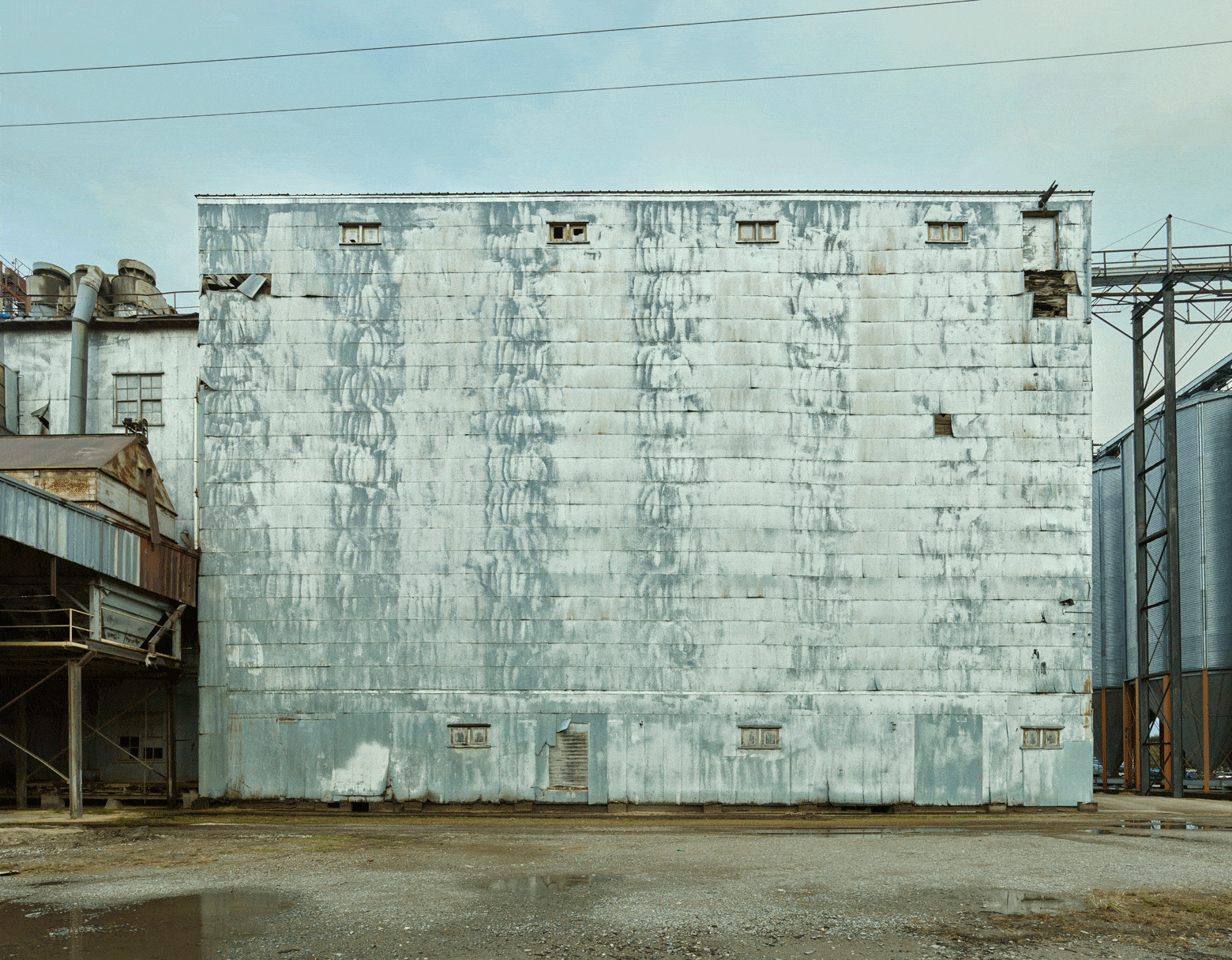
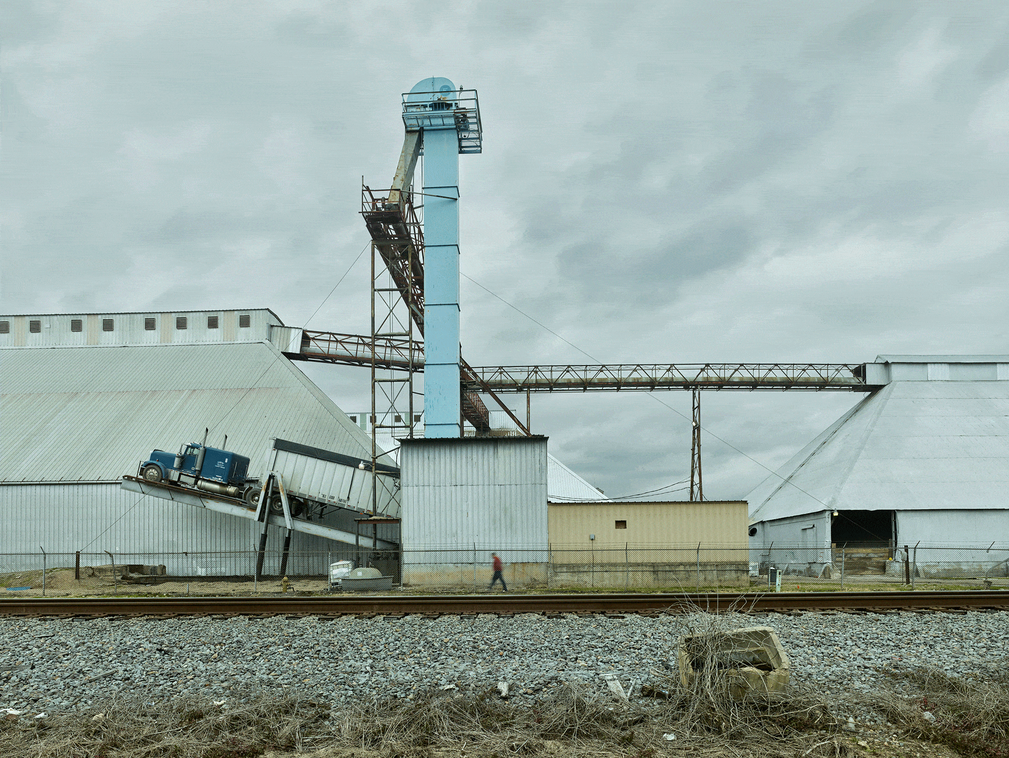
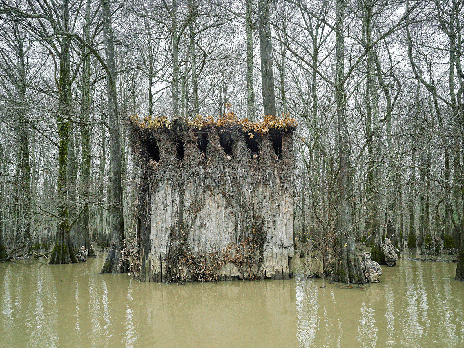
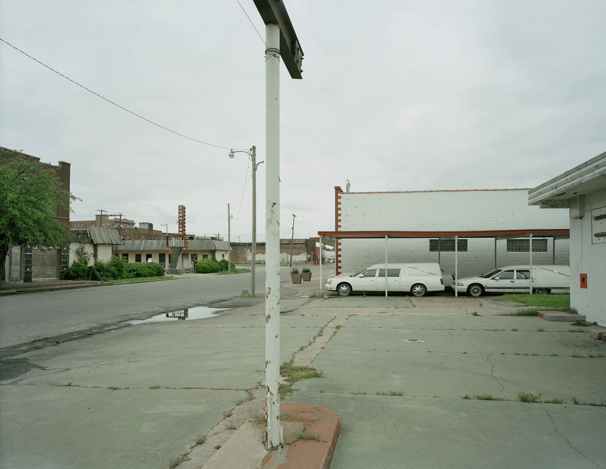
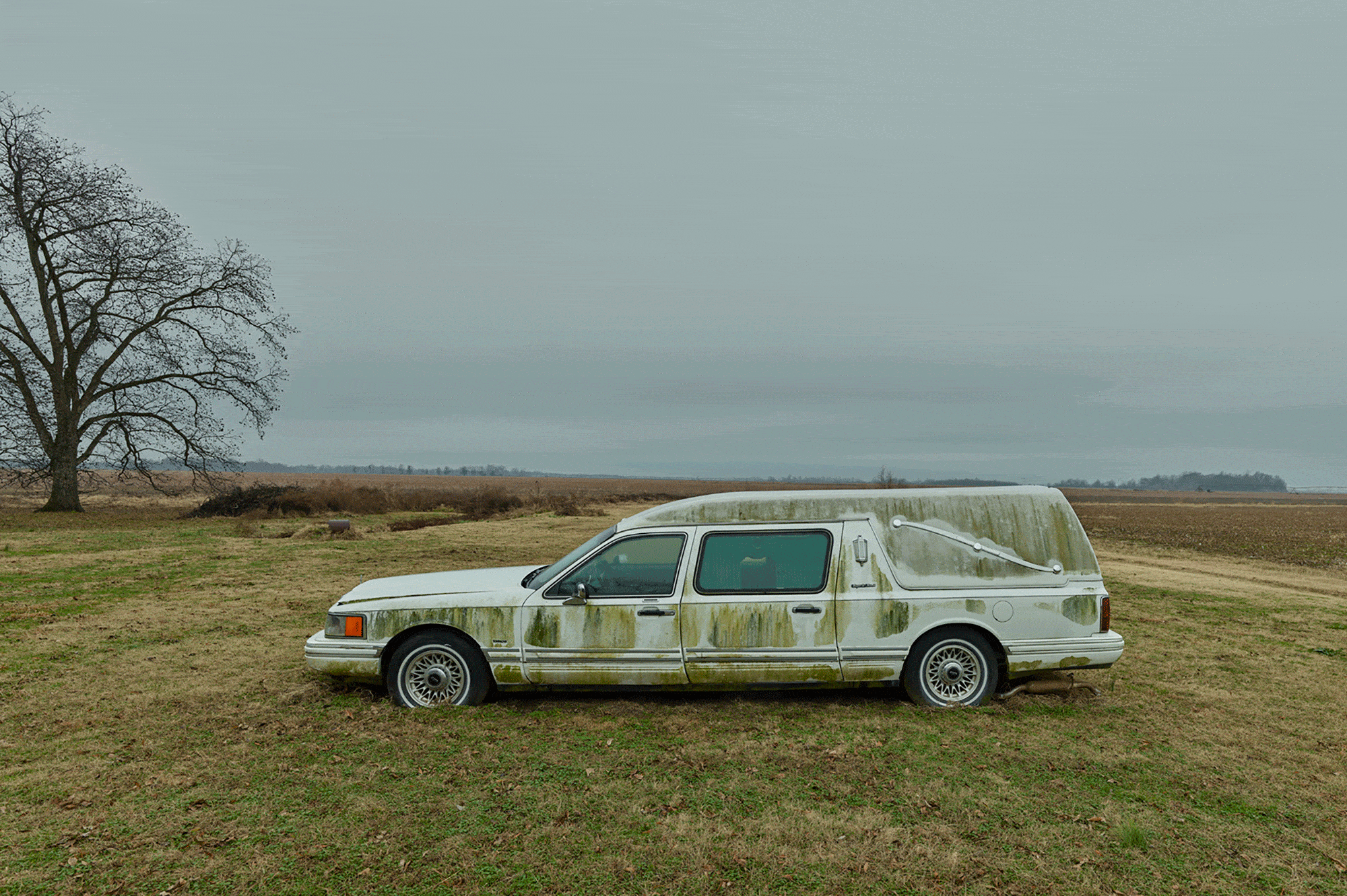
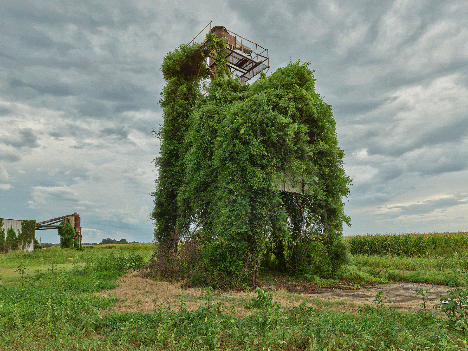
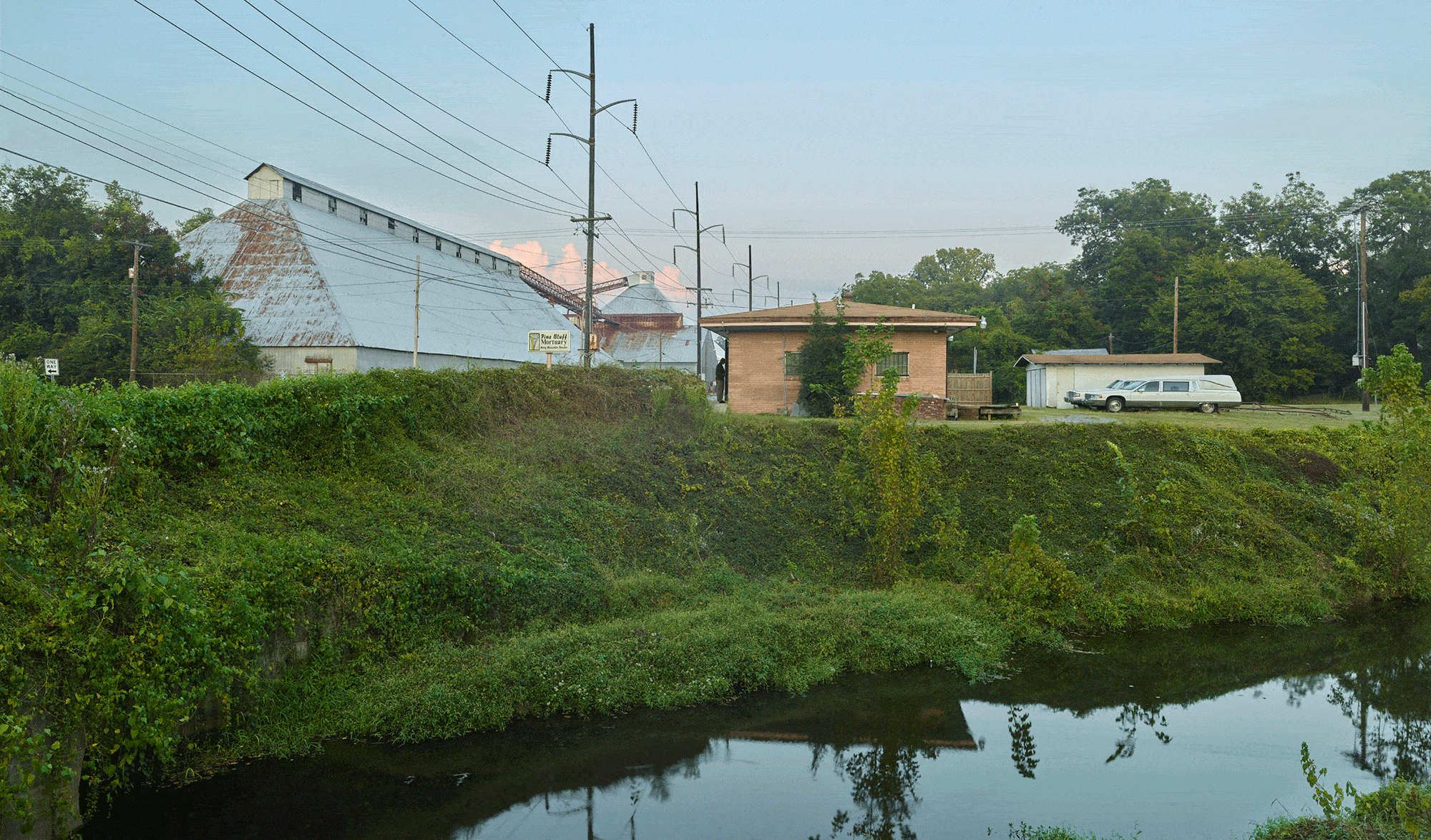
I am interested in both the old barn and the new kind of farming, for they tell different, yet interconnected, stories. This may be a partial explanation for my interest in the photography of Tim Hursley, whose palimpsestic images of decaying storefronts and Muskogee houses and the strange calligraphy produced by rice cultivation speak to the changing landscape of the Arkansas Delta, to conditions of economic abandonment and human persistence in the face of it.
Hursley is better known for his architectural work. He has photographed buildings by John Portman, I.M. Pei, Antoine Predock, and Marlon Blackwell, among many others. He has also been, for the past 30 years, the documentarian of Auburn University’s Rural Studio, a gig that takes him regularly from his home base of Little Rock, Arkansas, through the Mississippi Delta to Hale County, Alabama. But beginning about five years ago, and particularly amid the pandemic, Hursley began turning his attention to the abandoned streetscapes and agri-industrial ruins in his own backyard.

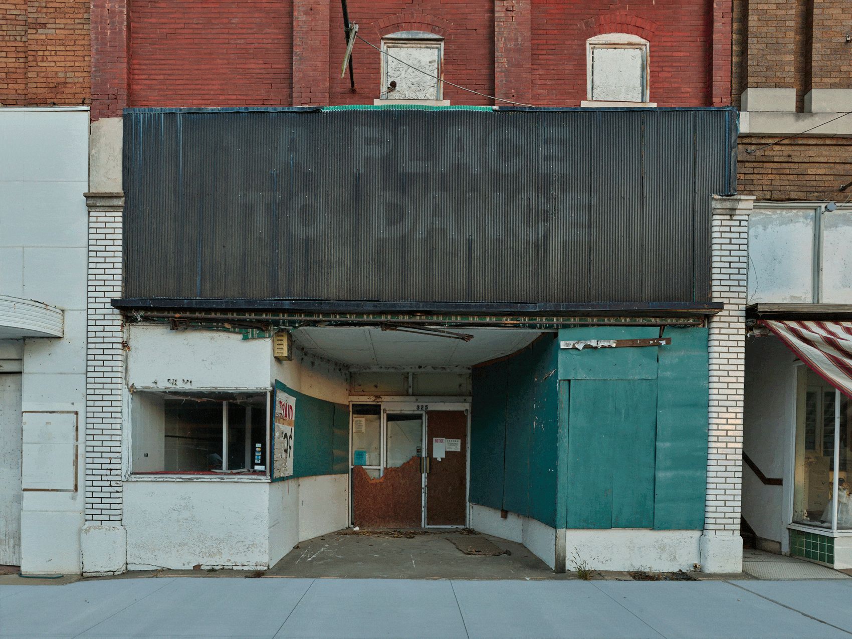
Hursley’s photographs raise as many questions as they answer. At a minimum, they offer a valuable window into a place that’s overlooked, that exists at the periphery of American consciousness; no matter that it has much to say about contemporary issues of race and racism, and of environmental and ecological collapse. But Hursley’s photographs also push us to think about what is out of sight, just beyond the frame; to consider the politics of possession and dispossession, and how these relate to landscape representation; and to consider the implications of dominant cultural narratives of rural decline — and how alternative narratives might alter what we see.
Land in the Delta does not stand still. It surrenders, sinks, bubbles back up. What is buried here rarely stays buried.
In the 1980s, a group of boaters on the Arkansas River discovered a wooden barge jutting out of the riverbank, upon which grew a “forest of sizable trees.” Researchers concluded that the barge had sunk and been buried beneath eight feet of soil and silt while the river moved on and “allowed a forest to become established over the burial. [T]hen the river had returned to exhume the corpse, all in only a century.” 4

All rivers meander, but the Delta’s waterways are particularly restless, regularly commandeering channels abandoned by other streams. As the ecologist Thomas Foti writes, “The Black River took over part of the former channel of the Mississippi, as did the White, the Cache, and the L’Anguille … The Arkansas took a shortcut more or less straight across the Delta to the Mississippi, and the Bayou Bartholomew occupied the old Arkansas channel.” 5 And as the rivers moved, they took towns with them. In the 1880s, portions of Pine Bluff and Helena collapsed into the Arkansas and Mississippi rivers, respectively. Columbia, Eunice, and Napoleon were washed away entirely. Other towns shrank or disappeared when rivers migrated away, leaving what had been a riverport high and dry. 6
It was the Delta’s trees that drew Euro-Americans settlers here. They logged the forest for lumber and shipped it east, first via riverboat and then via rail. Wood from the Delta helped build America. When Chicago burned in the Great Fire of 1871, it was reconstructed with pine and hardwood from the Delta, where entire towns rose up to meet the demand. 7 Today, only a fraction — estimates put it at anywhere from 20 percent to 5 percent — of the dense bottomland forest Hernando de Soto encountered in the middle of the 16th century survives.
Land in the Delta does not stand still. It surrenders, sinks, bubbles back up. What is buried here rarely stays buried.
One of the region’s most extreme landscape transmutations happened in the early 19th century, when the Delta was the epicenter of three of the largest earthquakes in North American history. Centered on the New Madrid fault, the earthquakes struck between December 16, 1811 and February 7, 1812. The most severe of them “did damage as far away as St. Louis, was heard in Ohio, and felt in Boston.” 8 Bottoms fell out of the riverbeds, creating never-before-seen cascades. Giant fissures opened, issuing otherworldly sounds and, in the words of one observer, a “vapor which seemed to impregnate the atmosphere.” 9 Bones of prehistoric creatures returned to the surface, and huge extrusions of sand — called sandblows — swallowed vast portions of the Delta. The University of Arkansas geologist Margaret Guccione has estimated that fully half of the nascent United States would have been able to feel the New Madrid earthquakes. In the aftermath, Congress issued what became known as “New Madrid Certificates” to compensate landowners for loss of property. It was one of the first examples of federal disaster relief in American history. 10
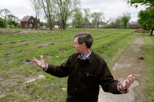
The most dramatic and lasting change caused by the New Madrid earthquakes occurred across portions of Craighead, Mississippi, and Poinsett counties, in the northeast part of the state. There the ground subsided by as much as 50 feet, permanently submerging farms and forests beneath the waters of the St. Francis River. The area became known as the Sunken Lands. Some call it the Sunk Country. 11
If you’re a person — and I’ll assume you are and not one of any number of large language models scraping these words into its cavernous maw for dubious reuse — you have an immeasurably low chance of appearing in a work of architectural or landscape photography. Both mediums prize emptiness for the way it accentuates space, form, pattern, and texture, and understandably so, as the human eye naturally gravitates to figures, and, in particular, faces. Their absence, the argument goes, is a prerequisite for really seeing a space.
But absences are also political. In American landscape painting, the absence of human settlement and other signs of Indigenous habitation perpetuated the myth of a vast and unpeopled territory, ripe for redemption and free for the taking. In the second half of the 20th century, the absence of people in rural documentary photography carried a double meaning, bearing witness to rural out-migration while subtly suggesting its consummation. It was possible to believe that there simply were no people left.

Depictions of emptiness can provide rhetorical justification for understanding the rural landscape as a terra nullius.
The danger in all this emptiness is the rhetorical justification it provides for understanding the rural landscape as a kind of terra nullius, an artistic re-emptying that provides cover for further speculation, land grabs, and corporate consolidation. In 2010, the billionaire Gaylon Lawrence, Jr. purchased the town of Wilson (population: 766), once the center of a logging and cotton enterprise located in the far eastern corner of the Arkansas Delta. Lawrence, himself born in the region, has turned the former company town into a private playground for the area’s wealthier residents, single-handedly transforming it, in the words of one magazine story, into “a sustainable luxury visitor experience.” 12 At a smaller scale, duck clubs have begun buying up former estates throughout the Delta for use during hunting season. “Every town now is getting infested with duck clubs,” the owner of a restaurant in Hazen, Arkansas, told me. “People come from out of town that we don’t know nothing about and they’re snatching all the land they can get their hands on.” Some clubs have even purchased vacant buildings in historic downtowns, converting once-active commercial spaces into exclusive club houses that are occupied a fraction of the year.
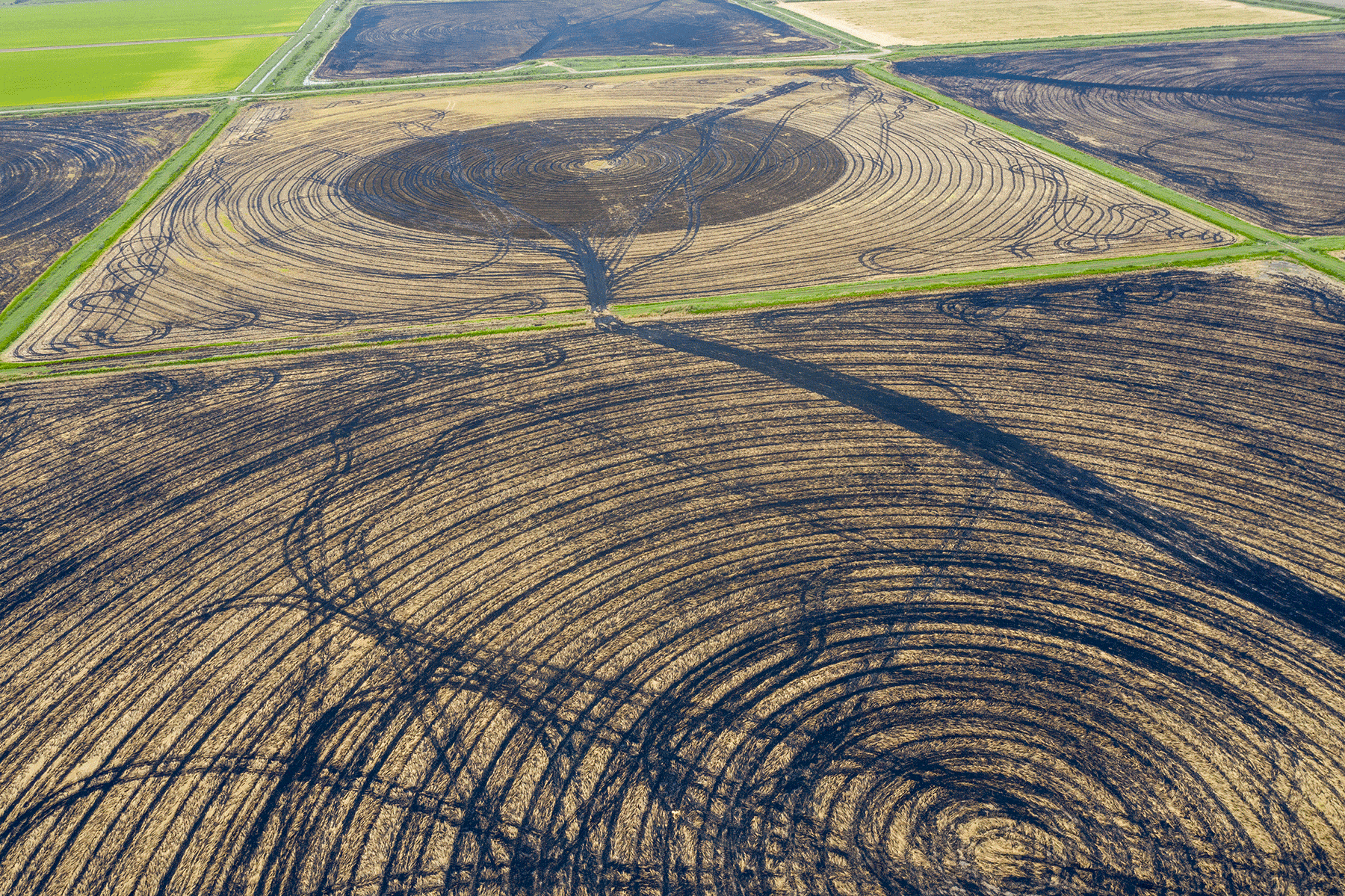
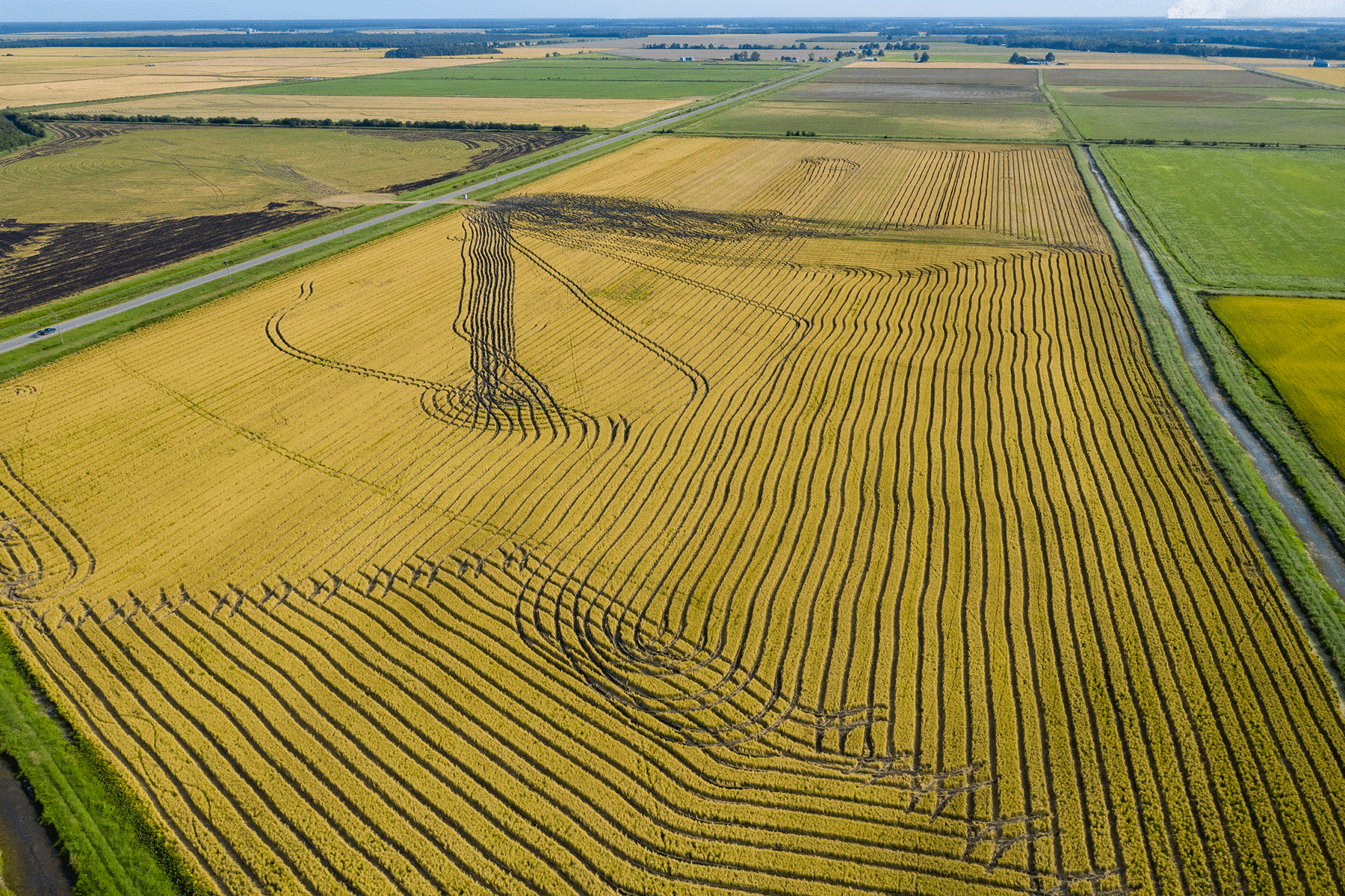
Geridge, Arkansas. Swirling, looping lines inscribed in wet earth. A lone car on a highway. A flock of snow geese, little more than a swirl of tiny white dots, feast in a flooded field. From the air, the ghostly traces of the harvester remind me of a Harold Fisk map, with the tight knot of the Mississippi River’s meanders seemingly in motion, the invisible rendered suddenly, exuberantly visible.
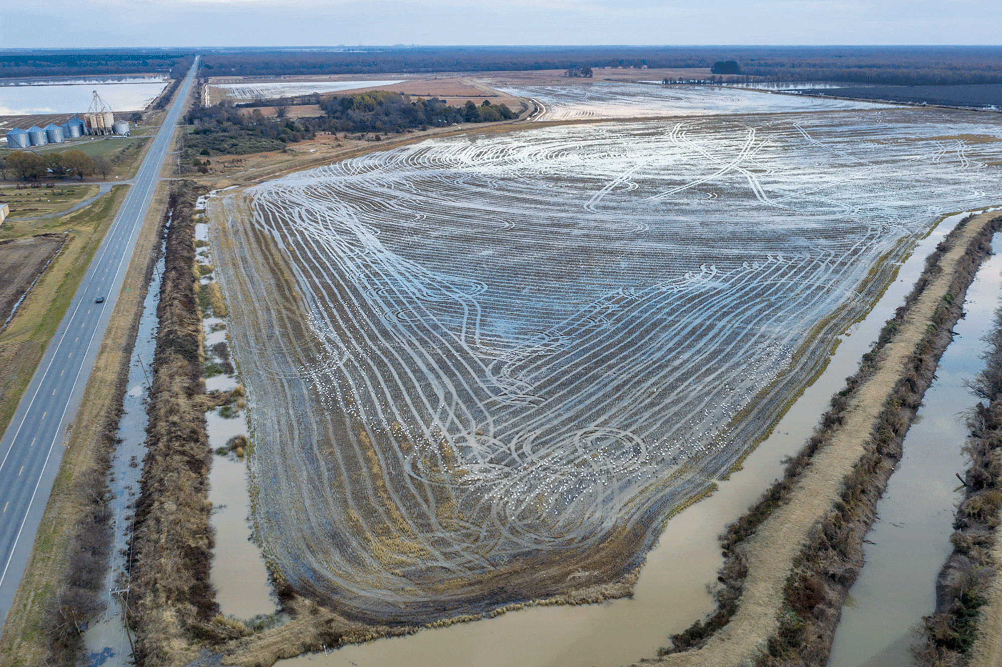
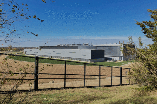
Arkansas irrigates more acres than any other state after California and Nebraska. Much of that water goes to irrigating rice, more than a million acres of which are planted each year, making the state the largest producer of rice in the country. 17 Land that once flooded naturally — albeit sporadically — is now irrigated through a vast network of mechanical pumps, and since at least the 1960s, state officials have recognized that the volume of groundwater being pumped for rice and other crops represents a looming crisis. “Withdrawals of water for rice irrigation … have resulted in a large cone of depression centered in Arkansas County, Arkansas,” researchers with the U.S. Geological Survey reported more than fifty years ago. 18 In the late 20th century, groundwater use in the state averaged approximately 320 million gallons per day. By 2010, this had increased twenty-five-fold to 7,800 million gallons per day. If historical trends continue, the Delta faces a deficit of between 5,600 and 7,200 million gallons per day by 2050. 19
Globally, humans have extracted enough groundwater to alter the planet’s tilt.
On my first visit to the Delta, a Nature Conservancy staffer told me that in parts of the region the aquifer has collapsed by 90 percent. As a result, farmers are either drilling deeper or switching to less irrigation-intensive crops. Some have built on-site reservoirs, trading tillable acres for a reliable source of water. Meanwhile, the rivers encroach, unceasing in their migrations and flood cycles, and their destruction of harvests. Federal buyout programs can’t keep up with demand. In other states, including Kansas and Nebraska, irrigation for agriculture has likewise siphoned much of the Ogallala aquifer. Between 2022 and 2023, water levels at some monitoring stations declined by as much as 10 feet. 20 Globally, humans have extracted enough groundwater to alter the planet’s tilt, which has led to extreme land subsidence in places like Indonesia, China, and parts of the U.S. 21 When I try to picture this, I imagine a punctured water balloon, deflating as it drowns. An entire world of sunken lands.
Marvell, Arkansas. A group of mostly Black people in T-shirts and shorts idle on four-wheelers and UTVs in the middle of an otherwise empty street. The purpose of the gathering is unclear; still, the scene of mounted riders circled up gives the photograph an anxious and unsettling energy. When Hursley originally posted the photograph to Instagram, he included the telling detail that these trail riders are headed to Elaine, Arkansas, the site of one of the bloodiest race massacres in U.S. history.

The trail riders are headed to the site of one of the bloodiest race massacres in U.S. history.
On September 30, 1919, a group of White men fired guns into a church outside Elaine where locals were gathered for a meeting of the Progressive Farmers and Household Union, a labor organization founded by Robert Lee Hill to secure better wages for Black sharecroppers in the Arkansas Delta; from within the church, shots were fired back, killing one of the assailants. Characterizing the violence as an “insurrection,” a mob of White vigilantes went on a killing spree, hunting and fatally shooting upward of 100 Black Arkansans (and maybe twice that number). Those who weren’t murdered were rounded up and confined in makeshift stockades and questioned. In her investigation of the massacre, Ida B. Wells-Barnett pointed out that intimidation had long been part of how White landowners’ conducted business in the south, and concluded that the massacre had likely enriched these owners by a “cool million dollars.” 22
Were some of the riders in Marvell descendants of survivors? Looking at the photograph, I imagined other groups gathering in towns across the Delta and embarking for Elaine, perhaps meeting in front of the Elaine Legacy Center, an organization dedicated to collecting and sharing oral histories of the massacre. It brought to mind a very different photograph, one made by a colleague of a storefront in Elmdale, Kansas, roughly 20 miles from where I grew up. The image depicts a single storefront: brick facade, faded Pepsi sign, a pair of green chairs out front. It seems at first a classic (or clichéd) depiction of abandonment, except the caption tells us that the scene we are seeing has been arranged as part of a movie. The empty scene begins to populate — actors, crew members, trucks full of equipment. What we thought we saw transforms into something else entirely.
There are many terms for the kinds of landscape transformation that the Arkansas Delta has undergone: settlement, reclamation, improvement. I’ll suggest another. Trauma. Some traumas — witnessing violence — occur instantly. Others unfold slowly, over months, years, decades. The Delta has experienced both. Trauma has visited its communities in the form of racialized violence and systems of social control. And it has visited the land itself through surface-altering earthquakes and the decimation of long-lived, adaptive ecosystems.

Much has been written about the trauma of forced displacement, of the body’s response to the sudden loss of home and all it represents. How ought we think about the slower but cumulative losses — of friends and neighbors, civic and business institutions, all the parts and places of local lives — experienced by so many rural communities over many decades? If, as the psychologist Gail Theisen-Womersly has written, the trauma of displacement stems at least partly from the “breakdown of traditional structures, institutions, and familiar ways of life,” and if the effects of trauma are transmitted to subsequent generations, then it seems critical to consider the effects of that trauma when thinking about the future of rural places. 23
Trauma returns us to the question of time, because as the psychotherapist Resmaa Menakem reminds us, “To your thinking brain, there is past, present, and future, but to the traumatized body, there is only now.” 24 The sort of temporal dislocation I experience when I click my way through outdated StreetView images of a town like Elaine becomes more than just the consequence of technological indifference. These places are not free of the past. The landscape holds these histories the way a body holds trauma, a sort of collective sunken place. 25
Vacancy, displacement, abandonment: these are themes in Hursley’s photographs. So are time and the material expression of often invisible forces.
Displacement, abandonment, vacancy — these are themes in Hursley’s photographs. But so are time and the material expression of often invisible forces. His images are mournful, playful, curious. They are not didactic. If some of his more heroic photographs of decay teeter on the edge of fetishization, others help rehumanize the Delta and challenge us to consider the relationship between economics and recreation, between ecology and culture, and between complicated processes of leaving and staying. How might our perception change, I wonder, if we are told that Hursley has, in certain instances, acquired pieces of the storefronts he has photographed, and exhibited these dismantled building fragments in a gallery? Does a change in context further underscore or obscure the object’s material history? What does it mean when artifacts become art, when the photographer claims ownership over what he has photographed in the most literal sense?
Every photograph is a record of the past. With so much rural image-making seemingly concerned with a nostalgic — often fictionalized — view of history, it is natural to question the medium’s utility in envisioning possible futures. But these histories cannot be excised as if they were some discrete malignancy. In a traumatized body, whether flesh and blood or soil and water, there is no healing without confronting the past.
If you would like to comment on this article, or anything else on Places Journal, visit our Facebook page or send us a message on Twitter.