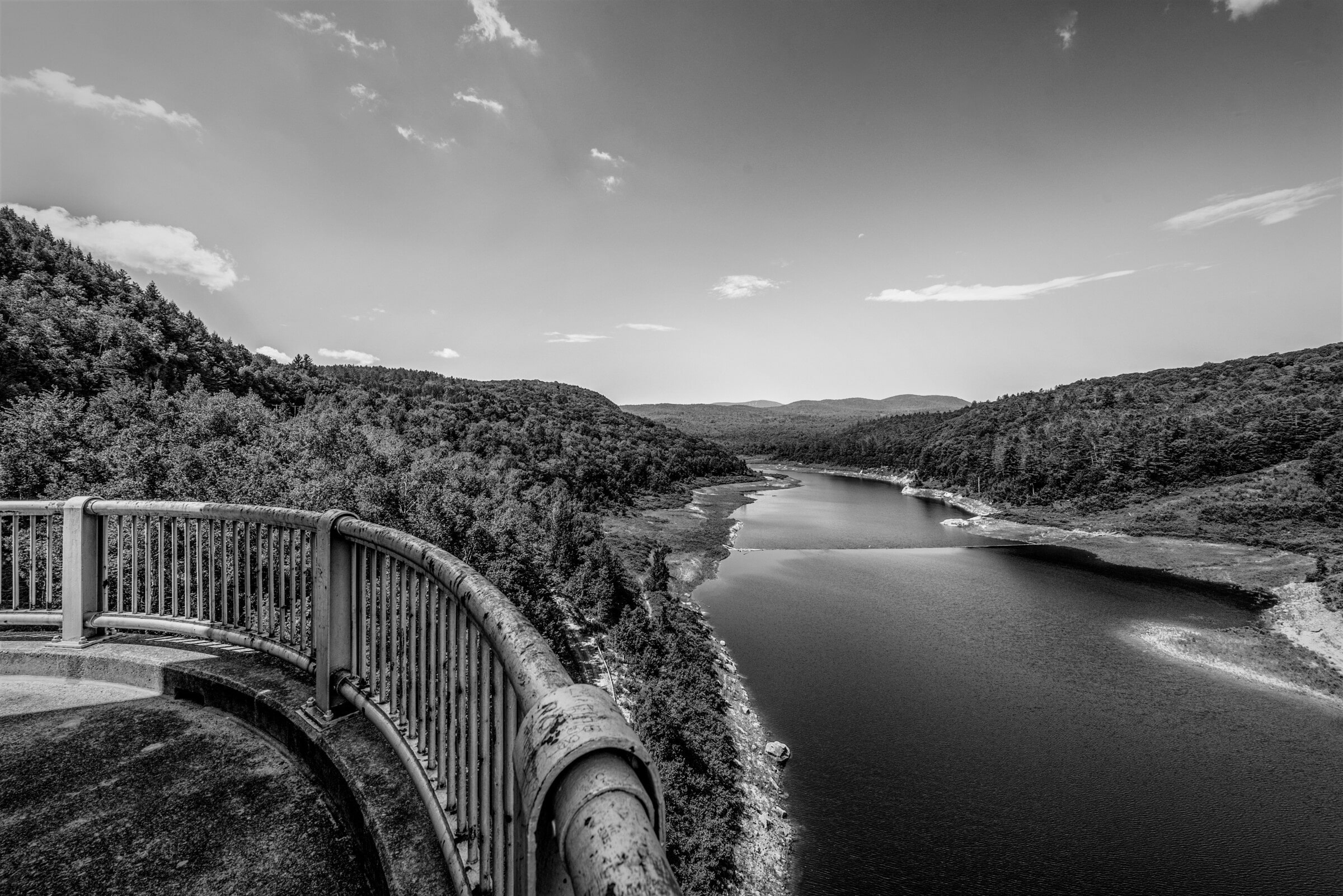
Facing west from the observation deck at Ball Mountain Lake in Jamaica, Vermont, visitors have little reason to believe the body of water before them isn’t a natural one. The lake stretches toward the Green Mountains, narrowing as it returns to its origin, the West River, which winds through lush hills and dense hardwood forests. Only when you glance back from your perch on the observation deck can you see what created Ball Mountain Lake: an earthen and gravel dam spanning 915 feet, capable of impounding more than 50,000 acre-feet of water.
Ball Mountain and Townshend are two of more than 700 dams managed by the U.S. Army Corps of Engineers.
On the other side of the dam, the West River flows southeast, continuing for nine miles before reaching Townshend Dam, then another 35 miles before joining the Connecticut River and eventually emptying into the Long Island Sound, more than 200 miles downstream. The dams at Ball Mountain and Townshend are two of more than 700 dams across the country now managed by the U.S. Army Corps of Engineers. They are also part of a cluster of dams erected in the Connecticut River Valley, beginning in the 1940s, following a protracted debate about how the region should respond to catastrophic flood events in 1927 and 1936.1
By the mid-20th century, the U.S. government had been involved for decades in dam construction across the country. The National Flood Control Act of 1938, passed by Congress partly in response to the destruction caused by the 1936 Connecticut River flood, granted federal agencies authority to build dams in areas prone to inundation. And yet, Vermont remained particularly reluctant to cede land and power to national control. Creating dams and reservoirs would mean flooding arable land and spoiling pastoral scenery to protect industrial towns in states to the south. Local utilities were also concerned that the dams might be used to generate electric power, a market they didn’t want to share with the federal government. 2 Eventually, state and federal authorities came to terms, and in 1950, the Army Corps began construction with Union Village Dam in Thetford, Vermont, at the mouth of the Connecticut River. Ball Mountain and Townshend Dams came later that decade, designed to “desynchronize” water surges from the West River into the Connecticut River and control flooding in downstream towns such as Springfield, Massachusetts and Hartford, Connecticut.3
Historians have written a great deal about American dams, focusing primarily on massive New Deal-era public works projects in the American West: Hoover Dam, on the Colorado River, Grand Coulee Dam, on the Columbia River, Fort Peck Dam, on the Missouri. These are multipurpose dams, designed not only for capturing water or controlling flooding, but also for irrigation and hydropower generation. Their scope and scale are forbidding. Grand Coulee Dam generates enough hydropower in one year to provide electricity to 2 million households.4 To visit Hoover Dam, you must pass a checkpoint, where a uniformed officer asks if you are carrying a firearm, or a drone.
I am keen to show seams where federal authority and expertise meet daily life.
By contrast, many of the dams built and operated by the Army Corps of Engineers, including at Ball Mountain Lake and Townshend Lake, are unassuming. These facilities tend to blend into their surroundings; there are no Bureau of Reclamation security officers to stop your car for inspection; visitors are more or less free to roam and recreate. The landscapes created by these dams reflect what geographer Wilbur Zelinsky called the “vivid inscription of the federal factor — and, to a lesser but notable degree, of local authority — upon the form and content of domesticated America.”5 The dams themselves are property of the U.S. government, and while certain areas are restricted, the adjacent land and water supports a variety of recreational activities.
Over the past three years, I’ve photographed more than 65 dams in 22 states, almost all of them in rural areas or near small towns. (I find that photographing in black and white accentuates the position of a dam in its surroundings, stripping the scene down to its essential elements. People appear sporadically in my photographs, and when they do, their presence serves to highlight the function — and might — of these unusual landscapes.) My aim has been to capture something of the beauty and history of these dams. I’m also keen to show seams where the national intersects with the local, and where federal authority and expertise meet the daily lives of American citizens.
Take the dams built by the Army Corps in eastern Ohio during the 1930s. In response to devasting floods that swept through the state in 1913, Ohioans conducted flood-control studies that soon led to the establishment of state conservancy districts and a recommendation that Ohio urgently build multiple dams and reservoirs. Several years into the planning process, the Army Corps stepped in to help. To this day, the Army Corps administers sixteen dams and reservoirs in Ohio’s Muskingum River watershed. The Muskingum Watershed Conservancy District manages the surrounding areas and recreational spaces — a model of collaboration and shared governance. 6
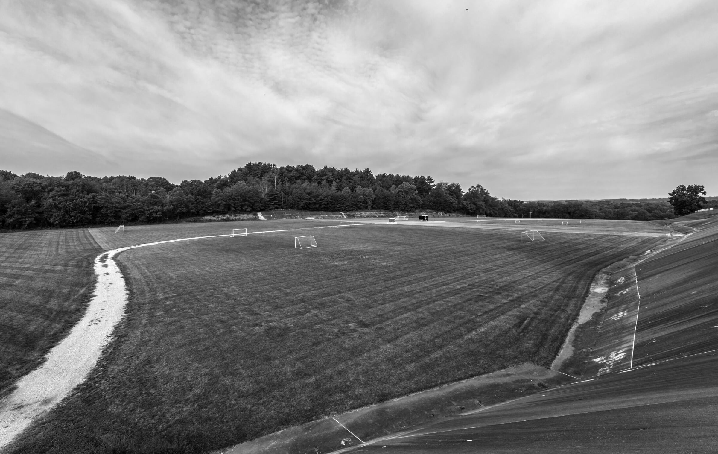
Like Ball Mountain and Townshend, Bolivar Dam, in Bolivar, Ohio, is an embankment dam, made of compacted soil and rocks, that regulates the flow of a river — in this case, Sandy Creek, a tributary of the Tuscarawas River. An intake or outlet tower controls the water level on the creek, impounding water when necessary. During my recent visit, the grounds resembled a community park. A new playground sits in front of the walkway leading to the tower. The spillway, designed to release surging water during a flood, cuts across a soccer field. On the morning I arrived to photograph the dam, a group of runners was preparing to follow the long embankment road toward town.
If I had worn the right boots, I could have waded right up to the sluice gates on the intake tower.
At the dams I visited in the Muskingum River watershed, there were few spots where I wasn’t permitted to wander and point my camera. In Mohicanville, I scrambled down to the bank of Lake Fork, a tributary of the Mohican River. The water level was low, and if I had worn the right boots, I could have waded right up to the sluice gates on the intake tower. Mohicanville Dam is a dry dam, meaning the river normally flows unobstructed; water is only stored during heavy rains, as in July 1969, when, after catastrophic flooding in north-central Ohio, the Army Corps of Engineers shut the sluice gates, creating a temporary reservoir.7 At Dover Dam, I followed a narrow drainage channel curving out from the dam toward the main road — part of a tiered system that conveys surface water off of the walkways. It’s a small intervention compared to the monumental engineering of the spillway, which has helped manage flooding on the Tuscarawas River since the Great Depression.
Not all such interventions are welcome. In 1965, with authorization from Congress, the Army Corps of Engineers began construction of Cochiti Dam on the ancestral lands of Cochiti Pueblo in New Mexico, despite opposition from the Pueblo.8 Designed to mitigate flooding on the Rio Grande and create opportunities for recreation near Albuquerque and Santa Fe, the project desecrated sacred Cochiti sites. When seepage from the dam flooded hundreds of acres of surrounding farmlands, the Pueblo sued the Army Corps of Engineers. Nearly four decades passed before the federal government issued a formal apology for the ruin the dam caused, and for the deceptive tactics the government had used to justify its construction.9 Cochiti Pueblo continues to negotiate with the federal government over management of their land.
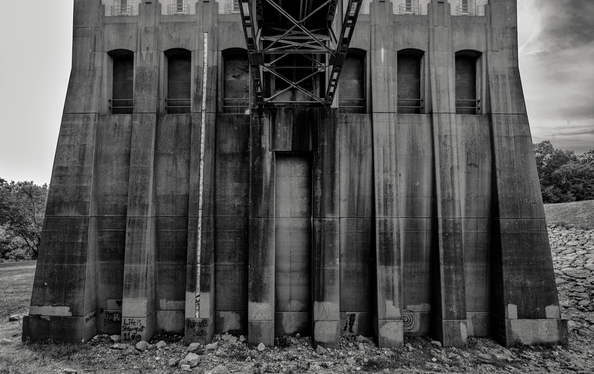
The dams I photographed for this project are all at least 60 years old. Some have weathered historic floods. Yet their significance is most seen and felt in the water that continues to run against, and through, them. A vertical gauge halfway up the wall of the Bolivar Dam intake tower measures the water level, when and if the gates close, impounding water from the creek. Such markers are standard features of the Army Corps dam system, and while they typically appear on walls that extend into water, I have also found them down the hill from towers or posted on embankments. At Barren River Dam, in Kentucky, I spotted one in what appeared to be a floodplain. Sometimes, these gauges indicate the dates of past water surges: an historical record that measures the future through the past, designating a possible high-water mark for the next surge. Implicit is the hope that, as climate change makes floods more common and increasingly severe, this aging infrastructure will be strong enough to withstand the storms that are to come.

Barren River Lake Dam, Kentucky, 2024.

Summersville Dam, West Virginia, 2023.
Carbon Canyon Dam, California, 2022.
Edward MacDowell Dam, New Hampshire, 2022.
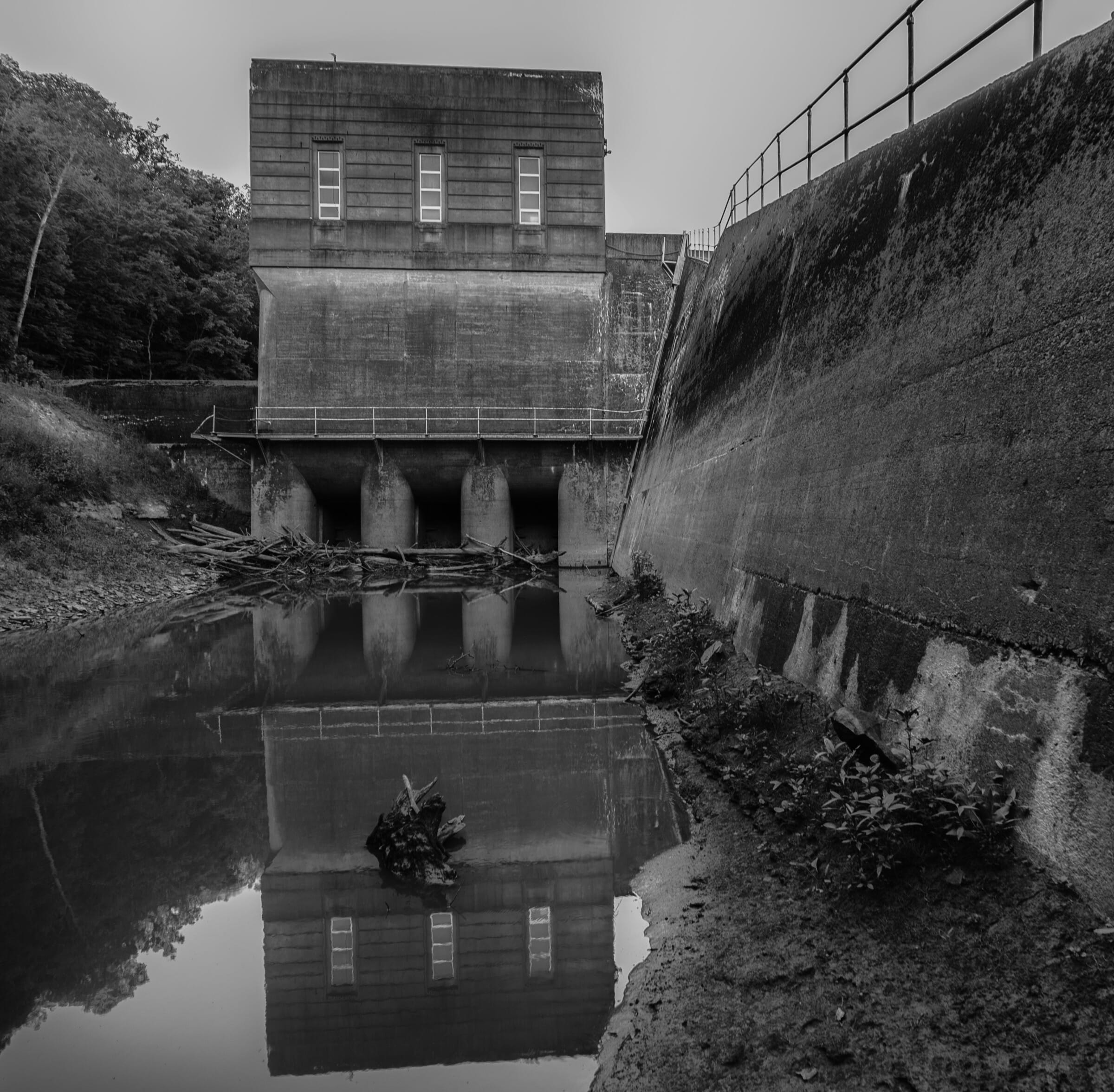
North Springfield Dam, Vermont, 2022.
Pleasant Hill Dam, Ohio, 2024.
Cochiti Dam, New Mexico, 2023.
Mud Mountain Dam, Washington, 2025.


If you would like to comment on this article, or anything else on Places Journal, visit our Facebook page or send us a message on Twitter.