
“God made the world, but the Dutch made the Netherlands.” 1 So the saying goes, in this swampy delta where the Rhine and Meuse rivers meet tidal flows of the North Sea. Dismissed in ancient times as “a pitiful land flooded twice a day,” the delta was transformed in the past millennium by thousands of “polders,” or low zones encircled by dikes and drained by pumps, which enabled farmers to reclaim land where there had been peat bogs, lakes, and sea. 2 A mid-20th century megaproject enclosed even more land behind locks, dams, and storm surge barriers, and today nearly 18 million people live inside an intricate landscape machine run by the ministry of infrastructure. 3 More than one quarter of the country is below sea level. 4
Here the position of the coastline, the height of dikes, and even the flow rates of rivers are defined by law.
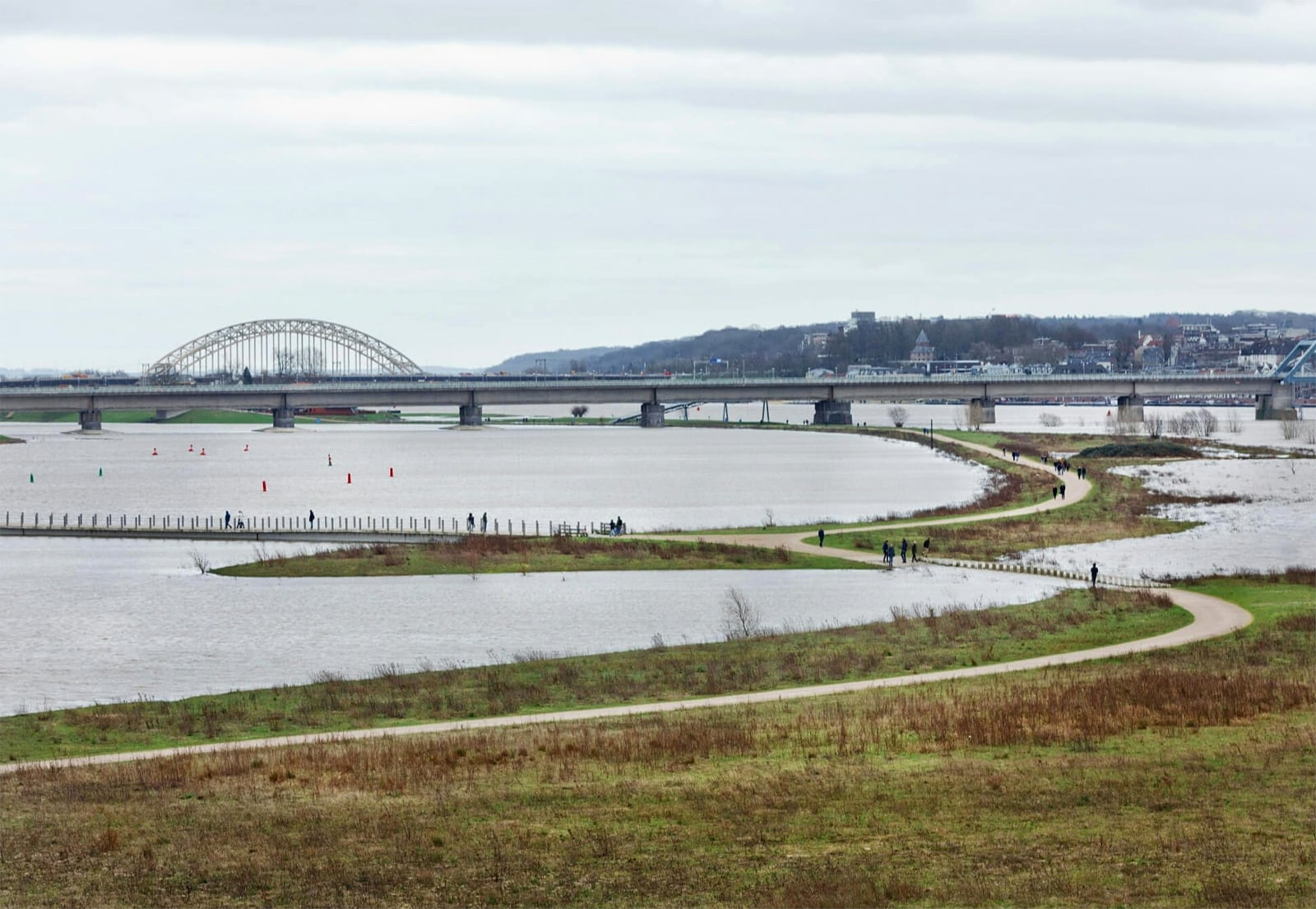
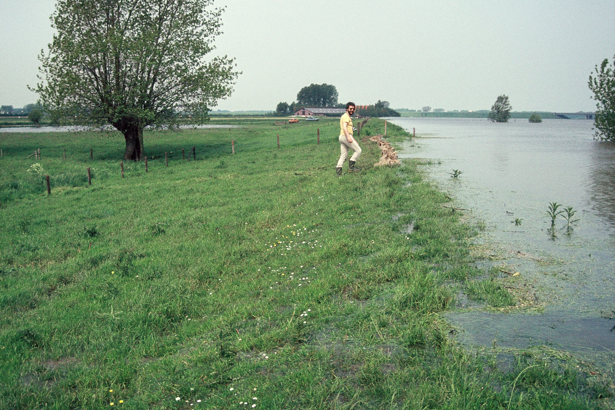
Here the position of the coastline, the height of dikes, and even the flow rates of rivers are defined by law, and these parameters shape computer models that determine how water is managed. But while the metrics are fixed, the behavior of water is not. Climate change brings rising seas and bigger storms that were not part of the calculations for last century’s Delta Works. With sea levels projected to rise further, planners are preparing for a time when enormous pumps may be needed to drain major rivers and lakes into the ocean. 5 More immediately, there is the question of how to handle flooding in the interior. When a so-called “rain bomb” fell on Germany and Belgium in 2021, high waters rushed through the patchy dike systems on upstream tributaries of the Rhine and Meuse. A similar event in the urbanized delta could be disastrous. 6
The Netherlands is thus caught in a paradox: as more land is protected from flooding, more development occurs in flood-prone areas. And so the country is now firmly in a period of “reflexive modernity,” a society organized around the risks of its own making. 7 Planners and engineers are adapting infrastructure to reduce flood risk without (only) raising dikes. Under a program known as “Room for the River,” the national agency Rijkswaterstaat has dredged deeper channels, lowered floodplains, and built bypasses to relieve bottlenecks on the Rhine. Public narratives have shifted away from the idea of “controlling” floods and toward “nature-based solutions” like “living with water.”

What’s more, the Room for the River program is being exported around the world, as a kind of repair manual for countries that are adapting their own infrastructure. With that comes the proliferation of a certain way of thinking — a hydraulic epistemology. For even as Dutch engineers repair and revise the dike system, they have not abandoned the underlying models. The calculus is different, but the logic is the same, rooted in an ideological assumption that experts can govern nature and manage risk through modernist abstraction. 8
As I research the politics and processes of climate adaptation, I’ve been meeting with these Dutch experts to get inside their way of thinking. On a recent trip, one hydrologist jokingly suggested I picture the nation’s development as a process of choking the Rhine. As he spoke, he moved his hands closer together, squeezing the invisible line of the river, until his palms almost touched. Then, at the last moment, he popped them an inch apart to show how Room for the River creates a buffer for future floods.
This was a revealing moment. I’m interested in how experts imagine “resilience,” and how their imaginaries shape practices of landscape planning and design, so I wanted to know more about the actual operations behind that simple, almost childlike gesture. I understood he meant channels dredged, houses moved, dikes pushed back from the water. But I also had my own abstract response. Thinking about all the challenges facing the delta, I wondered: will one inch be enough?
Ruling the Tide
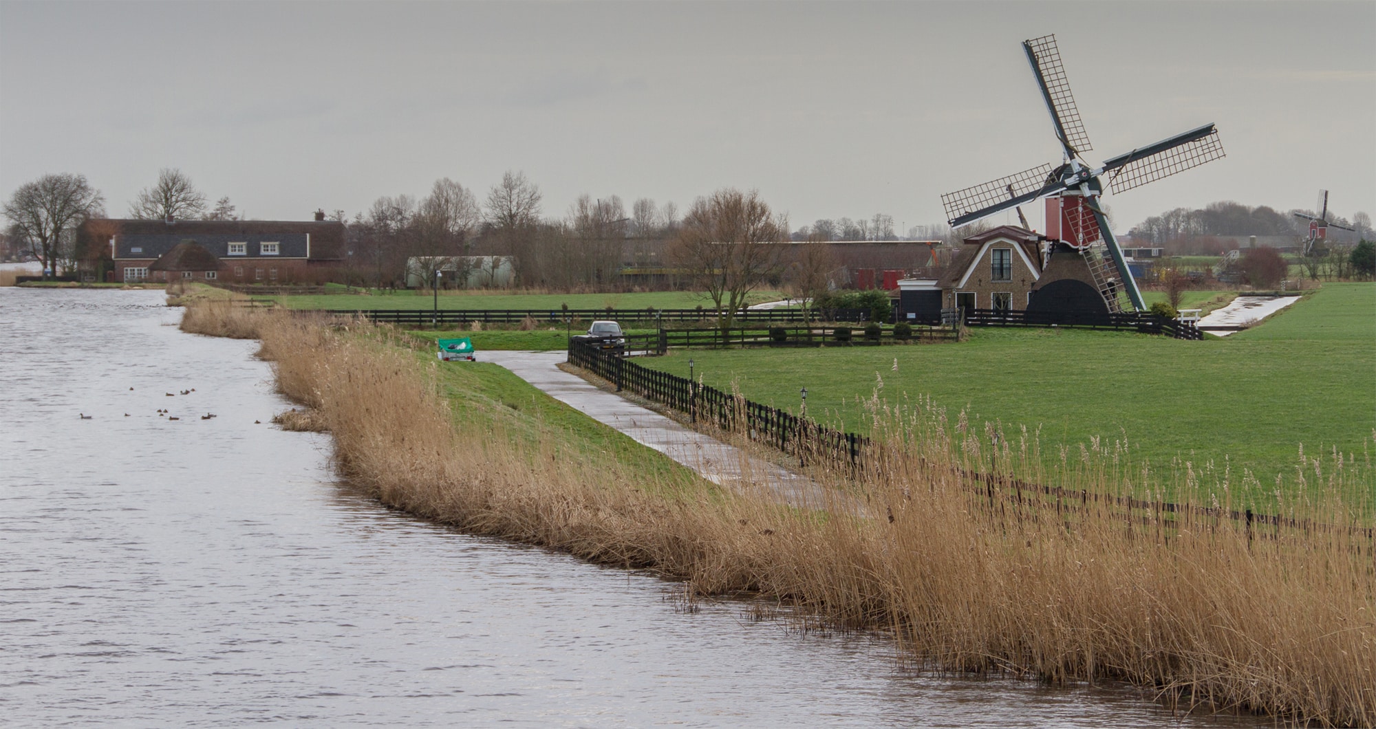
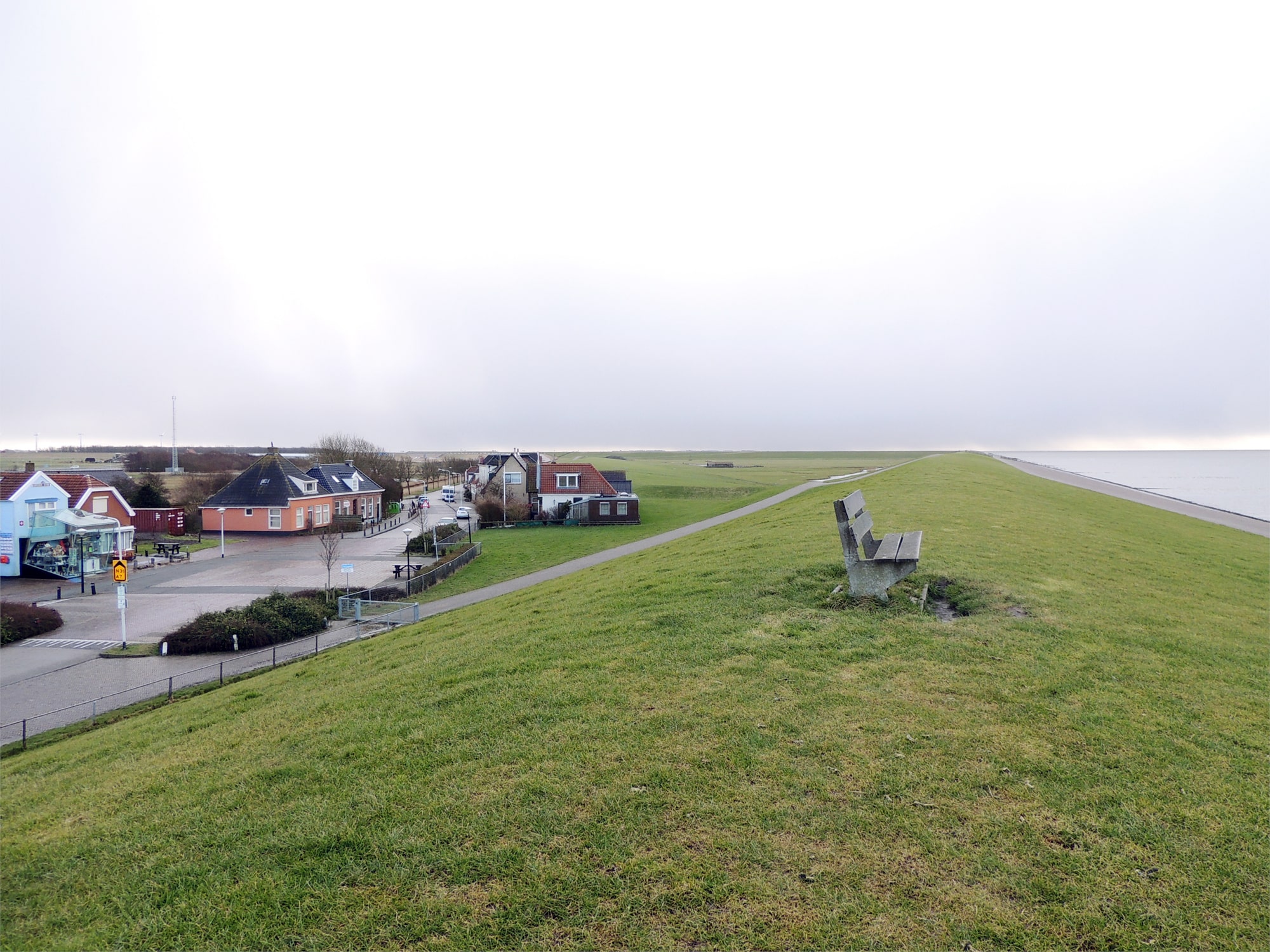
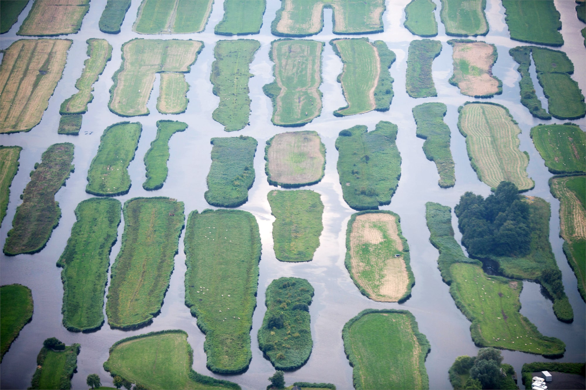
Climate scientists and activists sometimes describe feeling a sense of vertigo when they consider what the future holds. Global warming will bring societal changes that are truly disorienting, and we might imagine ourselves standing at the edge of a precipice. But visions of the future hit differently at sea level or below. In the Netherlands, you can experience climate vertigo while standing on flat ground. Those iconic windmills you see on postcards? They’re technically windpumps that move water out of the polders to ditches and canals that run alongside the dikes. In the lowlands, I experienced the uncanny sensation of walking next to waterways that seemed to float above the fields.
I experienced the uncanny sensation of walking next to waterways that seemed to float above the fields.
These polders are an important node in how the Dutch think about land use and resilience. Starting in the Middle Ages, polders were managed by local water boards — democratic collectives that built and maintained the dikes, pumps, and sluices in a given area, which might be as small as ten hectares or as large as ten thousand. 9 At the height of this system, in the mid-19th century, there were around 3,500 water boards, more or less one for each polder, but today they have been consolidated into just 21 administrative units. This reflects a shift that began early in the modern era, as water management became synonymous with the state. 10
The Bureau of Waterworks (now Rijkswaterstaat) was founded in 1798, only three years after the Batavian Republic, to manage regional flooding that was blamed on the ripple effects of these many uncoordinated local projects. 11 Superimposed onto existing water boards, the new bureau reframed the scale of flood management. Technocratic cooperation became part of the “national identity” and even a “moral imperative” for the young republic. 12 Yet there was respect for emplaced knowledge, too: “The physical maintenance of the nation could simply not do without the routine work of local and regional water managers and their knowledge and skills.” 13
Early on, the bureau set about creating a river atlas and installing river stage gauges throughout the country. With these tools, hydraulic management evolved from a traditional craft into a professional field. For the first time, the delta could be comprehended as a whole, through data. Then, in 1850, engineers began a delta-wide “normalization” plan, dredging and channelizing the rivers to straighten out natural bends and cut a more direct path to the sea. 14 The collective project of flood management was now a national project of river control. 15
The collective project of flood management was now a national project of river control.
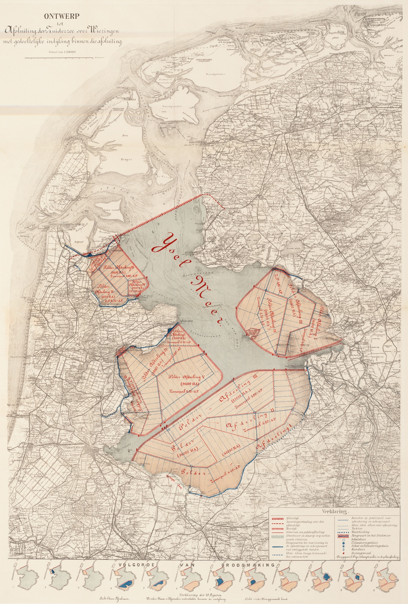
The next step was to build tools to visualize the newly optimized delta system. In the 1890s, researchers trained at TU Delft began experimenting with physical scale models. Now a segment of river could be built in a room, a chunk of the coastline reproduced in an indoor tidal pool. The 20th century brought a full shift to “hydraulic technocracy.” 16 After scale models were used to design the North Lock in IJmuiden in 1921, the Delft Hydraulics Laboratory was founded to build more experimental models, testing designs for public and private projects. 17 The lab’s first assignment was designing components for the Afsluitdijk, a dam 32 kilometers long and 90 meters wide that shortened the coastline of the Netherlands by enclosing a vast shallow bay, the Zuiderzee. 18
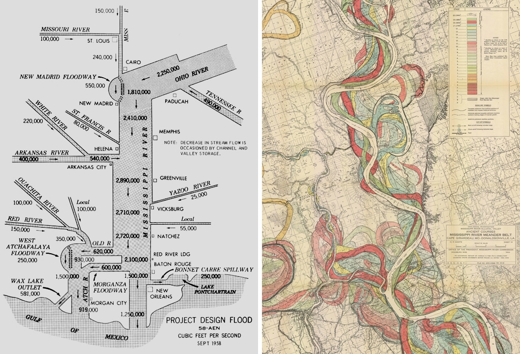
In 1930, Rijkswaterstaat’s new Research Service for the Tidal Rivers, headed by the renowned engineer Johan van Veen, was tasked with “mapping, measuring, and producing plans” for Lower Rhine estuaries and rivers. 19 Inspired by the U.S. Army Corps of Engineers’ large-scale model of the Mississippi River Basin at the Waterways Experiment Station, the Delft researchers decided to build a comprehensive hydraulic model of the Rhine delta on an outdoor lot overlooked by rowhouses. Initially completed in 1948, the Delft model cast the rivers in concrete, with a horizontal scale of 1:2800 and a vertical scale of 1:64. By adding or removing miniature dams and dikes, researchers could simulate the effects of interventions in the real world. 20
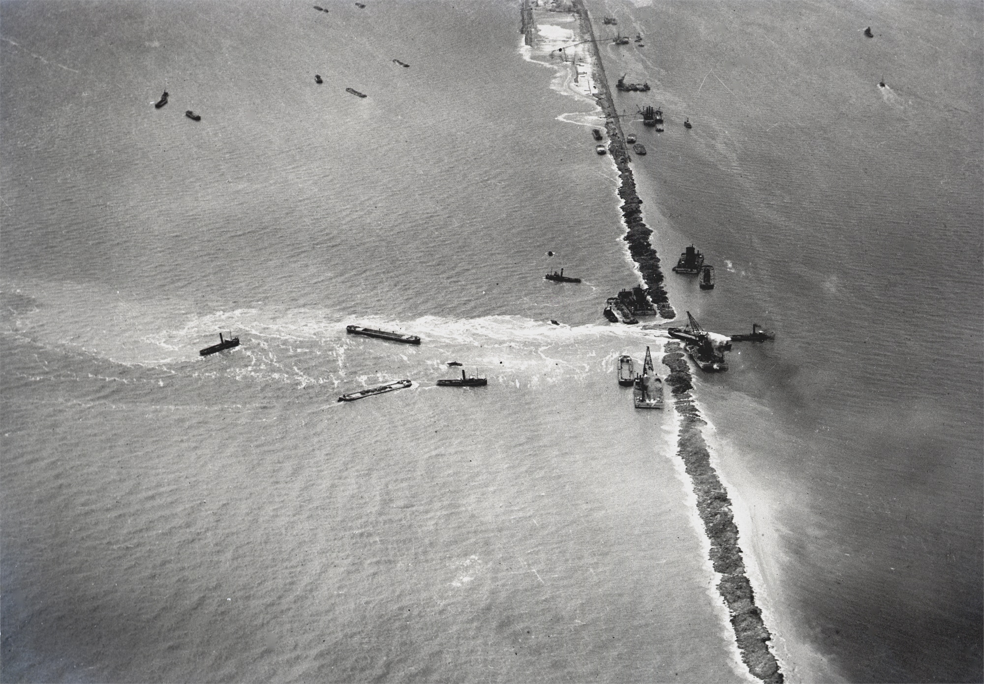
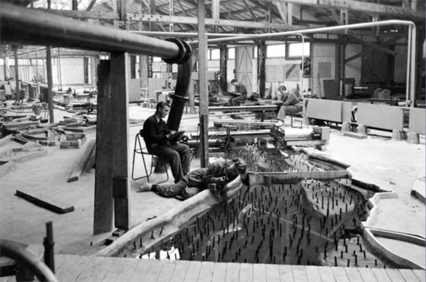
The Dutch techno-managerial approach reached its zenith in the aftermath of the 1953 North Sea Flood, which caused more than 1,800 fatalities in the Netherlands and threatened the entire project of land reclamation. Grainy photographs show water rushing violently through dikes; villages look as though they were built in the middle of the sea rather than tulip fields. In response, the Delft Hydraulics Laboratory expanded their model, 21 and the national government launched the intensive Delta Plan, fortifying and constructing newer and higher dikes and dams.
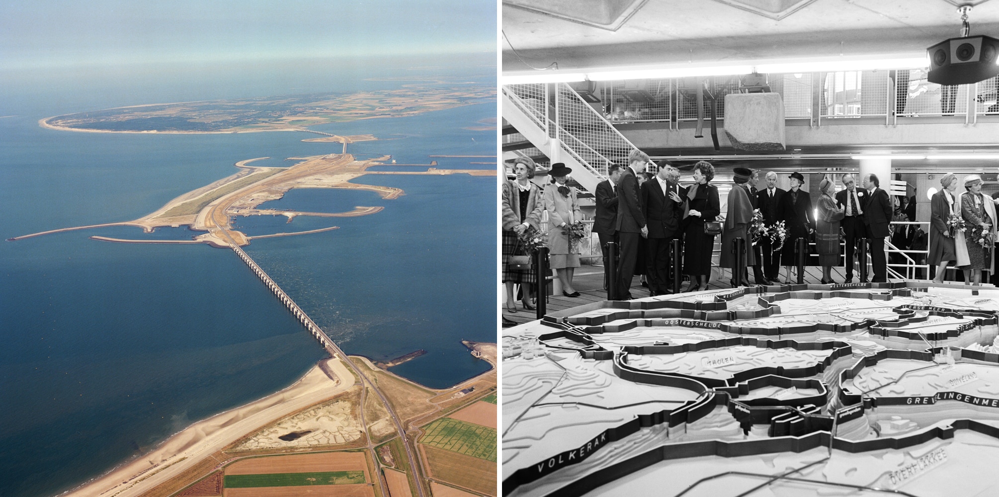
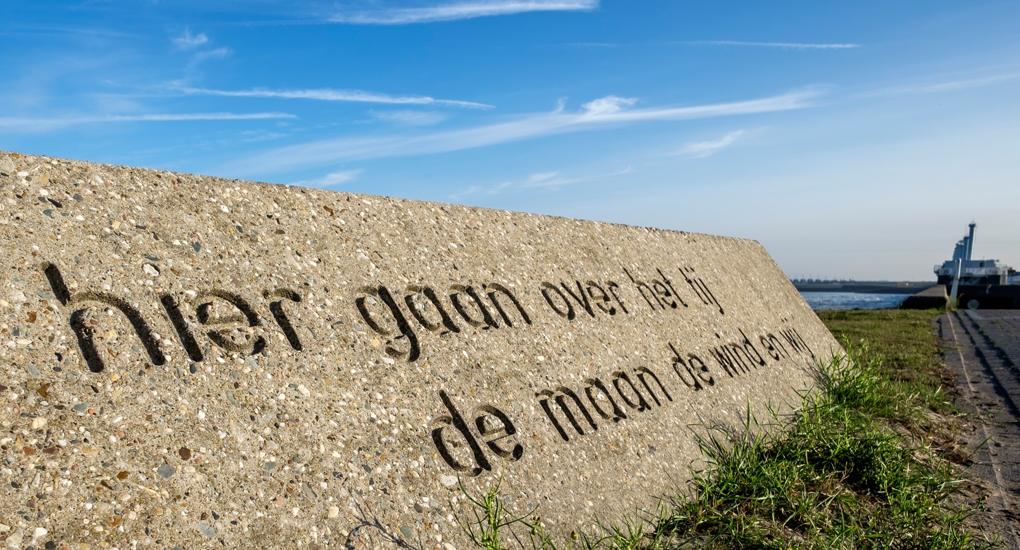
This was the age of monumental, modernist flood control infrastructures epitomized by the Delta Works, “the large hydraulic engineering structures that have come to figure as the iconic manifestation of the Netherlands’ advanced ability to deal with complex water problems.” 22 One report calls it an era of “technocratic paradise.” 23 Of the thirteen major dams in this project, the Oosterscheldekering is the most significant: a nine-kilometer barrier with a four-kilometer sluice gate that can be closed to keep out a storm surge. A plaque at one end boasts, Hier gaan over het tij, de wind, de maan en wij. “Here the tide is ruled by the wind, the moon, and us.” 24
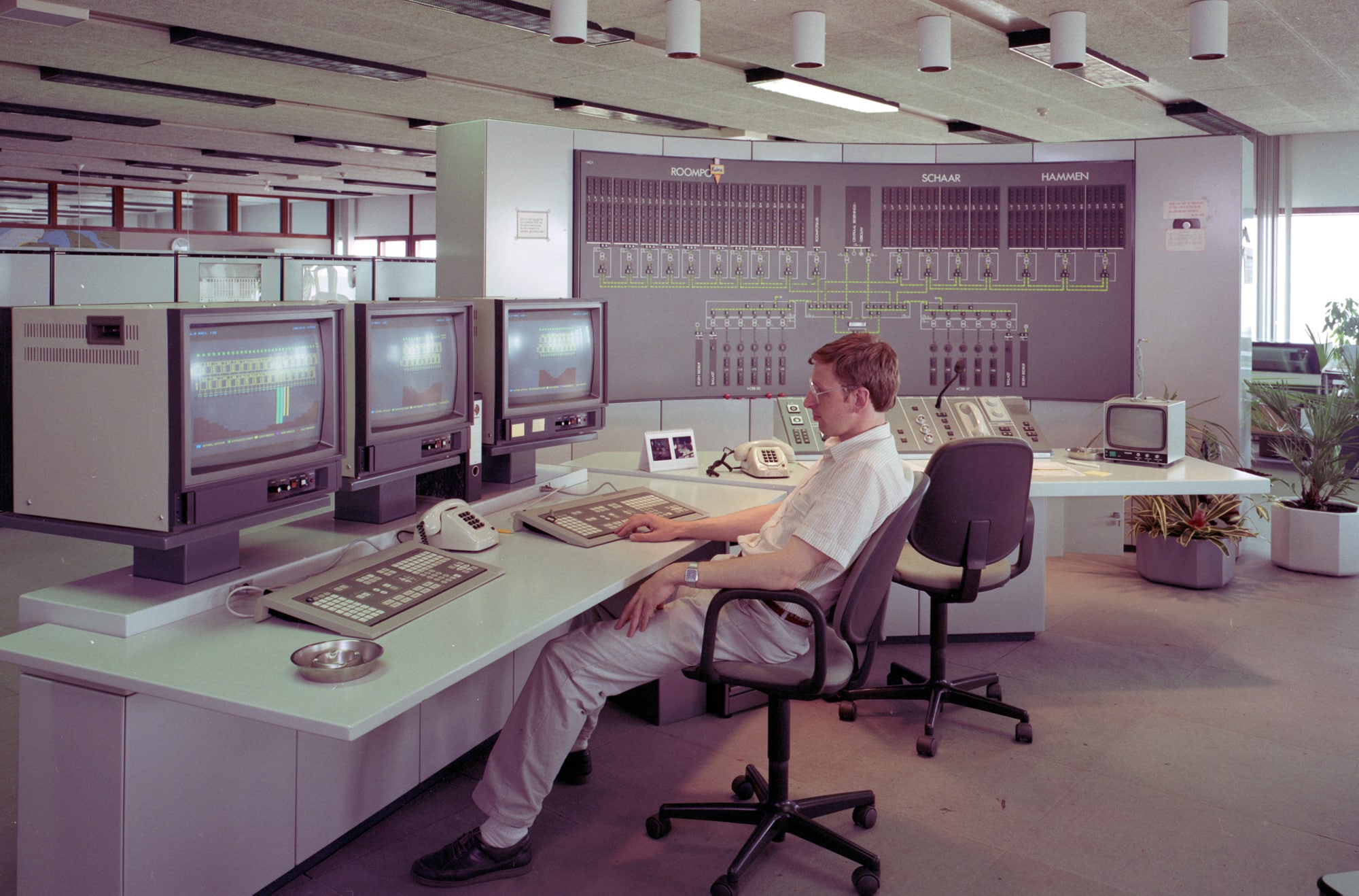
Of course, physical scale models were just part of the technocratic apparatus of flood control. Perhaps more important were the teams of “human calculators” with slide rules who modeled the complex effects of tides, marking up geometric diagrams of the coasts and estuaries with mathematical equations representing the physical principles of water. Briefly, civil engineers explored the potential of using electrical models to simulate water systems, drawing on the analogous properties of flow, resistance, and resonance. Computers began to replace slide rule operators in the 1960s and were predominant by the 1980s. 25
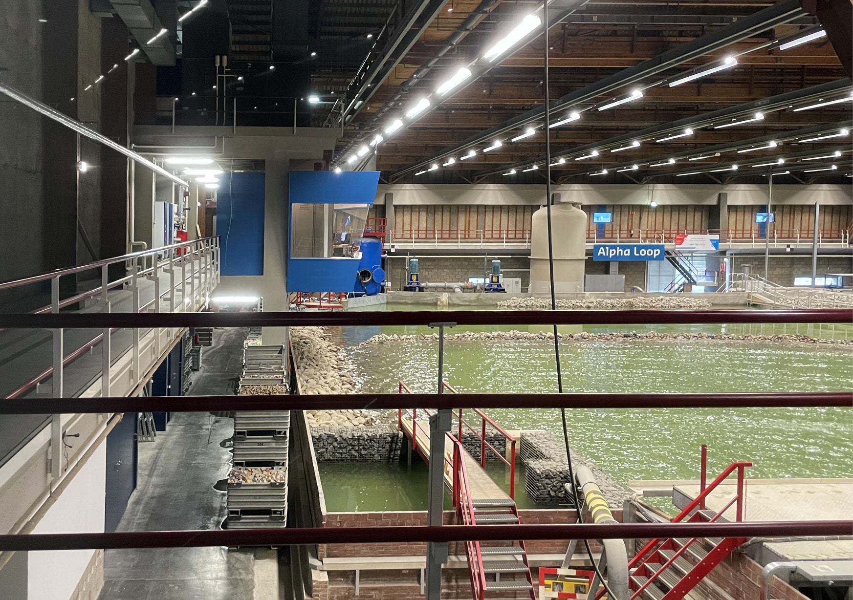
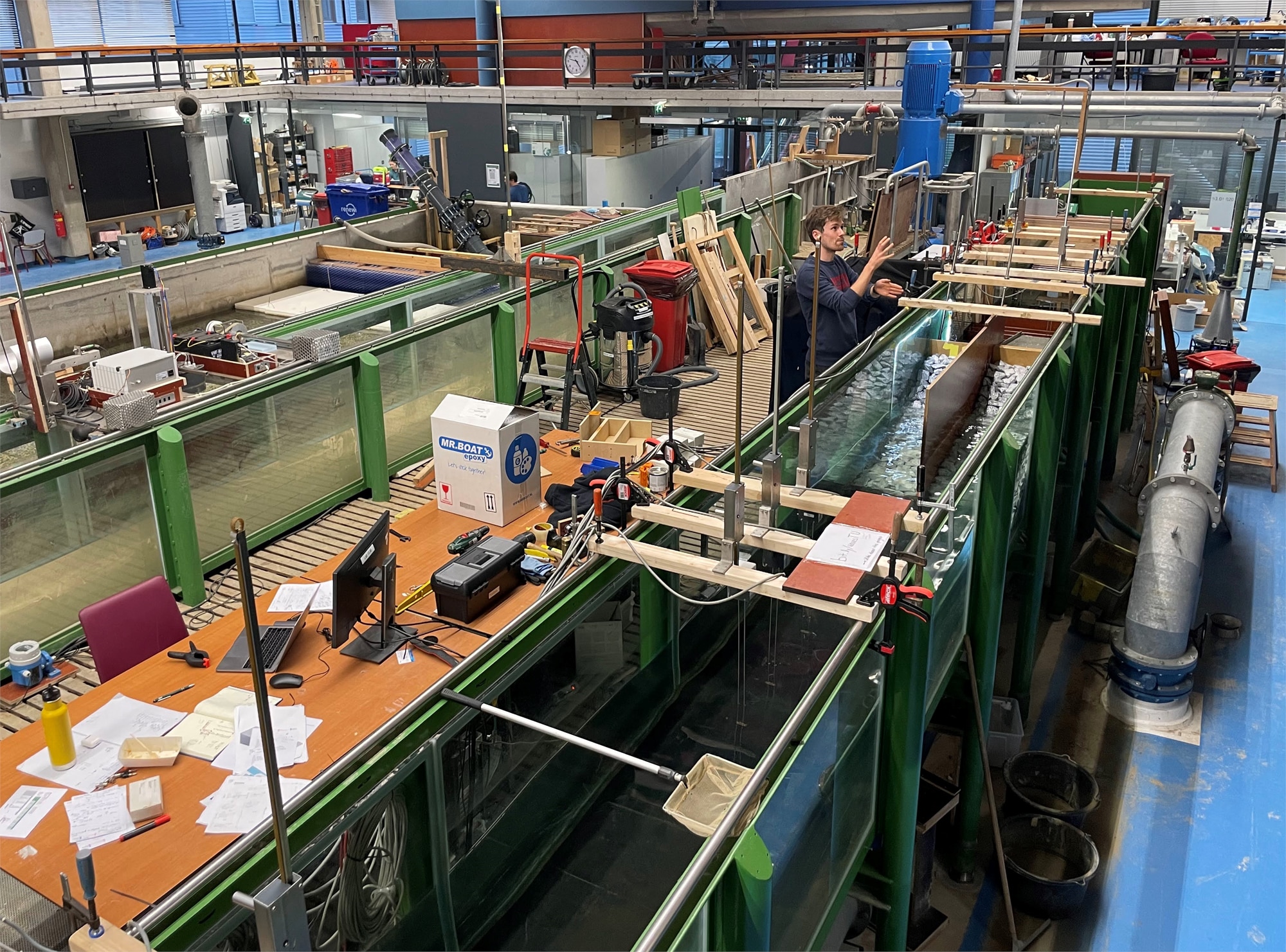
You can still see some of those scale models in use at Deltares Institute, the modern incarnation of the Delft Hydraulics Laboratory. While most researchers here work on computers — even developing their own line of dedicated hydraulic and hydrodynamic modeling software 26 — some research teams favor physical models. The “Delta Flume,” featuring pistons that simulate waves within a narrow channel 300 meters long, is used to test how dikes and other structures withstand wave action. Scale models are also increasingly used to test the dampening potential of vegetation. 27

Room for the River
Beginning in the 1970s, there was a professional and societal shift in the Netherlands toward “nature-based” water management. 28 In 1985, an influential government report on Living with Water placed the “water ecosystem” at the center of policy. 29 This was paralleled in the European Union by initiatives such as the 2000 EU Water Framework Directive, which adopted a watershed approach to river management, and globally by concepts like integrated flood risk management (IFRM), which incorporates “soft structural measures” as well as social encouragement and incentives to reduce flood risk. 30
The technical experts who sought to make Room for the River had to calculate which interventions would create the most benefit, with the least social and economic cost.
Severe storms in 1993 and 1995 accelerated this paradigm shift. 31 Recognizing that the hard infrastructures of the Delta Works were vulnerable to growing climate risks, engineers set out to adapt the system. The national initiative Room for the River (2006 to 2015) created more space for water to flow at 34 individual sites, through strategies such as depoldering, dredging new and deeper channels, and lowering the floodplain. It has been characterized as a “radical break” in Dutch water security, from “vertical (dikes) to horizontal (space claims).” 32 The primary goal of this program was to reduce flood risk to a quantified level, but there was also a second, more intangible goal, to enhance the “spatial quality” at these sites, measured on elusive criteria like cultural value, recreational potential, and aesthetics. 33
Like many efforts of “adaptation” and “repair,” this was as much a political project as a technical one. Lowering flood risk would benefit cities and towns throughout the watershed (including transnational interests), but it would be achieved through site interventions that had local consequences, requiring farmers to give up land and livelihoods or relocate their homes. So the technical experts who sought to make Room for the River had to calculate which interventions would create the most benefit, with the least social and economic cost. Policymakers would then decide which could go forward, sometimes in the face of local opposition. 34

Nobody questioned the need to manage floods, but the implementation was furiously debated at many sites. 35 And while “nature” was central to the program rhetoric, decisions about exactly which forms of nature would be allowed were made in highly technical terms. Since the earliest days of Rijkswaterstaat, the agency’s experts have relied on what Henri Lefebvre called “representations of space” — models, metrics, and technical schemas that reduce complex reality into imageable and manageable components. 36 The designers of Room for the River were charged with making changes to a system that they comprehended at a distance, through the professional tools they used to interface with environments. Models and metrics stood in for water flows and people’s homes.
Models and metrics stood in for water flows and people’s homes.
We can thus trace a line from the abstractions of the first national river atlas to the abstractions of the Delta Works to the abstract operations of repair in the 21st century. The Rhine (Rijn, in Dutch) originates in the Swiss alps, tracing the borders of Lichtenstein, Austria, Germany, and France, before flowing through Germany into the Netherlands, where it meets the smaller Scheldt (Schelde) and Meuse (Maas). As these rivers reach the delta flats, they spread across the landscape, splitting off into distributaries including the Waal and the IJssel. Sediment accreted over millennia forms the western half of the Netherlands, literally the ‘low lands,’ now transformed by poldering, pumping, and draining, and heavily urbanized. The eastern half of the country, near the border with Germany, comprises low hills, a moraine formed during the last ice age.

A farmer, a historian, and a geologist surveying that landscape will each see different things, according to their professional training and personal experience. 37 A water engineer, meanwhile, sees a diagram filled with numbers: specifically, the maximum discharge rate that can be accommodated along each section of river protected by dikes. When the Meuse flooded in 1926, dikes were raised to a level that would contain the river the next time the water was running that high. Back then, tools did not exist to model the discharge rate, but today we know it was about 12,000 to 13,000 cubic meters per second on the Rhine. 38 The catastrophic flooding in 1953 traumatized the national psyche and led to the establishment of a higher “design discharge” — this time, 18,000 cubic m/s. 39 And as engineers built new infrastructure to meet that standard, they reconfigured the Dutch landscape, displacing many people and destroying many historic structures. One trauma begets another. Yet in a country with a collective orientation toward flood management, even people who were displaced could perceive this tradeoff as necessary.
A farmer, a historian, and a geologist will each see different things in that landscape. A water engineer, meanwhile, sees a diagram filled with numbers.
In 1975, the Becht Commission was established to find a balance between safety and practicality. Maybe it wasn’t necessary to build defenses against a 1-in-3,000 year flood. Maybe 1-in-1,250 years was enough. This required not only crunching numbers, but also weighing values. The politically appointed commissioners proposed a lower threshold of 16,500 cubic m/s for the Rhine, and they recommended that planners consider cultural values beyond flood metrics. The standard was lowered again in 1993, after technical models were revised, and then raised again after another round of severe storms. 40 The difficult weighing of economic, social, and environmental costs and risks was negotiated through this single metric.
By the time planning began for Room for the River, the models had grown more complex. Policymakers specified a discharge rate of 16,000 cubic m/s on the Rhine by 2015, which would be raised to 18,000 on the Rhine and 4,600 on the Meuse by the century’s end, anticipating the effects of climate change, urbanization, and flood management interventions upstream. 41 Yet another commission recommended that these measures be implemented immediately, “subject to cost-effectiveness.” 42 In planning offices and senate halls, these numbers had real meaning, but to a farmer whose fields are protected by dikes, they could seem abstract and arbitrary. 43

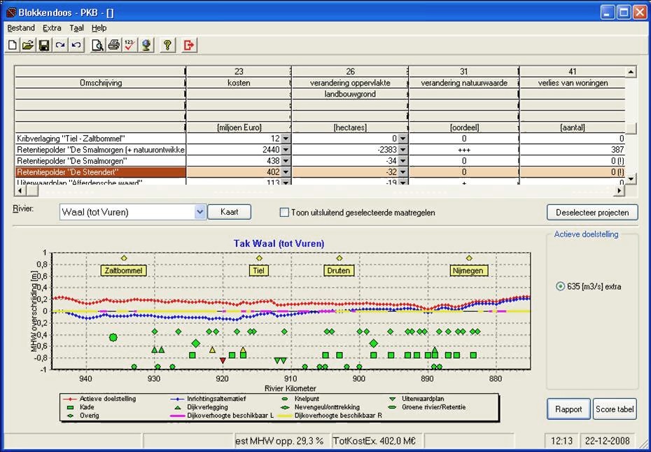
Nevertheless, the metrics were written into the legislative mandate for Room for the River. Design teams proposed about 700 different interventions, and planners and engineers evaluated their suitability for the program. How would each one affect river levels? How much would it cost? How large an area would it cover? How many houses would have to be removed? Since a hypothetical once-in-a-millennium flood cannot be measured in real time, the teams used software to help with the analysis. Known as the “Planning Kit” or “Blokkendoos” (Box of Blocks), this software synthesized data from thousands of model runs to show the effects of small measures like dredging and removing obstacles in the floodplain, as well as large measures like depoldering an area, creating retention basins, and developing bypasses (or “green rivers”) to be only used during flood events. It also illustrated tradeoffs to policymakers and other stakeholders. 44
Software users toggled the options — adding a bypass here, removing a bridge pylon there — until the blue line representing the river fell below zero.
In the Planning Kit, the delta river system was divided into ten discrete sections, and the software included a graph to show how high the river would rise relative to the design flood level. Individual interventions could be switched on and off to evaluate the cumulative effect. Users toggled the options — adding a bypass here, removing a bridge pylon there — until the blue line representing the river fell below zero along the entire section. 45 Each intervention was like a toy block, to be taken out of the box, added to the overall system, and considered. Planners and policy-makers could then “play,” creating different assemblages. Hydrological modeler Jaap Kwadijk recalled that in the late 1990s the Deltares offices were buzzing with young engineers running hundreds of 2-D computer simulations that formed the backbone of the Planning Kit. “Everybody who had an idea of how to do it was taken seriously, and the ideas were simulated in hydrodynamic models, and then were evaluated: Okay, if you will do this, what would it mean for the water levels?” 46
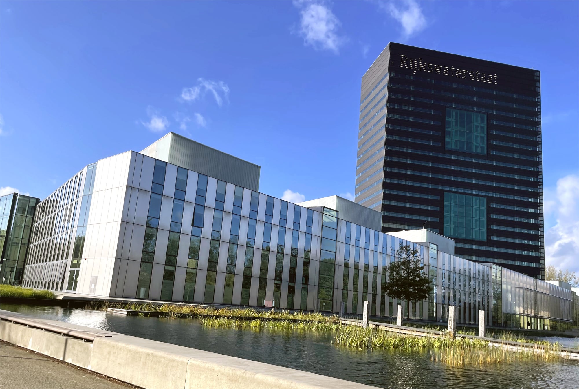
I had the chance to see how this tool worked when I visited Robert Slomp, a senior advisor at Rijkswaterstaat, at the agency’s headquarters in Utrecht:
You can click the measure, and then you can see what the footprint is of the measure. Is it a dike relocation? Is the dike going to be here? How many houses are here? … If you’re talking to the population, and you say, ‘We have a 30 centimeter drop in water level … and this measure will cost 50 houses. And this [other] measure will cost 1000 houses.’ It’s something you can really discuss with politicians, you can talk to the population, and people can understand. … It makes it a lot more transparent. 47
There are always tradeoffs in climate adaptation projects, and in Slomp’s example the software neatly explains the costs and benefits, guiding decision-makers toward a preferred outcome. If the choice is lose fifty houses or a thousand, the answer seems obvious. But there was much less “transparency” about decisions made earlier in the design process. In many cases, by the time a proposed project advanced to the stage of public debate, designers had already narrowed the range of possibilities through which flood mitigation could be achieved or imagined.
As geo-ecologist Frans Klijn explained, the Planning Kit was a model of models, essentially an “Excel sheet” that combined the results of prior model runs. Only after a proposed intervention was included in the database could experts verify it, “by running the model with all the interventions in combination again, to see whether adding up their effects was good or not.” 48 But the model’s focus on peak river discharge volume excluded other indicators of flood risk, such as wind and wave action, as well as complexities like how side channels would react to waves caused by water discharge. 49 In the “collective quest for physically realistic hydrologic models,” there are simplifications that must be made at every step, from the mathematical equations, to the parameters, to the limits of computing power. 50 National policymakers tend to trust the expertise of the people running those simulations, “ignoring the model’s internal details, functioning and uncertainties.” 51 But local actors, in places where projects have direct impact, are more likely to interrogate the uncertainties and limitations of black-box planning tools.

Depoldering the Noordwaard
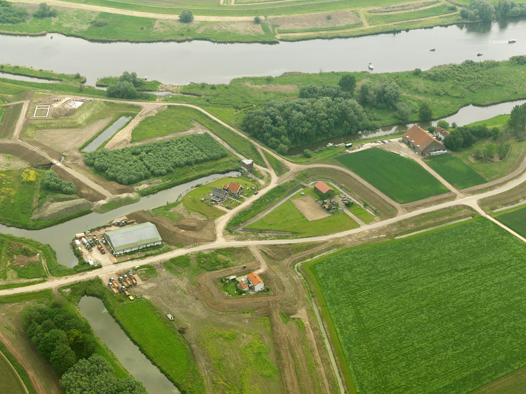
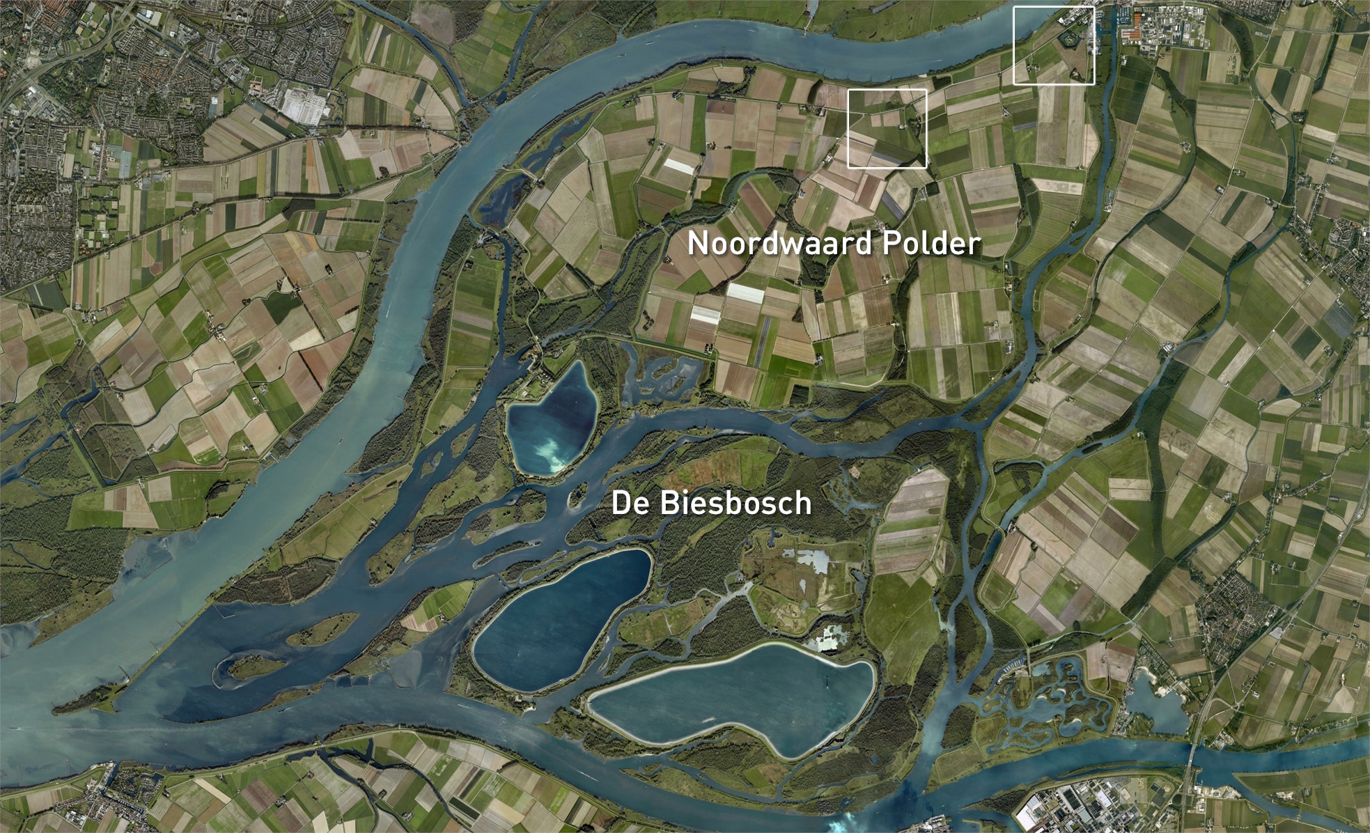
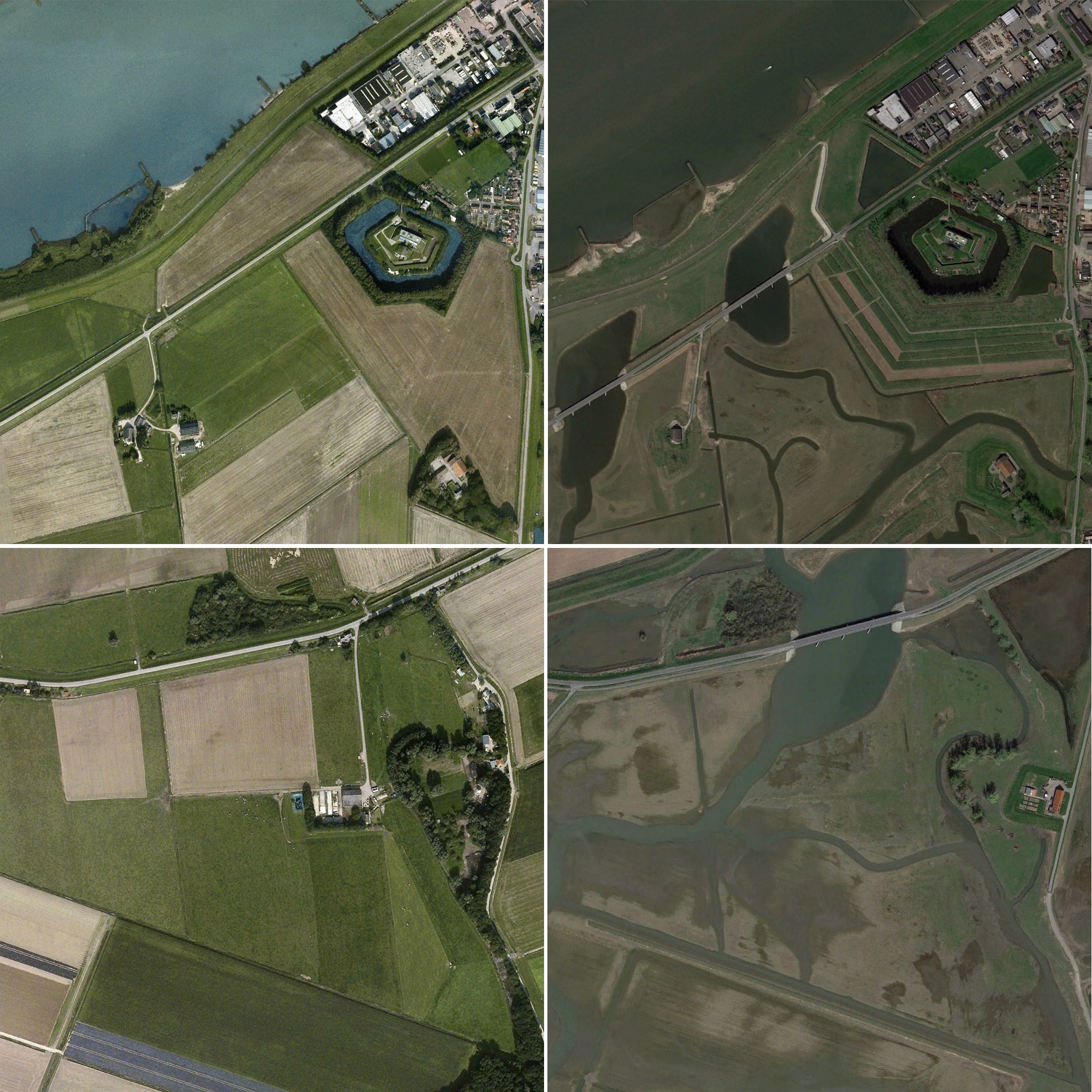
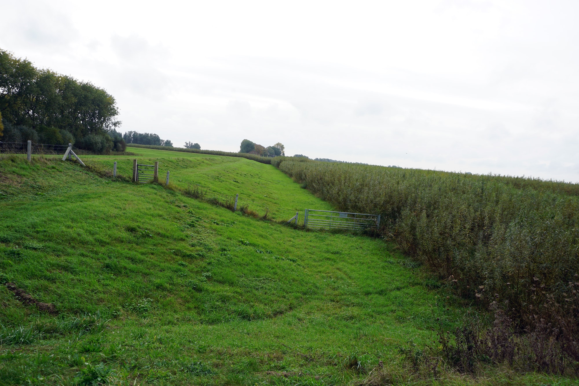
Some of the most contentious proposals involved depoldering, or removing the ring dike around a given area so that it floods during high water events. Because this meant surrendering land, only a handful of these projects were selected for implementation. In some cases, dikes were moved back from the river, requiring the relocation of farms and households, without fully erasing the polder. 52 And at Overdiepse, the dike was lowered, so that the polder would flood once every 25 years or so. 53 Only the Noordwaard polder, built in 1970 at the confluence of the Nieue Merwede and Waal rivers, was fully breached. Completed in 2015, this was the largest single intervention in the Room for the River program. 54
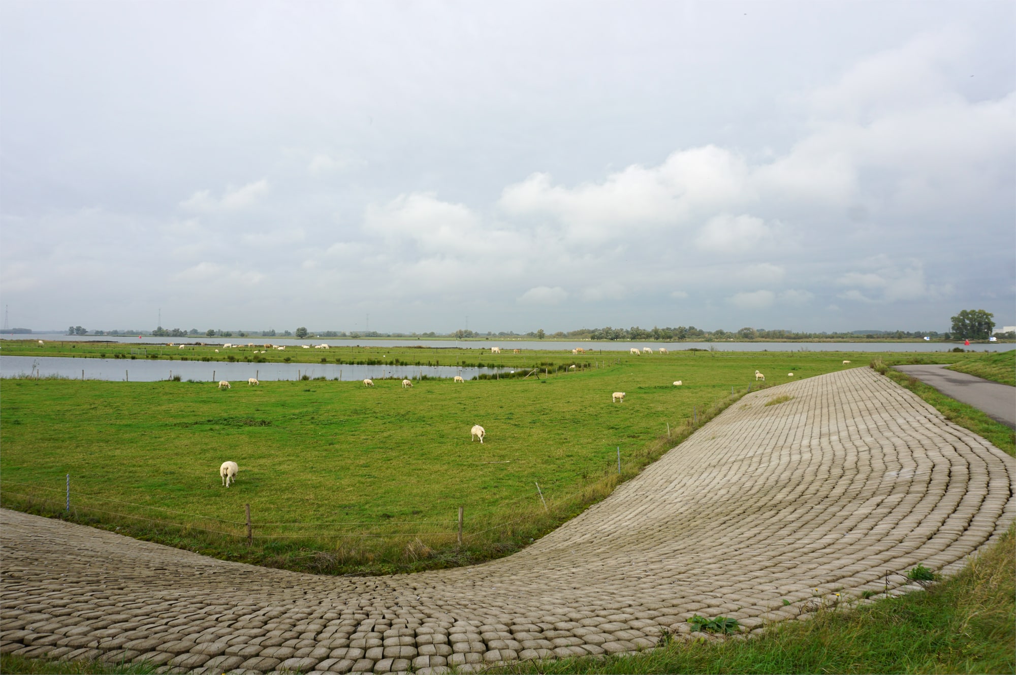
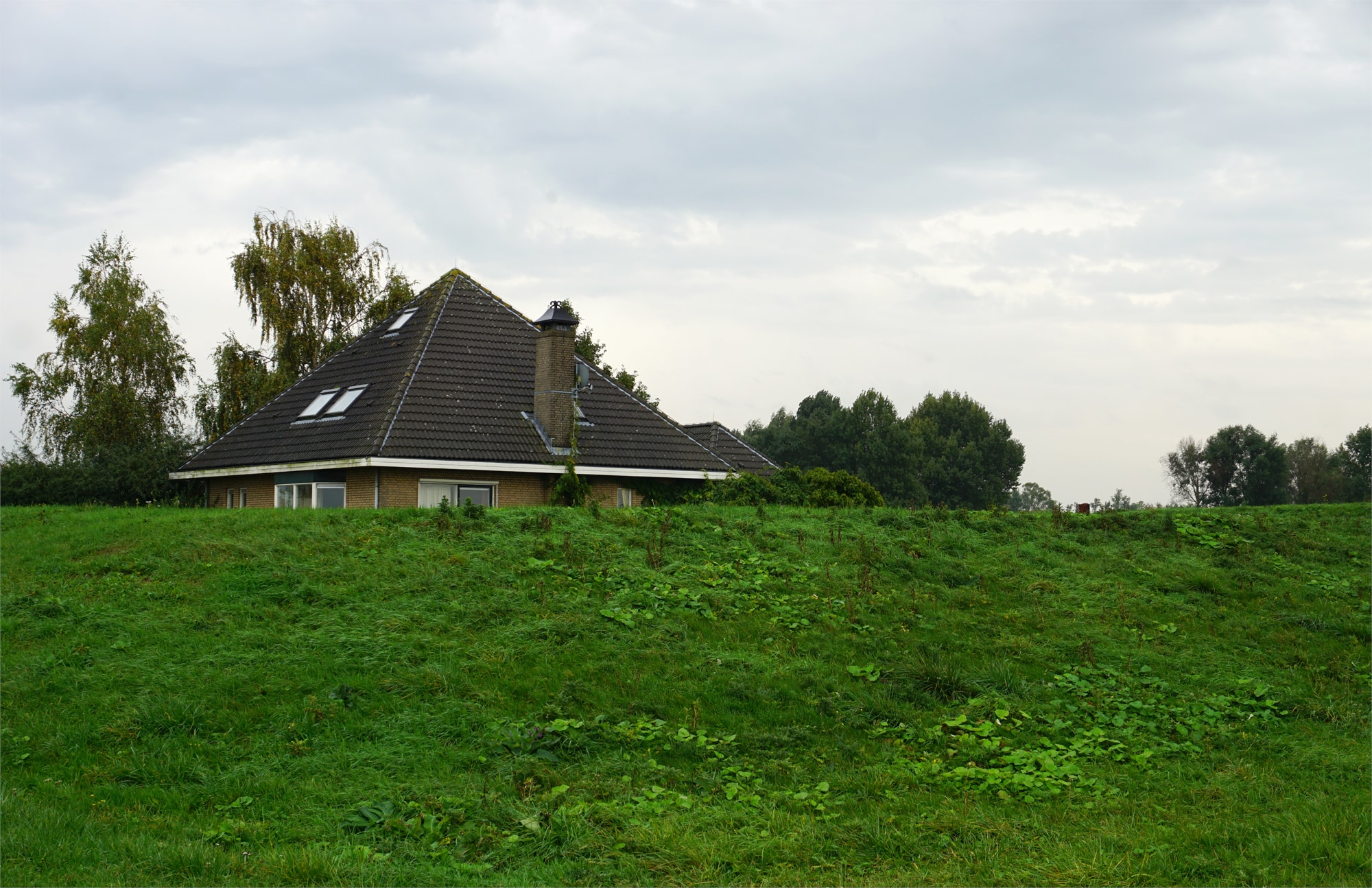
Today, an access road follows the old dike until the point where it was sliced open, then arches over a small pond filled with ducks. This pond connects to channels that wind through a closely cropped grazing area into the center of the former polder. If you were to come on a high-water day, you’d find cows and sheep with soggy feet grazing the muck or huddled on one of the embankments. In the distance, small patches of constructed high ground known as “terps” host a handful of weathered farmsteads.
Depoldering the Noordwaard required building 70 kilometers of new dikes, 33 bridges, and 31 pumping stations, and moving 4 million cubic feet of soil — a tremendous effort. But this was justified by the potential to lower river levels by as much as 60 centimeters, which would make a significant contribution toward meeting the “hydraulic objective” of 18,000 cubic m/s. 55 When the river was running high, water could flow into and through the center of the Noordwaard, preventing flooding elsewhere. To date, this has only happened a few times. One engineer told me that when a spring storm met high tides in February 2020, half his office took a day trip to see the result. 56

Noordwaard after depoldering. [Robbert de Koning landschape architect BNT]

Noordwaard after depoldering. [Robbert de Koning landschape architect BNT]
Noordwaard after depoldering. [Robbert de Koning landschape architect BNT]
Noordwaard after depoldering. [Robbert de Koning landschape architect BNT]
Noordwaard after depoldering. [Robbert de Koning landschape architect BNT]
Noordwaard after depoldering. [Robbert de Koning landschape architect BNT]
Noordwaard after depoldering. [Robbert de Koning landschape architect BNT]
Noordwaard after depoldering. [Robbert de Koning landschape architect BNT]
Noordwaard after depoldering. [Robbert de Koning landschape architect BNT]
Noordwaard after depoldering. [Robbert de Koning landschape architect BNT]


Making space for water here meant surrendering space for people. 57 In the course of depoldering the Noordwaard, farmland was converted into floodable pastures and fifty households were relocated. Other homes were elevated on mounds or, for the particularly reluctant, surrounded by small ring polders in their own private bathtub. The community had been through something like this before, in 2008, when six farms comprising 600 hectares were relocated within the polder to expand the National Park de Biesbosch so that two wetlands could be connected. At the time, the provincial government promised there would be no future displacement of Noordwaard residents. 58 But when Rijkswaterstaat’s engineers fired up the Planning Toolkit, they found that other interventions throughout the country would be too small (or too contentious) to meet the benchmarks for Room for the River. So plans to depolder the Noordwaard were pushed forward despite local protest.
The outcome was foretold by the use of a hydraulic model as a legislated planning tool, even though it didn’t neatly fit the material conditions of the site. An early model, created in the 1990s, remained in effect despite later improvements, and the design team was not allowed to make fractional adjustments within the model’s margin of error. 59 And after the project was completed, maintenance engineers would need to contend with a dynamic landscape — shifting topography, soil, and vegetation — that did not perfectly conform to the modeled world.
The channel profiles can be ‘natural’ only in so far as they do not disrupt the abstract flow rates.
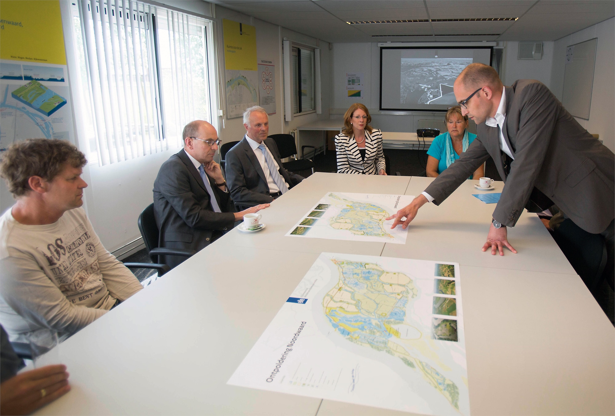
Although the Noordwaard polder has now been returned to “nature,” this section of the river must still be kept navigable for freight barges. 60 Bram Evers, a hydraulic engineer involved with project maintenance, explained that the design re-inscribed a series of historic creeks into the landscape, based on old maps and aerial analyses. (When I visited the offices of the project’s landscape architect Robbert de Koning in 2019, he spread out large satellite prints on the floor, as if we were giants standing over the former polder’s fields.) Yet in the real world, distributaries like these tend to move around. The creeks were designed with a “very theoretical profile,” Evers said, recognizing that their course would be changed over time by tides and rain. Evers’s team measures these shifts and re-inserts data into the model to check the impact on the 60 cm flood reduction. If anything interferes with that goal, the team will have to intervene, likely by re-dredging the channels. Thus, the channel profiles can be “natural” only in so far as they do not disrupt the abstract flow rates. 61
Maintenance teams map vegetation so that they can tell when the ‘performance is off’ and they need to ‘tweak [the] roughness coefficients.’
Vegetation must also be maintained to meet the flow rates mandated by the model. A key limitation here is the parameter of “roughness.” A closely mown field has low roughness, and thus slows the flow of water very little, but if left alone, bushes and trees will grow, and the roughness will escalate to the point that the logic of depoldering is undermined entirely. As Evers explained, a “rough patch” slows the water and raises overall river levels, increasing the risk of a dike breach elsewhere. And so the maintenance team is in the somewhat absurd position of mapping vegetation so they can tell when the “performance is off” and they need to “tweak [the] roughness coefficients” accordingly. On the ground, that means mowing the fields and clearing scrub until the landscape aligns with the mapped roughness levels. And it’s not only trees that pose a problem; ecologists found that “the hydraulic resistance of reed was […] almost as high as that of alluvial forest.” 62 As Evers said, “It’s all in the validation and calibration of those models.”
Room for the River, and Room for Us
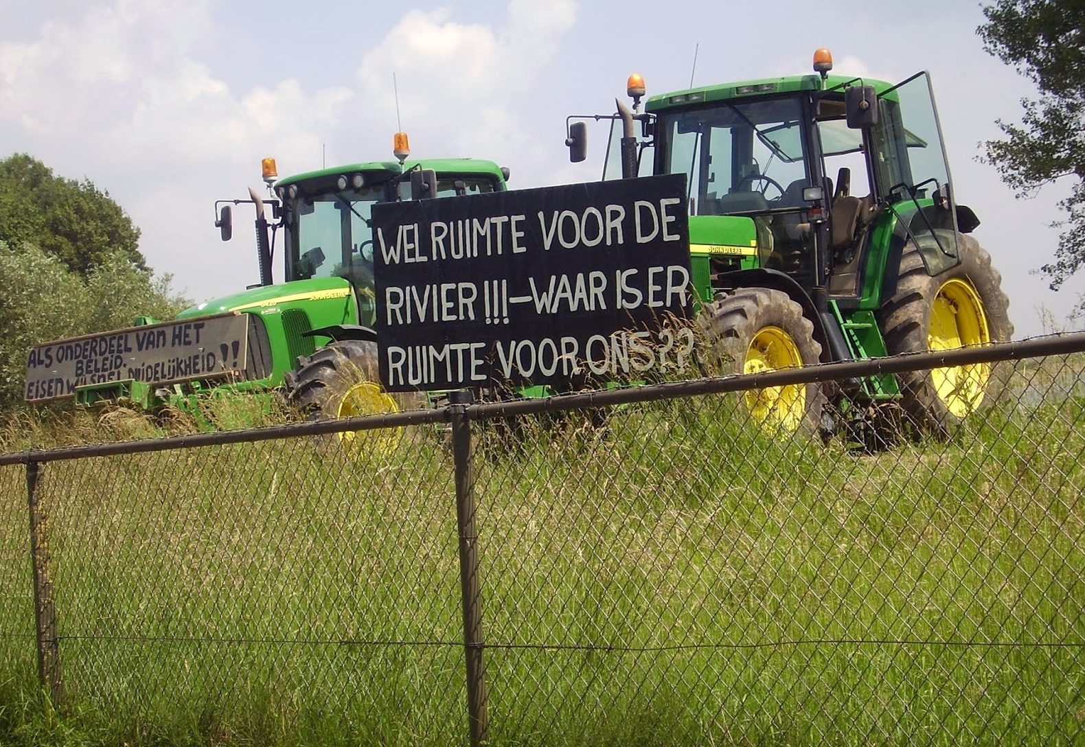
Landscapes — and plans to adapt them — are always contested, involving negotiations over competing values and priorities. In the Netherlands, making local sacrifices for the sake of national water management is a shared cultural value, but that doesn’t mean there is consensus about how sacrifices are calculated. A very real conflict, with people fighting for their livelihood, can be expressed as an abstract dispute over metrics. When plans to depolder the Noordwaard were announced, local farmers objected to elements of the government model that said they should be displaced. They took to their tractors in protest, blocking the delegations of visiting public officials, carrying hand-painted signs: “THERE IS ROOM FOR THE RIVER!!! — WHERE IS ROOM FOR US??” 63
A very real conflict, with people fighting for their livelihood, can be expressed as an abstract dispute over metrics.
In 2004, some of these farmers joined with academic collaborators to establish Platform Save the Noordwaard, which published counterplans that would save homes and allow agricultural activities to continue. One report envisioned protecting the center of the polder with a dike high enough that it would flood only once every two millennia. Another proposed to cut a river channel through the Biesbosch nature preserve. The activists disputed the flow rate used in the government model, questioned the exclusion of IPCC climate change projections, and complained that they were denied access to the model to test their own work. 64 Then project officials reportedly began “stalking” the farmers, visiting them at work, “several times per week, unannounced,” and spreading rumors about their noncooperation to neighbors. After deciding that “casualties were likely,” the academic collaborators withdrew. 65 Whether or not this is hyperbole, it’s clear this was a hot fight over a flood-rate metric. In a later senate hearing, the State Secretary for Transport, Public Works and Water Management acknowledged there was no scientific consensus or “solid scientific proof” behind the 18,000 cubic m/s standard; it was, rather, an “administrative norm.” 66
As for the softer measure of “spatial quality” used to evaluate Room for the River proposals, even the assessors described it as “elusive” and “difficult to define.” 67 Who decides which landscapes have value? As one administrator observed, “landscaping and nature conservation may conflict,” 68 because some people want trees and bird habitat, while others want space to play or walk their dogs. In this case, the “Quality Assurance Team” was composed of five middle-aged white men who were designers, engineers, and scientists. No doubt, their personal and professional backgrounds shaped their understanding of spatial quality. 69
Pushing back against the abstract space of the model, activists sought to establish a more inclusive, politicized space of negotiation.
For some locals, these judgments about “quality” were even harder to swallow than the river flow metrics. They perceived that the government wanted to depolder the Noordwaard for ecological reasons but used flow rate numbers as justification. One resident observed that “there has always been a battle for the area.” If the dispute was solely around conserving nature, landowners would have the upper hand, but with flood safety as the priority, “nobody could object to that.” 70 It’s one thing to be displaced for a prettier polder, but another to be asked to move for the sake of national safety. These residents saw the program rhetoric as a way to limit debate. 71
Models, metrics, and experts can help us understand the climate-changed world and provide options for how we adapt to it. 72 Yet these technical tools cannot be a substitute for political negotiation. Adaptation — including its technical dimensions — must happen within, not outside of politics. 73 In making Room for the River, metrics reigned supreme, powerfully shaping the interventions that were ultimately selected. But the discharge rates were arbitrary, the measures of spatial quality were subjective, and the analysis was performed by experts who were insulated from real-world consequences. By pushing back against the abstract space of the model, groups like Platform Save the Noordwaard sought to establish a more inclusive, politicized space of negotiation. 74
Ironically, the very tools meant to improve participation and overall project quality led to residents feeling disempowered. Setting up a Quality Assurance team to review proposals implied that experts, not local residents, were best equipped to know what makes a “good” landscape. And the Planning Kit, although often characterized as an innovation in participatory planning, was hampered by a narrow sense of just who should participate and when. It was a fantastic and innovative tool for the rapid comparison of options, but it was primarily used “between policy makers from different levels, jurisdictions and regions.” 75 In practice it lent itself to high-level deals: “So the mayor of this city said, ‘Okay, if I do this, [then] you have to do that.’” 76 While that is part of politics, too, it’s not the same as public participation. 77 Because of the complexity of the interface, non-professionals had to expand their own expertise before they could effectively engage with the tool. 78 And, in the end, someone from Deltares was always sitting behind the keyboard. Calling this participatory planning flattens the real hierarchies of power.
Hannie Visser-Kieboom, a journalist and member of the Rivieren Water Board (which includes the Noordwaard), studied the local response to the depoldering project three years after it was completed. She found that while many people were ultimately happy with the transformation of the area, they wished they could have skipped the anxiety and uncertainty in the decade of planning and construction. Residents felt manipulated or perceived an imbalance of power in the public engagement process. Experts wielded models, metrics, and technical assessments of quality that residents could not effectively contest. One said, “We played a game we didn’t know the rules for.” 79
World-Building with Nature
“Calling some landscapes ‘natural’ and others ‘artificial’ or ‘cultural’ ignores the fact that landscapes are never wholly one or the other,” observes landscape architect Anne Whiston Spirn. 80 In my interviews with Dutch water experts, I often asked them to explain what they meant when they talked about nature. The question typically provoked laughs, then hedging. The Netherlands, they tried to explain, “doesn’t have nature.” As Evers put it:
So we call our floodplains and rivers natural but of course, it’s all managed. And it’s all mapped out and it’s all needs to be within the boundaries. So the line on the map, which shows where we can have a bush or a tree, and the line where it needs to go into grasslands. That’s actually something that they maintain all throughout the floodplains. So, yeah, it’s quite controlled. 81
Many preferred to use the word as an adjective. One designer said, “So I think …when we talk about nature, what we really mostly talk about are different natural processes and characteristics and qualities that we want to protect, improve, enhance.” 82 By that logic, any project more green than a concrete dike can be justified as natural, from floodplain expansion to grazing pastures to beach nourishment. These are all “nature-based solutions” in the Dutch delta.
As foreign planners and funders are brought to tour the Noordwaard, ‘living with water’ is not just a domestic value, but an export product.
Jean-Marie Stam, a senior advisor at Rijkswaterstaat, compared the Dutch approach to the history of landscape modifications in the Mississippi River Basin. Making horizontal space for water is an “age-old discussion,” she said. “Personally I would call it ‘good engineering,’ and now [with] Room for the River, overnight it’s called ‘building with nature.’” Perhaps one reason for the rise of this term is the pressure for projects to be not only locally successful but also to create international precedent or serve as a model of best practices. “It became a big narrative,” Stam said, “told that way also to all the delegations that come from other countries.” 83 Foreign planners (and funders) are brought to tour the Noordwaard and other sites, to see a better way to “live with the water and use nature to reduce our flood risks,” as the former Director General of Rijkswaterstaat put it. 84 “Living with water” is not just a domestic value, but an export product.
However, not everyone tells the same story. At the Rijkswaterstaat headquarters, Slomp sketched a simple graph to explain the logic of Room for the River, putting time on one axis and the height of dikes on the other. As time marched to the right from the year 1000, the dikes got taller, and this trend continued into the future, accounting for rising sea levels and larger storms. Then he added a tiny notch to indicate the present moment. Room for the River, he explained, is just “a small dip in one thousand years of constructing dikes.” It corrects a set of specific bottlenecks that occurred because of towns and polders encroaching too far into the floodplain. “So if you look back at this line, if you correct those big spatial planning errors, you can just continue with your dikes again.” 85
There has been no reckoning with what it means to live in a risky world transformed by human action at every scale, from nanoplastics to global climate systems.
That brought me back to Stam’s reference to the Lower Mississippi, where the U.S. Army Corps of Engineers has spent the past hundred years moving back levees and constructing floodways in response to past breaches. 86 While horizontal flood planning is a spatial shift in the Dutch model, it doesn’t challenge the technocratic vision of governing nature. There has been a change in method, but no real change in mindset, no reckoning with what it means to live in a risky world transformed by human action at every scale, from nanoplastics to global climate systems. The room given to the river is tightly calculated according to technical models, the old managerial approach refined.
Of course it’s not true that dikes can get bigger indefinitely. As sea levels rise and polders sink, the landscape of the Netherlands becomes more like a reverse bathtub: dry on the inside, surrounded by water. Dikes will have to become not just higher but wider, and continuous power will be needed to pump out water. Internally the Dutch are very focused on the threat of climate change. At a conference in 2022, Marjolijn Haasnoot of Deltares described an experiment that modeled the impact of a rainfall event like the one that had recently caused deaths in Germany. “We may have flooding for more than a week,” she said. “We may even not be able to avoid casualties.” 87 While outcomes like that are normal in many parts of the world, they are unfathomable here. The Dutch infrastructure is built for a 1-in-1,250 year disaster, and the events that motivated the Room for the River program were not even floods — more like a reminder that floods could happen, with water levels nearing the crests of dikes and towns briefly evacuated.
As climate change accelerates, researchers at Deltares and TU Delft are indeed considering more radical proposals for extreme sea level rise. One idea is permanently enclosing the coastline behind a massive dike and pumping water from river mouths below sea level out to the North Sea. Another proposal would leave river mouths open but raise coastal and river dikes, so instead of one large polder, there would be many smaller bathtubs. A third strategy proposes “living with water,” perhaps even retreating to higher ground, as more of the landscape gives way to frequent flooding. Finally, the “advance” scenario would see the creation of new land on offshore islands, and perhaps the construction of an offshore dike to create a large zone for development. The authors emphasize that these are possibilities, not recommendations — but as rapid sea level rise becomes inevitable, every decision and non-decision shapes the larger trajectory of the country’s adaptation. 88
In the coming years, options like these will be modeled and refined and synthesized and compared, perhaps with tools like the Planning Kit used in Room for the River. Models by definition are not perfect representations of reality, but as they become more comprehensive and visually sophisticated, they are accepted as valid tools for understanding and intervening in reality, and even perceived as “real.” 89 As Paul Edwards shows, in his study of global climate models, “knowledge claims” in the sciences are not neutral facts but rather “value laden.” 90 Self-evident, you might say! But in my interviews with Dutch water experts, they often contrasted their “apolitical” approach with the “politicized” situation in the United States. Models are world-building tools used to persuade, advocate, and govern. We need to ask, whose world are they building?
Room to Reimagine
Room for the River is in many ways an admirable program. Its interventions embody an expanded understanding of natural systems, creating more space for water to flow and wet ecologies to form. Yet the model’s simplifications remake socio-spatial space in their image. Rather than returning the Noordwaard polder to “nature,” the site must be constantly managed, carefully mowed and dredged, in order to manifest the metrics that govern its form. And those metrics were not up for negotiation, because the government framed the flood standards as an issue of national safety. Planning offices prioritized hard, inexact knowledge over the situated knowledge of residents and their supporters. 91
How much effort should go toward preventing a once-in-a-millennium flood in the Dutch lowlands when the whole world is facing climate crisis?
In the case of the Noordwaard, early results suggest that residents may have been right that such a high volume of water retention was unnecessary. Planners estimated the central polder would be inundated 30 to 60 days per year, but in the first five years after its completion, the polder hadn’t flooded at all. 92 Strictly prioritizing national flood risk over local land-use decisions doesn’t allow space for negotiations around concepts like “nature,” “safety,” and “spatial quality,” 93 or for the really difficult question: How much effort should go toward preventing a once-in-a-millennium flood in the Dutch lowlands when the whole world is facing a climate crisis that will require socio-environmental transformations of an entirely different magnitude?
Also: should this approach really be applied everywhere? Room for the River is not just a project defined by models, but a “model project” in the other sense. Because of the Dutch focus on exporting expertise, it has been made “imageable” and “marketab[le]” around the world. 94 When the levees burst in New Orleans, Dutch experts were on hand to suggest making room for the ocean. The Dutch Aid-to-Trade program envisioned helping countries like Bangladesh and Vietnam with water management planning, in the hopes that foreign aid could eventually be converted into paid consulting. 95 And when I was in Vietnam for my doctoral research on climate adaptation, I often bumped into Dutch experts pitching “nature-based solutions” for the Mekong delta. They were happy to explain how and why the Mekong was just like the Rhine, sometimes with a caveat that the Mekong was “still natural” while the Rhine was not. 96 Even when “nature-based” strategies are part of the sales pitch, many Dutch researchers believe “climate-proofing” can be achieved using “hard infrastructure to reduce risks to a quantified level.” 97 But it is folly to impose hard metrics on unpredictable environments.
The currently fashionable effort to reframe “nature” as modellable, calculable “natural systems” often seems an attempt to enroll an unruly nature into the work of water management. Same project, greener tools. If modernism enacted a conceptual shift from nature-as-risk to nature-as-manageable-resource, the era of reflexive modernity involves a campaign to coerce nature to manage itself. 98 The idea of making room for the river, on its face, seems to acknowledge that modernistic strategies of river control are insufficient. But a closer look at the project shows that it epitomizes modernism even more clearly than the U.S. Army Corps of Engineers’ efforts to command and control the force of the Mississippi River. 99
There is no universal definition of a flood; it’s just water that exceeds the boundaries we have drawn on maps and created through infrastructure.
To understand possible future climates, we rely on modeled systems. My aim here is not to cast doubt on the science behind these tools, but rather to bring the messiness to the surface. Reductive approaches obscure the social values and politics that are so vital to adaptation — to deciding what kind of world we want to build under climate change. Designers, planners, and engineers must understand the role our representations of the world play in re-shaping it. And, as part of this, we must always situate models and metrics, acknowledging that expert tools are embedded in place and politics. 100 As we expand who and what counts as expert/ise in the context of adaptation, we must draw on everyday knowledge and practices, allowing for wide variance in what people identify as a risk, let alone whether the risk requires adaptation.
There is no universal definition of a flood; it’s just water that exceeds the boundaries we have drawn on maps and created through infrastructure. 101 There may be “conflicting rationalities” between experts and constituents, particularly when a sharp distinction is drawn between the two. 102 For example, differences in gender, socio-economic status, and occupation can all affect whether a high-water event is seen as a “flood.” 103 At the same time, redistributing expertise without redistributing the power to make decisions just perpetuates old technocratic hierarchies. 104 If we understand adaptation to be a social, political domain, then experts must understand their work, clients, and selves as entangled in the politics of adaptation.
Our attempts to govern the natural world through abstraction have gotten us stuck in cycles of solving problems of our own creation, stuffing the cracks in our models and holes in our levees. 105 In a world simultaneously parched and drenched, overheated and flooded, it should be clear that while these models help us scope out possible futures, nature will not be governed by them. We are living in a climate crisis, and to survive it we need more than regimented space for the river. We need room to reimagine our relationships to the environment around us.


If you would like to comment on this article, or anything else on Places Journal, visit our Facebook page or send us a message on Twitter.