
In 2011, a catastrophic flood washed through greater Bangkok. Hydrologically, this was not so unusual; Bangkok occupies the Chao Phraya River Delta, and although the rainfall that year was higher than normal, the waters didn’t reach the hundred-year flood level. But the landscape was more vulnerable than in past cycles. 1 Factory development in the flood plain, subsidence caused by groundwater extraction, and mismanagement of dams upriver led to severe flooding that killed more than 800 people and affected some 13 million lives. Protected by the King’s dike, which encircles the Bangkok Metropolitan Area, the capital city was largely spared, but displaced floodwaters made conditions worse in outlying districts. The sacrifice zones were inundated for weeks, and then months. As angry “flood mobs” descended on the protected areas, opening flood gates and tearing holes in the sandbag walls, the prime minister counseled them to think of the national good. If the city center flooded, she said, it would cause “foreigners to lose confidence in us and wonder why we cannot save our own capital.” 2
And here is a dark truth of planning for “climate resilience.” Decisions about which areas will be protected are not only about whose safety will be guaranteed; they also involve transnational concerns like reassuring global investors and preserving manufacturing supply chains. In Thailand, thousands of soldiers were dispatched to patrol the floodwalls. They were enforcing resilience. This is both a rational decision and a disturbing vision of our climate-changed future. We are heading toward a world in which the unequal distribution of environmental risks is administered by state violence. How did we get here?
Thousands of soldiers were dispatched to patrol the Bangkok floodwalls. They were enforcing resilience.
This article looks at four large cities in Southeast Asia facing major climate risks: Jakarta, Manila, Ho Chi Minh City, and Bangkok. Each is home to at least 8 million people living in a low-lying delta threatened by rapid urbanization, sinking ground, and rising seas. As officials seek to make their cities more resilient, they bring in outside planning experts who push “climate-proofing” models 3 developed in Japan and Europe, especially in the Netherlands, which has a long history of advanced water management strategies. 4 Highly engineered, technocratic programs come with readymade slogans, like “making room for the river,” a concept which works well along the banks of the Rhine but can mean mass evictions in the Global South. When “slums” (often a slur for urbanized villages with deep histories) are represented as a blight, to be scraped away with little if any recompense, and their people resettled in untenable locations far from the city center, we must ask: “Whose resilience” is really being promoted? 5 Too often, the rhetoric of climate adaptation is doublespeak for the displacement of poor, informal communities, and an alibi for unsustainable growth.
This is not to argue against planning for climate change. We should strive to build cities and landscapes that are socially and ecologically healthy, and the interventions of planners and designers can help us adapt to uncertain future conditions. But we need to be mindful about the language and narratives we celebrate, particularly where the cultural contexts are different from our own. Climate adaptation projects are never win-win scenarios. They are negotiations over competing priorities, some of which have nothing to do with “resilience” at all. 6

Jakarta
Let’s start in Jakarta, where the “Great Garuda” is the charismatic megafauna of resilience infrastructures. About 40 percent of the city is below sea level, and regular flooding along the highly polluted rivers and colonial canals is a fact of life. In 2007, floods forced 300,000 evacuations and spurred new plans to fortify the city against rising waters. An international team led by the Dutch engineering firms Witteveen+Bos and Grontmij proposed to build the National Capital Integrated Coastal Development, which envisioned artificial islands in the Jakarta Bay anchored by the world’s largest sea wall. The scheme, which resembled a garuda, the mythical bird that is a national symbol of Indonesia, was to be financed largely by private development on the islands, including a new Central Business District housing 1.5 million people.
Some families have been displaced as many as eight times. Officials refer to these evictions by the Orwellian term ‘river normalization.’
Victor Coenen, the project manager for Witteveen+Bos, described the NCICD as “one big polder,” 7 referencing the Dutch strategy for enclosing land within dikes to artificially control its hydrology. Essentially, Jakarta Bay would be a bathtub, completely separated from the Java Sea; the city’s rivers would drain here and then be pumped out to the ocean. 8 Critics argued that disrupting the hydrology would harm local fisheries, trap polluted waters within the city, and exacerbate flooding outside the wall. In response to these concerns, as well as allegations of corruption, the project was scaled down to a mere(!) 30 km. Some parts of the plan, including onshore dikes, are already under construction. 9 If the bay is polderized, it will be Jakarta’s iron lung, requiring a whole secondary life-support system of pumps and drainage systems. To prevent retention areas from becoming polluted “black lagoons,” 10 the city will need major sanitation upgrades, which are being led by German and Japanese partners. Getting the various projects to play well together, on time and within scope, is an immense challenge.
One of these parallel works is a “room for the river” plan, the Jakarta Urgent Flood Mitigation Project, supported by the World Bank. In the Netherlands, making room for the river means clearing land in the flood plain and moving back dikes to accommodate the river’s fluctuations. In Jakarta, the government must first remove 2,300 structures and evict some 200,000 people from kampungs, urban villages along the river where land tenure is blurry. 11 Kampungs are often described as illegal slums, but many have deep pre-colonial histories. As places of transition for migrants seeking a better life (or fleeing the destruction wrought by the palm oil industry), 12 these villages have expanded deep into urban waterways, where they hinder flood management. Since effective drainage of the city’s rivers will be essential to the operation of the polder system, the sea wall project is tied to the campaign of kampung removal. 13 City officials refer to these evictions by the Orwellian term “river normalization,” and they have stepped up their efforts as the sea wall project advances. Sandyawan Sumardi of the advocacy group Ciliwung Merdeka explains that many residents are caught in an ongoing cycle of evictions, moving to a new kampung or resettling on the site of the one that has just been demolished, only to see it cleared again months later. Some families have been displaced as many as eight times. 14


Many kampungs are now piles of rubble. Residents who have not yet been allotted resettlement housing, or who have determined that the off-city sites are unlivable, rebuild homes and shops amid the debris of their former lives. Demolition is the government’s first priority, and little else has been done to improve the flood plain. When I visited Pluit reservoir, one of the pumping areas in the master plan, I found a retention basin resembling a “black lagoon” like the ones Coenen described. Choked by debris from upstream — some of it, no doubt, from demolished kampungs — the reservoir resembled a wet landfill, overrun by water hyacinth. Backhoes precariously balanced on makeshift barges chipped away at detritus to keep the water flowing, while garbage trucks dumped waste directly into the lagoon.
In Jakarta the ground is actually sinking faster than the sea is rising.
We often perceive risk in coastal cities through the lens of climate change. If seas are rising, a Great Sea Wall will hold them back. But in Jakarta the ground is actually sinking faster than the sea is rising. The delta is urbanizing rapidly, and the weight of construction compacts the alluvial soil while population growth strains the groundwater supply. This subsidence can be seen clearly in the Pluit neighborhood. Walking on top of the sea wall puts you at eye level with boats in the harbor, while on the other side kampung life bustles a full story below. Needless to say, the neighborhood floods during heavy rains and king tides. Deltares, a Dutch research institute, identified subsidence as a major risk factor in 2007 and has published multiple reports since then, 15 yet Jakarta officials have taken little action. Projects that can be sold as climate adaptation (like building a polder and clearing waterways) seem to have priority over efforts to mitigate groundwater extraction. 16

Manila
The World Bank is also funding slum clearance projects in Manila, an extremely dense, coastal city with a metro population of 24 million. Manila is sinking at a rate of nearly five centimeters a year, 17 but here subsidence is a lesser concern than storm surges and typhoons. Manila is battered by several typhoons each year, and they are projected to grow stronger and more unpredictable with climate change. In 2009, Typhoon Ondoy caused nearly 750 deaths and over $1 billion in damages; a few years later, Super Typhoon Yolanda, one of the most powerful storms in recorded history, killed more than 6,000 people in the Phillipines. 18
Bernarte protests, ‘We are not getting people away from danger… just transferring them from one risky area to another.’
The Metro Manila Flood Management Master Plan, approved in 2012, aims to mitigate this risk through physical strategies such as dams, dikes, canal-dredging, new pumping stations, and “resettlement of informal settlers that have encroached on the waterways.” 19 While not explicitly a climate adaptation plan, one of its proposed outcomes is “increased resilience to natural disaster and climate change impacts.” The $8 billion master plan is led by Joop Stoutjesdijk, a Dutch irrigation engineer who works for the World Bank, and local officials were invited to the Netherlands on a “study tour” to learn about “a new approach that makes room for the river to flood.” 20 A government report describes this as a “modern” and “ecological” approach to managing watersheds, even as it defines the river clearance zone in terms of fixed distances, rather than ecological parameters:
The banks of rivers and streams and the shores of the seas and lakes throughout their entire length and within a zone of three (3) meters in urban areas, twenty (20) meters in agricultural areas and forty (40) meters in forest areas, along their margins are subject to the easement of public use in the interest of recreation, navigation, floatage, fishing and salvage. 21
This is a dramatic redefinition of the city’s relation to its rivers. Historically, Filipinos have lived in flood zones but managed risk through adaptive architectures, such as the bahay kubo house, which is made of light materials and raised on stilts. 22 The World Bank plan targets 125,000 households (nearly three quarters of a million people) for eviction, almost exclusively in the so-called slums along waterways, while largely ignoring wealthier neighborhoods and new developments in the flood plains. 23 “Operation Evacuation” initially emphasized voluntary relocation to sites within the city, where residents could maintain social and economic ties, but with affordable urban land now scarce, the program has shifted toward forced relocation (“involuntary resettlement,” in World Bank parlance) to sites that are two to four hours away. 24
Volunteers report they are not always moved to the site they were promised. 25 And when residents resist, evictions can turn violent, as in Sitio San Roque, where 1,000 armed officers descended on a barricaded neighborhood and flattened it. 26 Although the evictions are framed as being for the residents’ own good, Alfredo Bernarte, deputy director of the advocacy group Urban Poor Associates, compares the resettlement sites to refugee camps. Relocation disrupts the social networks and economies people have built their lives around, and sometimes the new housing is not any safer than the old. At Kasiglahan Village, a resettlement site in a flood plain and geohazard zone, nearly 2,000 homes were flooded in a storm. 27 Bernarte protests, “We are not getting people away from danger and putting them in a safer place. We are just transferring them from one risky area to another.” 28 Cut off from jobs, friends, and families, half of the evictees abandon resettlement housing and return to the city. 29

Ho Chi Minh City
Ho Chi Minh City (formerly Saigon) sits on the edge of the Mekong River Delta, a 15,000-square-mile zone made ecologically and agriculturally rich by the fertile soils carried by distributaries that fan toward the sea. Humans in the delta have long regulated water levels with small canals and dikes; in addition to land-based agriculture, there are floating rice crops and fisheries. 30 During the French colonial era, farmers developed a more comprehensive strategy of “dutch dikes” and polders, which was further intensified during the “rice everywhere” campaigns of the 1970s and ’80s. While frequent flooding is a part of rural systems, in the city it brings life to a standstill, leaving homes waterlogged and commuters pushing motorbikes through waist-deep water. Dr. Ho Long Phi, director of the Center for Water Management and Climate Change at Vietnam National University, observes that in the past decade the city has experienced a new intensity of flooding, “rising year by year” in frequency, duration, and extent. 31
In the next few years, the city will spend $4.4 billion on flood management, including improvements to drainage systems and sewers, tidal control projects, dikes, and reservoirs. 32 No surprise, many of the projects are driven by Dutch partners, who helped draft the Ho Chi Minh City Climate Adaptation Strategy, which strains to compare the Vietnamese city with its adopted cousin, Rotterdam: “both cities are located in the delta of a large river system, have a large port and are an important factor in national GDP.” 33 The focus on these superficial similarities belies vast differences in social, economic, and institutional structures. The document conveniently ignores Vietnam’s large informal population and lack of political freedom, not to imagine the complexities of land tenure in a nation where private property is an emerging concept.
The Climate Adaptation Strategy is filled with ideas that may make sense in a Western context but fail to translate smoothly to local conditions.
The original plan envisioned a $2.6 billion ring dike that would stretch 172 km, wrapping the urban area with flood protection infrastructures moderated by sluice gates that allow canals to empty into the Saigon River, and twelve large tidal barriers. In response to criticism that the proposal was intentionally over-scaled to boost kickbacks for bureaucrats, two Dutch firms were commissioned to develop a cheaper and slightly smaller version. Neither plan is likely to be built soon, but some components are under construction, such as an 8 km dike along the Saigon River set up through a public-private partnership with a Vietnamese developer who will receive land rights in exchange. 34 As many as 1,500 people will be evicted, and the project has been criticized for increasing flood risk for the poorer, rural neighborhoods on the wrong side of the wall. 35
As with plans in other cities, the HCMC Climate Adaptation Strategy is filled with ideas that may make sense in a Western context but fail to translate smoothly to local conditions. For example, it states that dikes should “be located leaving as much room for the river and its flood plains as possible,” 36 which makes sense until you realize that what is “possible” here depends on whether the government admits the land rights of thousands of people. The pilot plan gives District 4 its own small ring dike that neatly eviscerates the island’s perimeter of informal housing while allowing the sale of land for new development atop and around the dikes. The strategy document says this plan was created in collaboration with the community, but a white paper clarifies that workshops were held with government staff and “additional experts” as stakeholders. 37 Since there is no right of free speech in Vietnam, community participation is suspect. The displaced are offered settlement sums that are too low to buy housing near their former communities, and possibly anywhere in the city.

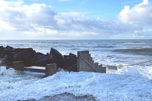
Bangkok
That returns us to Bangkok, where there has been little progress toward a comprehensive plan for climate adaptation since the catastrophic floods of 2011. The immediate response was not to build more resilient housing, but rather to harden defensive infrastructures in industrial areas, in order to discourage investors from fleeing the country. 38 Since the city occupies a flood plain, it will inevitably be inundated again; adding concrete just makes the situation worse. Bangkok is constantly fortifying against flood risk created by its very existence, thus exemplifying Ulrich Beck’s framing of a “risk society” in which modern humans are caught in a cycle of mitigating risks they themselves have created. 39 In decades past (and still today in some rural parts of the country) Thai people lived in “amphibious communities”; for example, in “raft houses” which float upwards on stilts during floods, or in villages built on two levels where upper walkways and living quarters can be used during the rainy season. 40 But those adaptive patterns are disappearing, even as climate risk grows.
Critics say the ironically named megaproject ‘Chao Phraya for All’ will disconnect people from the river while exacerbating flood risk.
Apiwat Ratanawaraha, a lecturer in planning at Chulalongkorn University, told me that the military government (like its predecessors) sees flooding as a “water infrastructure issue,” with little regard for the complex layering of social and spatial factors. 41 In the 1980s, Dutch and Japanese engineers helped build a polder system protected by a 72 km dike, but as the city sprawled, urbanizing districts outside the polder faced flooding more severe than if there had been no dike at all. After heavy floods in 2006, engineers drew a bigger circle, expanding the King’s dike to the boundary of the Bangkok Metropolitan Authority and raising the height in some areas, which only intensified problems outside the line in 2011. Meanwhile, the Chao Phraya River is boxed in by 80 km of floodwalls, and a system of pumps helps mediate the urban water network — so long as the power stays on. While the official policy is to “keep Bangkok dry at any cost,” 42 that is an impossible task, given the city’s hydrology.
Now there are efforts to reclaim a large swathe of riverfront land for the ironically named megaproject “Chao Phraya for All.” The master-planned development will stretch 57 km along the river behind a levee that protects a transportation corridor and riverwalk green spaces. (The first phase, 14 km, is slated to open later this year.) As in other cities, this will involve clearing “illegal” housing in dozens of communities along the river. The project has met vocal public resistance even under Thailand’s repressive government, some of it organized under the hashtag #rivernotroad. But the junta has already removed more than half the homes in the first phase, while providing few details about its plans and avoiding engagement with local communities. 43
Designers opposed to the project say it will disconnect people from the river while exacerbating flood risk on both sides of the wall. 44 They argue that the high dike will narrow the river channel, accelerate flow, and raise water levels, while also blocking runoff from the highlands, potentially turning “the inland into a bowl of soup.” 45 Some, like architect Dungrit Bunnag, claim the megaproject is not really about building resilience at all, but rather a veil for corrupt developers and government officials to line their pockets. 46

Imaginaries of Resilience
As these scenarios show, one problem with the now-ubiquitous discourse on “resilient cities” is that there is no shared understanding of what resilience is. We should speak instead of imaginaries of resilience, or the diverse sets of ideas and practices around adapting to environmental risk. These imaginaries reflect political values. Sometimes, the clash of imaginaries is made suddenly visible, as when flood mobs descended on the King’s dike in Bangkok, revealing the tension between the prime minister’s vision of a dry urban center projected outward to global media and the residents’ insistence that their own homes and neighborhoods be protected. But such occasions are rare. More often, conflicts between imaginaries of resilience are obscured by the depoliticized language of bureaucratic reports and climate adaptation projects.
There is no shared understanding of what resilience is. We should speak instead of imaginaries of resilience.
Poldering has been used successfully since the 13th century in the Netherlands, where polders are managed at the community scale by elected water boards. 47 But the Netherlands is a (relatively) socially homogenous country with strong democratic traditions. In places like Ho Chi Minh City, “ring dike” strategies are imposed from the top down, without the participation of those whose homes will be inundated or demolished, and so the conditions of success look very different. Polders also require active pumping systems, which only work if water levels remain below the dike tops, and that becomes harder to guarantee as sea levels rise. Failure can be catastrophic; a 1953 flood in the Netherlands killed 1,800 people.
From 2005 to 2016, the Netherlands developed the national scheme known as Room for the River (ruimte voor de rivier), which entails moving dikes and dredging new channels along the Rhine and its distributaries to expand the natural flood plain. As the program has matured, it is now in a phase of “international spinoff.” 48 In cities like Jakarta, Manila, and Ho Chi Minh City, local officials and foreign experts have all adopted this rhetoric. When I spoke with Stoutesdijk, he noted that it was not possible to create room for the river in metro Manila, due to local settlement patterns. Rather, he said, relocation projects were focused on removing people from danger zones, i.e. “people who are actually located in the river.” 49 However, “room for the river” is listed as a strategy in World Bank documents associated with the project,50 which indicates that this language — this imaginary of resilience — is being selectively leveraged.

The concept of “living with water” is relatively new in the Netherlands, which in addition to its experience with water management has a long history of creating artificial land. In fact, the country went so far as to outlaw coastal erosion or migration, legally fixing the 1990 coastline in perpetuity. 51 The 1953 floods led to the creation of the Deltaworks — a massive feat of engineering which uses mega-storm surge barriers, levees, dikes, sluices, locks, and dams to artificially control the many mouths of the Rhine Delta. But after heavy flooding in 1993 and 1995, Dutch water managers came to understand the limitations of hard systems.
Architects bring their own imaginaries to ‘climate-adapted’ projects, which can obscure how these projects create social inequalities.
The new thinking is reflected in Rotterdam Climate Proof, 52 a program launched in 2008 that integrates various strategies for living with water, including the widely heralded “water squares,” open public spaces which can double as water retention basins. These models demonstrate a shift “from vertical (dikes) to horizontal (spatial) security provisions.” 53 However, even in the Netherlands these new ideas were contested. Farmers whose lands were to be de-polderized felt that they were being asked to sacrifice their livelihoods. The resilience imaginary “room for the river” disguises the activities of displacement and relocation that the model inherently requires. Compare the American euphemism of “managed retreat,” which conjures an altogether different imaginary, a pseudo-military fallback in the face of a greater enemy. Or the Indonesian framing of river “normalization,” which suggests a return to a healthier riparian state (laughable in the context of Jakarta’s explosive urbanization), while also attempting to normalize — in the Orwellian sense — mass evictions.
Architects and designers bring their own imaginaries to “climate-adapted” or “ecological” projects, which can obscure the way these projects perpetuate or create social inequalities. For example, the Thủ Thiêm New Urban Zone in Ho Chi Minh City, set on a marshy peninsula just across the river from the city center, is being redeveloped from scratch based on a Sasaki master plan. According to the designers, the plan “incorporates the natural delta landscape and river fluctuations into the urban fabric and preserves native vegetation.” 54 Compared to other new districts around the city, the plan does retain significant wetlands. Radial blocks of new towers are interwoven with waterways and green spaces. Not retained, however, are the 14,600 families who made this district home. 55

A short ferry ride from downtown, the peninsula houses service workers who support businesses in the city center, and the area has a deep history as an agricultural zone and ship-repair district. Until recently, the wet, marshy landscape deterred large-scale development. But now it looks like free land to planners managing the transition to a capitalist economy. Yale anthropologist Erik Harms has shown how the recent creation of private property in post-reform (đổi mới) Vietnam underwrites urban development: “unlocking land values to rebuild the city seemed almost like a magic solution.” Many of the buildings threatened by the New Urban Zone are not shacks but solidly built French-colonial era homes. One resident observed, “It hurts the gut to watch this. Houses like that were strong. So many storms over the years. Strong winds, heavy downpours. Nothing ever happened to those houses.” 56
A 122-page report prepared by Sasaki included tidal analysis, climate change projections, “vegetation, waterways, orientation and views,” but the occupants of the land (“informal settlement housing”) were mentioned only once. 57 The design rhetoric focused on the technical and ecological achievement, while making invisible those who would have to sacrifice their homes. 58 The resettlement site envisioned in the plan was not completed until years after demolition began, and it can accommodate only a fraction of the displaced. As one evictee said, “Everybody likes a new urban zone, but nobody likes a new urban zone that causes poor folks to live on the streets.” 59
When I spoke with technical experts on the ground in these four cities, they emphasized the gap between what is attractive and what is needed.
Across Southeast Asia, infrastructures (often at incredible scales) are promoted as the answer to climate and environmental risks. Importantly, these projects provide an image of resilience, even if the actual merits are uncertain. But when I spoke with technical experts on the ground in these four cities, they emphasized the gap between what is attractive and what is needed. In Jakarta, for instance, donors and politicians are drawn to the flashy Great Garuda instead of addressing the subsidence that underlies the city’s flood risk. Tangible, visible infrastructure projects are prioritized over underground works like water pipes. International organizations know that “climate change” attracts donor dollars, even though delta cities face more urgent threats, like the weight of construction, groundwater extraction, and the disruption of sedimentation regimes by dams and development. Those cities could be made slightly more resilient tomorrow, through small regulatory actions such as limiting the “dewatering” of construction sites during excavation. But any activity that could hamper growth is anathema to local governments and development agencies. Climate resilience is a “super-wicked problem” with no single solution, and many interventions have unforeseen consequences. 60 It’s easier to muster political will and funding for projects that have been successful elsewhere.
In Ho Chi Minh City, Phi believes these dynamics have led to the preference for foreign consultants and project managers, and for “hard systems” (infrastructural) over “soft systems” (social and institutional). Donors like to fund technical solutions that can be achieved quickly and visibly. Soft systems don’t lend themselves as easily to images of resilience. As Pakamas Thinphanga of the Urban Climate Resilience in Southeast Asia partnership observes, “Donors are usually looking at countable outputs. You can see an infrastructure project, but you cannot see ‘knowledge capacity.’” 61 By that, she means local institutions developing local models for climate resilience, conceived as experiments rather than universal models or solutions. 62 Phi acknowledges that many of the foreign models incorporated in Vietnam’s climate change and flood management plans are sound, but implementing them as intended is not possible in the local context. Conflict arises when plans fail to anticipate social realities. He gave the example of government dikes meant to control salinity and increase rice production in the Mekong Delta. Shrimp farmers, who favor higher salinity, broke down the floodwalls.

Imaginaries of Growth
The kinds of climate adaptation projects moving forward in Southeast Asia make sense when you look at how they are financed, with support from global development agencies and private land developers. The Ho Chi Minh City plan, for example, frames “delta dikes” as a “multifunctional measure,” meaning that the “the space on top of the dike, usually including a river view, can be used for urban development.” 63 This sort of “win-win” framing is pervasive, and it favors investor-friendly options over scientifically sound approaches. 64 Cities may end up building “resilience” projects that actually increase risk by encouraging development in vulnerable areas.
We should not see the process of creating land for one group (elites) and taking land from another (the poor) as discrete.
But the deeper and more insidious problem is that the technocratic language of climate adaptation rationalizes mass evictions. Naomi Klein’s concept of the “shock doctrine” explains how “corporate interests have systematically exploited … various forms of crisis to ram through policies that enrich a small elite.” 65 Climate change provides an opening for “disaster capitalists” whose neoliberal, growth-centric ideologies created both the climate crisis and the rapid, unregulated urbanization that have increased environmental risk in Southeast Asian cities. Yet in our current paradigm these ideologies are also expected to provide the solution. As Bernarte explains, “They are using climate change adaptation as a reason, for example, that some informal settler communities have to be relocated somewhere else, to pave the way for a road dike, or a pumping station, or a flood control gate. But history tells us that once the land is cleared and made available, it is the people with the resources that benefit, because they are the ones that can propose, ‘This is how we want to redevelop this land.’” 66
Even as residents in Manila’s waterways are told the land they live on is too wet, entirely new ground is being raised from the sea. A 2011 master plan revealed the government’s intent to reclaim a thick zone for development along the entire waterfront, a total of over 100 square miles.67 Proposed land reclamation projects like Solar City are praised by boosters as sustainable developments that will raise the city’s tax base. 68 But according to geologist Kelvin Rodolfo, these projects will exacerbate flood risk across the city by compacting soils, accelerating subsidence, and causing changes to seafloor bathymetry that can propel storm surges upward and deeper inland. The elevated artificial land will help defend the city against rising seas, but it will also block water draining toward the sea during flood events caused by inland rainfall. 69 Officially, Manila’s flood protection projects and land reclamation works belong to separate plans, but they are both entangled in the complex system that is an urban watershed, and ultimately we should not see the process of creating land for one group (elites) and taking land from another (the poor) as discrete. In fact, the Phillipine government recently announced that Deltares would lead the creation of the Manila Bay Development Masterplan. 70

Too often, global media and institutions measure the impact of disasters by their monetary cost, rather than by the number of lives lost or impaired. We must ask, then, whether climate change adaptation is framed through the same lens. Do resilience projects truly alleviate risks for those who are most vulnerable to floods, storms, and heat? Or do they protect investments and foster speculative development by global elites? When adaptation planning is sponsored by developers or international banks, these categories become blurry. I don’t mean to paint any of these actors as villains; many are working earnestly to improve the built environment through their own resilience imaginaries. But in a world in which dollars often count more than lives, acts of prioritization can become acts of violence.
Corporations and developers are almost never asked to sacrifice, to relocate their activities or cede ground.
It is telling that corporations and developers are almost never asked to sacrifice, to relocate their activities or cede ground, even when they contribute to environmental problems in delta cities. The urban poor, on the other hand, are blamed as the cause of flooding. Planners identify informal settlements as a “danger” rather than acknowledging how the municipality has failed these communities. 71 In the Philippines, the government claims that 20,000 informal settlers “are located near the government’s priority waterways whose mere presence put at risk the well-being of 2.2 million Metro Manila residents.” Meanwhile, a lack of regulation has allowed factories and warehouses to fill in waterways; the same document notes that 41 percent of creeks and tributaries have become “ghosts” or disappeared altogether, yet no fingers are pointed there. 72 Occupants who can produce a title for their land are allowed to remain, even directly on top of a waterway, while informal communities are eradicated. 73
Likewise, in Jakarta, “normalization” actions target kampungs along waterways rather than the other actors who affect water systems. Development upriver has infilled wetlands and flood plains, while deforestation in the highlands has increased runoff. Jakarta’s 170 malls have paved over huge areas 74 and its factories extract much more groundwater than residential users. Subsidence is highest in industrial zones, 75 implicating the city’s growing export-oriented manufacturing industry in its flood risk. Real estate is being traded and developed at a frantic rate, and commercial properties are often bought in cash and below value, a sign of possible money laundering. 76 So owners of formal developments share the responsibility for environmental problems, but only the lives of kampung-dwellers are destroyed by resilience projects. The burdens of adaptation fall on those least able to afford it.

In fact, slum clearance has a long history in Jakarta, including the eviction of nearly a million people to make way for middle-class housing in 1997. 77 In Manila, evictions were increasing and becoming more violent even before the flood master plan. 78 As Nancy Kwak has argued in Places, framing informal zones as “danger areas” can be a mechanism for generating compliance while moving communities “out of the way of development.” 79 A 1992 law in Manila allows for relocation only “in cases where the informal settlers are considered to be in danger, when land needs to be cleared for infrastructural reasons, or if there is a court order.” 80 In 2016, that happened at 521 different sites, with as many as 190 households affected at one site. 81 But while “danger zones” are declared unfit for residential occupation, they remain “open for commercial business.” 82
Exporting Experts
The patterns we see in climate adaptation are rooted in earlier eras of infrastructure-building, such as freeway construction in the United States. In 1956, the National Interstate and Defense Highways Act was considered forward-thinking (as “efficiency” is so often mistaken for a progressive good), and it reshaped the American landscape. But building that infrastructure required clearing or otherwise disrupting large urban areas, and it did immense damage to black and latino neighborhoods like Detroit’s Black Bottom and Los Angeles’s Boyle Heights. Protestors led “freeway revolts,” marching against evictions, but they were successful only in well-resourced neighborhoods like Beverly Hills and the French Quarter. 83 The costs and benefits of freeway infrastructure were distributed unequally.
Most planners recognize the errors of mid-century urban renewal. Now they need to have a similar awakening about climate adaptation.
Governments created destructive policies, but it was designers who put those ideas into action, and whose high modernist theories provided the conceptual framework. Too often they didn’t understand the local context, and they systematically ignored effects on communities, businesses, and tax bases. 84 Today, most planners and urban designers recognize the errors of mid-century freeway construction and urban renewal, and they have accepted that their disciplines were partly responsible. Now they need to have a similar awakening about climate adaptation projects in the Global South.
The foreign experts who consult with a rotating set of international clients are not always sufficiently embedded to see the multiple and contested “imaginaries of resilience.” This is especially true in countries that lack free speech. (Indonesia, the Phillipines, Thailand, and Vietnam all rank in the bottom third for press freedom, while the Netherlands ranks near the top.) 85 These “portable experts,” sensitized to a more democratic political climate, may not see or understand the priorities of groups who are not their clients. 86 The global financial order (as embodied by the World Bank) has inherited the technopolitics of the Cold War era, which valued foreign experts and political agendas above “place-based knowledge.” 87

Development agencies have policies that claim to protect the rights of the disenfranchised, but these are often insufficient. For instance, the World Bank’s Operational Manual on Involuntary Resettlement, while clearly sensitive to the disruptions that displacement can cause, regards involuntary resettlement as a technical eventuality: “Involuntary resettlement should be avoided where feasible, or minimized, exploring all viable alternative project designs.” 88 There is no allowance that eviction might be impossible or immoral. The manual gives special attention to “indigenous groups” and persons with “land-based livelihoods,” but reduces them to a cost calculation. Meanwhile, residents “who have no recognizable legal right or claim to the land they are occupying” are not entitled to compensation for the land they use. In a country like the Philippines, with a contentious history of land grabs in the name of land reform, that is a real problem. Bernarte expressed concern about what happens when the World Bank hands over its project in Manila to local actors who have a history of ignoring oversight regulations.
We should also consider the incentives behind foreign consulting contracts. Why are government agencies in the Netherlands so interested in sharing their knowledge on dikes, polders, and “living with water”? The Dutch appear to see climate adaptation expertise as an export economy from which they can benefit. The Rotterdam Climate Change Adaptation Strategy proposes global “spin-off” projects as an aspect of “added value for the economy.” 89 Meanwhile, the National Climate Adaptation Strategy directly states, “Dutch water management expertise represents a valuable export product.” 90 Piet Dircke, whose title is “Global Leader in Water Management” at the Dutch design and consultancy firm Arcadis, takes this one step further: “We are branding this knowledge around the globe, and we are benefiting from it.” 91 While making a profit from exporting such knowledge is not inherently unethical, it could be seen as a kind of “disaster capitalism”-light. As resilience design grows as a sector of the Dutch economy — Arcadis’s revenue now tops €3.4 billion 92 — what is the incentive of these companies to “climate-proof” cities, rendering their services obsolete?
It is not possible to ‘proof’ a city against climate change, an inherently uncertain compendium of risks which are constantly being revised upwards.
The rhetoric of “climate-proofing” implies that climate change, flooding, and other environmental risks are merely technical problems, with definite solutions. One imagines a physical remedy, like weatherproofing a home. But this is a transparently false claim. It is not possible to “proof” a city against climate change, an inherently uncertain compendium of risks which are constantly being revised upwards. The rhetoric also ignores those left behind in planning processes. When Danish consultants make a preposterous claim like “Ho Chi Minh City is climate proof thanks to Sweco expertise,” 93 they write off those communities that are still inundated by regular floods, and those families pushed to the urban periphery by “adaptation” projects.
As outside experts fly in with plans in hand, the colonial context of these cities cannot be ignored. Indonesian sovereignty was recognized only in 1949, and the hydrology of Jakarta is still shaped by the colonial canals of Dutch Batavia. Japan, which invaded and occupied Indonesia, Vietnam, and the Philippines during World War II, has helped develop flood infrastructure in all these countries. 94 The former colonies are testing grounds for experimental fixes like the world’s biggest sea wall. As the urban historian Ananya Roy cautions, “The technologies of modern urban planning, be they zoning or preservation, emerged not in the West but in the experimental spaces of the colonies, under conditions of rule and through the exercise of unlimited political power, often action by decree.” 95

A New Framework of Critical Resilience
So what are the alternatives to these top-down, technocratic, socio-spatially uneven plans? Where are the projects that elevate local knowledge or return justice to the displaced? In her doctoral dissertation, “A Political Ecology of Design,” architect Kian Goh uses the term “counterplan” to describe projects that critically “envision transformative social and spatial change as part of environmental resilience.” In Jakarta, kampung-dwellers who were excluded from consultation on the government’s normalization and resettlement plans collaborated with architects and universities to promote alternative visions for kampung futures. In this context, Goh argues, “Design becomes part of a platform for organizing,” 96 a way for communities to visualize and formalize different ways of understanding and constructing the city. These alternatives are needed, because megaprojects at the scale of the Great Garuda negate the possibility of discourse. As geographer Erik Swyngedouw observes, “Any policy intervention, when becoming concretely geographical or ecological, is of necessity a violent act of foreclosure of the democratic political (at least temporarily), of taking one option rather than another, of producing one sort of environment.” 97 While megaprojects present a singular solution to the problem of resilience, counterplans emphasize that climate adaptation is a negotiated space.
When neighbors form close relationships, they are attuned to cyclical and seasonal shifts in the environment, and also to the changing needs of others.
Urban Poor Associates maintains that communities in Manila’s “danger zones” should be able to determine for themselves whether and how they relocate. UPA sees this as a fundamental right. People along urban waterways should be informed about the risk and offered resettlement assistance, Bernarte says, but if they choose to stay, he argues for upgrading homes in-situ. The organization’s ethos is to “go where the people want to go.” With UPA’s support, the informal community at Estero de San Miguel created a “People’s Plan” for upgrading their urban village to be more flood and earthquake resilient. They brought their proposal to the national government (taking advantage of their electoral power during an election year) and got approval to build colorful, energy-efficient, three-story housing for 600 people, with floodable commercial space on the first floor. 98
Stories like that back up UPA’s strategy of promoting urban resilience by building tightly-knit community networks in the informal neighborhoods where residents spend the majority of their time. When neighbors form close relationships, they are attuned to cyclical and seasonal shifts in the environment, and also to the changing needs of others. In 2009, when Typhoon Ondoy flooded parts of Manila with ten feet of water, the informal communities where UPA works had no casualties, while death tolls were highest in wealthier suburban neighborhoods. The Phillipines gets hit by as many as twenty typhoons a year, and communities along esteros (waterways) are used to adapting without the help of outside designers. They raise floor levels, build bridges, establish community evacuation centers, and commute by boat during high waters. 99

As an alternative to floodwalls, some architects have proposed climate adaptation models that draw on local vernaculars for living with water. Terdsak Tachakitkachorn, a professor of architecture at Chulalongkorn University in Bangkok, told me that villagers in Ayutthaya incrementally jack up their houses a half-meter at a time, adapting the ground plane to peak flood levels. Rice farmers in greater Bangkok, accustomed to fluctuation in water levels, will switch from farming to fishing in times of flood. Call it “waterscape urbanism.” 100
We need more ‘counterplans’ that give voice to the vulnerable, elevate local knowledge, and reveal alternative models of resilience.
In the allied disciplines of design, architecture, and planning, there has been a lack of sustained critical attention to discourses of climate adaptation and resilience. 101 Dutch models are simply accepted as best practices, or even as “portable solutions” that can be applied in any context around the world. We need more “counterplans” that give voice to the vulnerable, elevate local knowledge, and reveal alternative models of resilience. This is not to suggest that “big plans” to mediate environmental risk are never appropriate — inevitably, climate change will require radical conceptions of how we make and re-make our cities. But their conceptualization cannot be left only to leaders and experts. We must understand climate change adaptation as a negotiated terrain, with competing imaginaries of resilience, rather than as a technical solution that leaves no room for contestation. Designers and planners should reflect critically on language that suggests adaptation projects can be win-win for both cities and developers, and recognize that the emerging financialization of adaptation prioritizes growth over collective security. It elides the differences between the small-d development of speculative, for-profit real estate construction, and the big-D Development of modernizing “underdeveloped” societies or spaces. In societies where the forces of global capital have outmaneuvered local politics, megaprojects built under the banner of climate adaptation can overrun those most vulnerable to (and least responsible for) climate change.
When planners and designers fall in line with conventional climate-proofing and pro-development narratives, they help erase the communities who are not their direct clients. Technical experts are primed to apply their training to design problems within their scope and ignore much else. But resilience is not fundamentally a technical question. It is social and political. Pre-determined models will not work on this contested ground. Planners and designers must recognize and negotiate the various values, motivations, and “resilience imaginaries” across the diverse cities in which they are needed. Otherwise, they will end up building infrastructures, like those dikes in Bangkok, that have to be guarded at gunpoint.


If you would like to comment on this article, or anything else on Places Journal, visit our Facebook page or send us a message on Twitter.