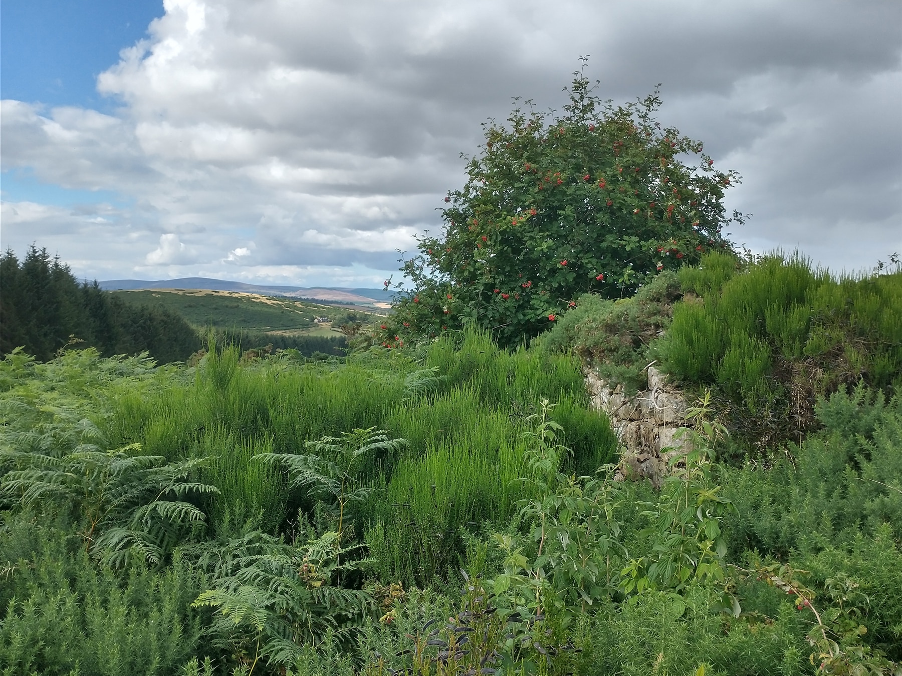
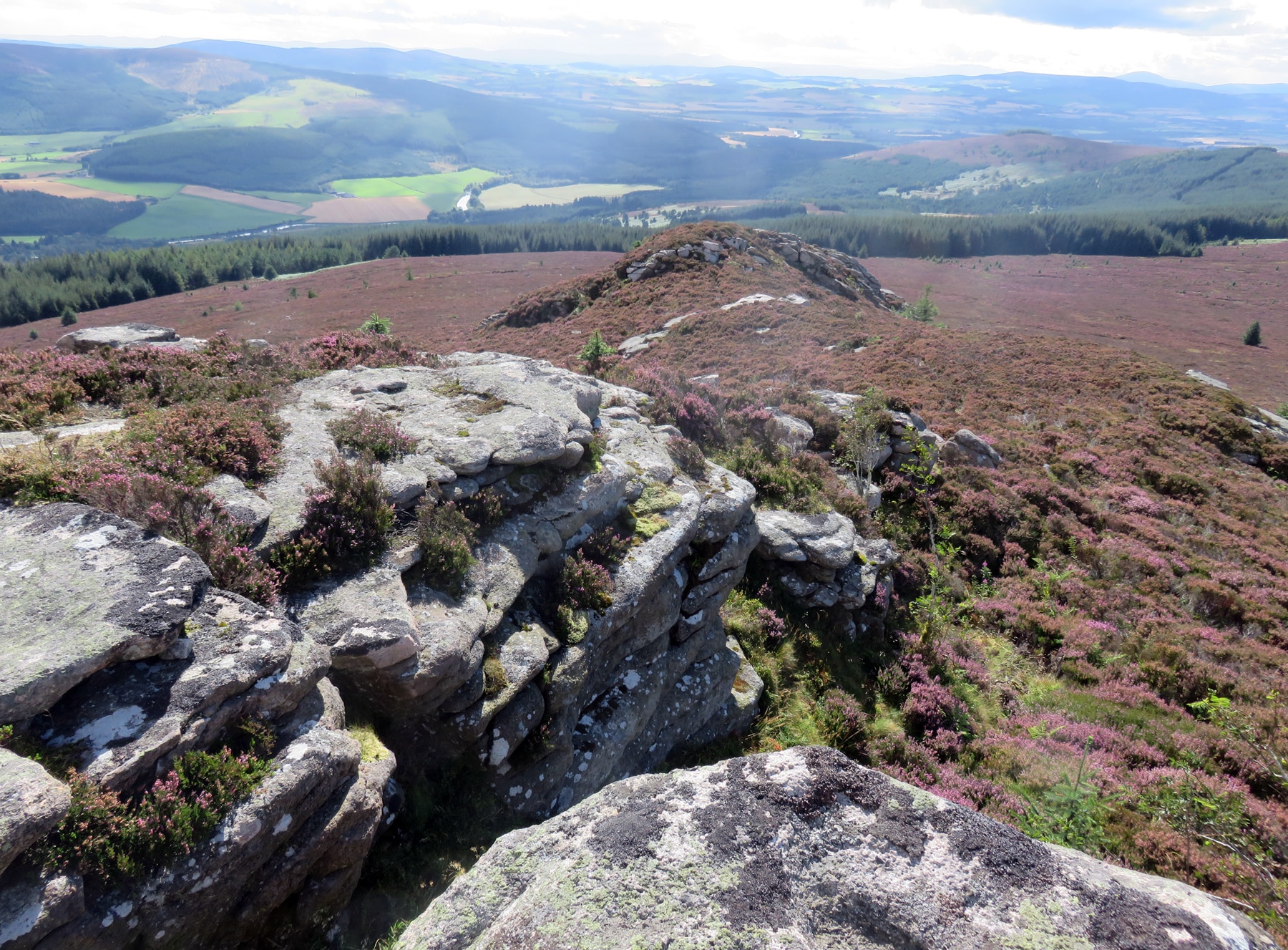
From the base of the hill, Corrennie Moor appears to be in full bloom. It’s the end of summer in northeastern Scotland, and the hilltops are clad in violet heather. Afternoon sun casts shadows through a copse of Scots pine. But from our position halfway up the slope, the Scottish sublime is offset by shoulder-high grass, and sodden moss sucking at our boots. Squinting at the map tells us that we ought to be standing at our destination, a geometric protrusion of stones not more than a meter high. But a sea of spiky gorse spoils our view. There should be an old croft — a rural farmstead — here. We’ll need a higher vantage point to make out what we can’t see right in front of us.
What now appear to be empty wind-swept heights were once jostling with the voices of a rural underclass.
These overgrown uplands have a topographical secret: the braes (or hillsides) are studded with the ruins of stone-built houses and outbuildings, dry-stone enclosure walls, and farmers’ trackways. In the roughly 150 years since these lands were most thickly inhabited, nature has done its work; industrious small farms have been overtaken by gorse and heather, broom and sedges. Such visual cues of wilding can infuse a sense of amnesia across a landscape. Yet these were once busy worlds of commitment and endeavour. What now appear to be empty wind-swept heights were once jostling with the voices of a rural underclass, which — as in so many stories nations tell about themselves — has mostly been written out of regional history.
From the late 18th century and continuing well into the 19th, lowland estates in Scotland witnessed a cascade of social and economic transformations, sweeping away an order that had persisted, at least in part, since feudal times. 1 Capitalist farms, with surveyed boundaries, rent-paying tenants, improved agricultural lands, and value in an emergent real-estate market began to replace common fields and wild edgelands, eroding the peasantry who once had rights to graze their beasts and cultivate strips of land in these places. Amidst this upheaval, the country’s last frontier — largely unpeopled uplands of moor and bog, contiguous with but distinct from settled lowland properties — were colonized, first in extra-legal and then in legal ways. Pressured to withdraw from lands undergoing reform, the landless poor looked elsewhere. Many migrated to swelling towns and cities. But others moved uphill, carving out small squatters’ colonies in braeside redoubts. From the 1830s through the 1850s, as landowners were increasingly grasping the latent value of their upland holdings, property lines were regularized, and squatters dwelling within them were converted into tenants. Or, for those who could not pay even nominal rents, pushed on again.2
Rural heritage is more than grand houses and manicured surrounds. It is a story of resistance and adaptation to a propertied status quo.
In some cases, these hardscrabble communities endured for decades; in others, they collapsed nearly as quickly as they had been established. In the century and more since, rural outmigration and the modern use of uplands for livestock pasturing and timber plantations have combined to erase the crofters’ social and historical legacies. In Scotland as in many other places, sanctioned national heritage has long favored the mansions, gardens, and parklands of the elite, while architectures and landscapes expressing traces of the rural poor lie largely forgotten.
But rural heritage is more than grand houses and their manicured surrounds. It is also a story of the landless, and their resistance and adaptation to a propertied status quo. This is a story that, at least in its aftermath, can still be read in the landscape here in northeastern Scotland — where, ironically, the very rigor of the setting has helped to preserve remnants of the old crofting system, in stone ruins and non-native plant communities. Areas with more productive soils would almost certainly have seen the removal of enclosure walls and abandoned cottages to make way for larger and more productive fields. But on Corrennie Moor and in rural uplands like it, the marks remain of crofters’ active “worlding.”

“Worlding,” as the anthropologist Marisol de la Cadena explains it (following Donna Haraway and Anna Tsing), “is the practice of creating relations of life in a place and the place itself.” 3 In attending to the vestiges of such practice in this place where humans and the rest of nature actively remade each other — “asking large questions in small places,” as the American historian Charles Joyner famously phrased it — our hope is to emphasize the ways in which historical archaeology can enrich social histories and microhistories. 4 As standing archaeology (ruins visible to the eye), these humble sites offer a unique opportunity to reanimate forgotten landscapes shaped by the strenuous efforts of the disenfranchised.
Communities like those whose traces remain on Corrennie Moor ranged from single cottages with a kitchen garden (“kailyard” in Scots) to settlements of ten or more dwellings, each typically comprising a kitchen and a “good room,” and perhaps a low attic space for storage. Each house had its small fields and, occasionally, outbuildings. In contrast to the highly regulated landscape of the estates, the enclosed grounds of braeside settlements occupied at most a few acres. Even at this scale, however, squatters and tenant crofters alike not only established a built landscape, but lastingly transformed hillside ecologies.
Crofters worked to pull an agricultural landscape up toward the hilltops, improving soils, clearing fields, erecting buildings, enclosing, planting.
In effect, the crofters worked to “pull up” an agricultural landscape from below toward the hilltops — improving soils, clearing and levelling fields, erecting buildings, enclosing, and planting. Typical field crops were oats and bere (an ancient barley) or potatoes and turnips, while kailyards grew kail (a type of cabbage), along with raspberries, gooseberries, and currants. 5 Despite the marginal environment, with its meager soils and short growing season, cultivation was sufficiently intensive that vegetation patterns remain conspicuous — lines cutting across the contour of hillsides, lynchets (the ridges or terraces left by hillside plowing), transformations of drainage patterns, and surviving communities of garden plants and valley cultivars. We should not, for example, find regal chestnut trees this distance up a Scottish hill. Such trees should be downslope, lining a carriageway leading to a mansion. Yet there they are, where colonists seeking to beautify their smallholdings planted them. Here is a stand of rowan trees, similarly telltale. Rowans are native uplanders. But crofters planted rowans at the edges of their fields, in rows we can still discern. Not only are they beautiful, but rowans were believed to keep malevolent spirits away. 6 Locating a row or even a solitary specimen on hillside often means that we have identified the boundary of a farmstead or the location of its cottage.

The landless settled on nutrient-impoverished hillsides for reasons bound up with the significance of commonties. A commonty is a medieval anachronism, a Scottish legal designation for “land possessed in common by different proprietors.” 7 Not be confused with English common lands, used by the peasantry on a single estate, commonties were by custom shared among surrounding estates and their dependents as sources for fuel and stone for building, as well as for grazing animals. At the turn of the 19th century, most commonties in this part of Scotland lay toward the west, where the landscape tilts into glacially weathered hills, outriders to the Highlands. Much of this land, at elevations of between 200 and 500 meters along vast interfluves, was then considered “waste.” 8 This provided a protective legal ambiguity for those who wished to squat, “rivin in” or breaking a patch of ground unmolested by landlords.
Yet the indeterminate status of unimproved areas made them ripe for economic and social reconfiguration.
Yet the indeterminate status of unimproved areas also made them ripe for economic and social reconfiguration. As squatter encroachment began to reshape the commonties, landed interests increasingly came to recognize their potential. Neighboring landowners colluded to use their wealth, the courts, and a century-old law known as the Act for the Division of Commonties (1695) to carve the hillsides up. 9 In the process, many looked to commonties with a boosterism comparable to that which, in the same era, was animating speculators on frontiers in the Americas and Australia, with the result that crofter colonies were actively promoted by lairds seeking to establish settlements that could expand estates’ cultivated areas, not to mention their rent rolls.
Squatters and crofter colonists had different legal status; while sanctioned crofters normally held short-term leases, squatters had no tenancy agreements, and were subject to stereotypes about trespassing and related forms of othering levied on the landless. 10 With that said, in many places, the categories were easily elided. Unlike lowland tenant farmers, who typically had to abide by onerous improvement leases, upland crofters paid only token rents, and tended to enjoy a good deal of practical freedom. Squatters, moreover, could be tolerated where they were seen to be economically useful; indeed, a squatter could become a respectable crofter once inscribed on the rent rolls. 11 Both squatters and crofters were subsistence farmers, and both sold their labor to wealthier tenants, or to landlords. Settlements of both types tended to cluster at the edges of commonties, where proximity to the estate landscape of fully improved farms provided opportunities for selling labour, crafts, and surplus agricultural produce. In the process, the inhabitants — like colonists everywhere — became shock troops in a battle to transform moorland and moss into spaces of productive economic activity.
Traversing Hillsides
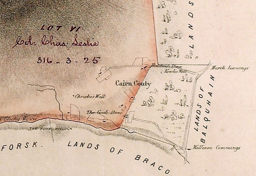
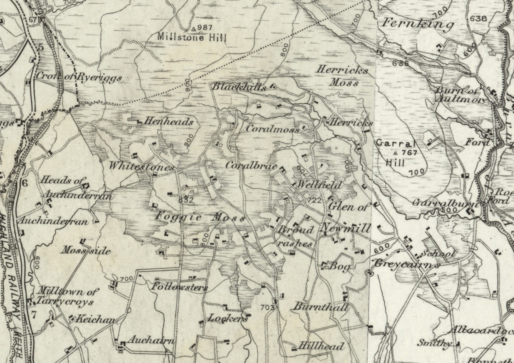
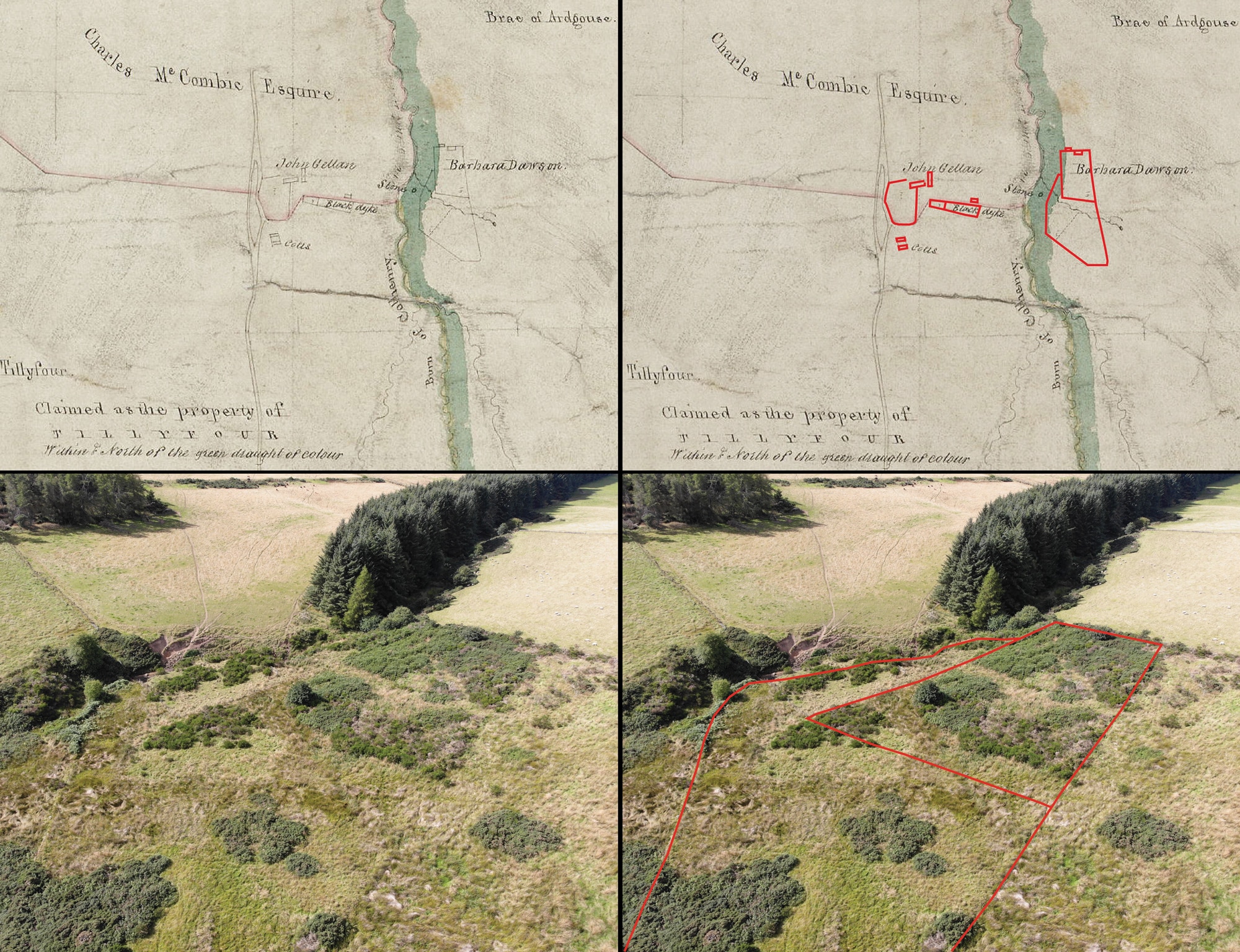
Our present-day search for upland settlements begins in the University of Aberdeen’s Special Collections, the largest historical archive in northern Scotland. Land surveyors in the early 1800s were commissioned to walk the metes and bounds of commonties as part of the legal process of apportioning what had been shared braes among adjoining estates, and it is here, in the records of long defunct survey firms, that the first documentary glimpses of these enclaves of the landless come to life. Surveyors employed local informants to help fill in their maps with local knowledge about place names and land use, often relying on such data to interpret the very boundaries of commonties, which had been negotiated, for centuries, through customary use. 12
Yet even as the surveys drew on long-established habit, the new phase of estate-approved settlement began to extinguish the traditional freedom of the commonties. The uplands began to be treated instead as fungible property, a defined quantity of ground that could be exploited, bought, and sold. Comparing division plans from the 1830s and ’40s with maps produced in 1860s and 1890s under the auspices of the first national mapping system, the Ordnance Survey, we can see how the sinuous irregularity of squatting settlements was slowly but surely replaced by the regulated geometry of estate-sponsored colonies.
The sinuous irregularity of squatting settlements was slowly replaced by the regulated geometry of estate-sponsored colonies.
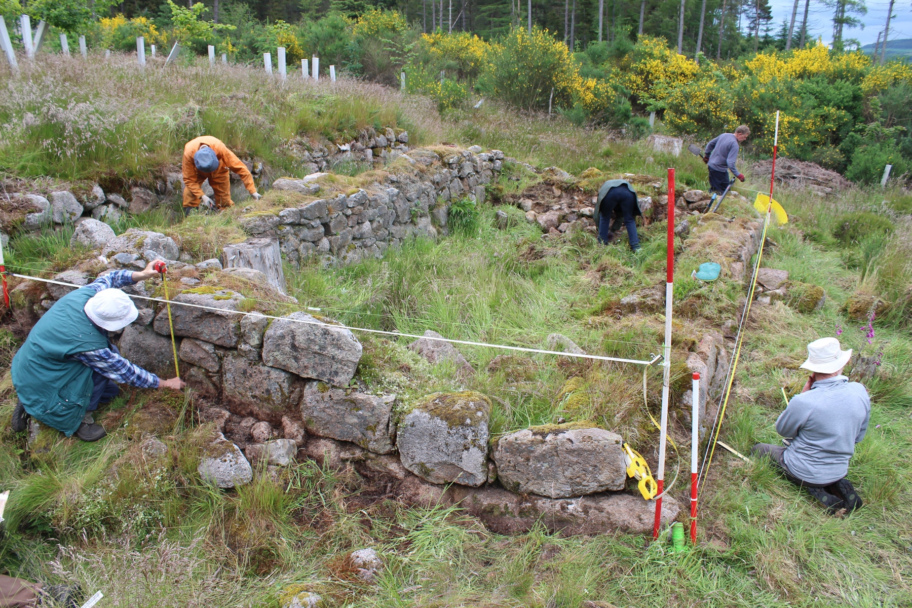
Cartographic records are helpful for placing erstwhile settlements in the landscape. But as documents produced in particular moments, with particular goals in mind, they offer at best a partial picture. It’s in ground truthing, visiting sites on foot to confirm what we’ve seen on the maps, that we begin to fill in the outlines sketched in historical plans. In this case, if we don’t go to look, no one will know what these settlements were like, what remains of them, or even that they existed. The social history they represent will vanish.
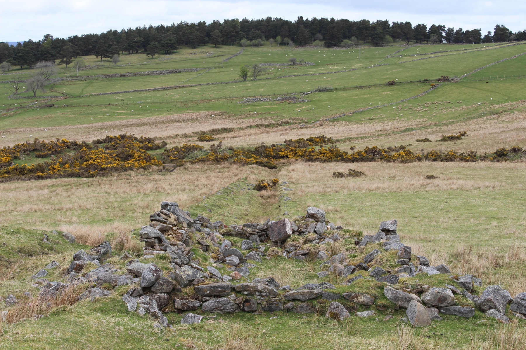
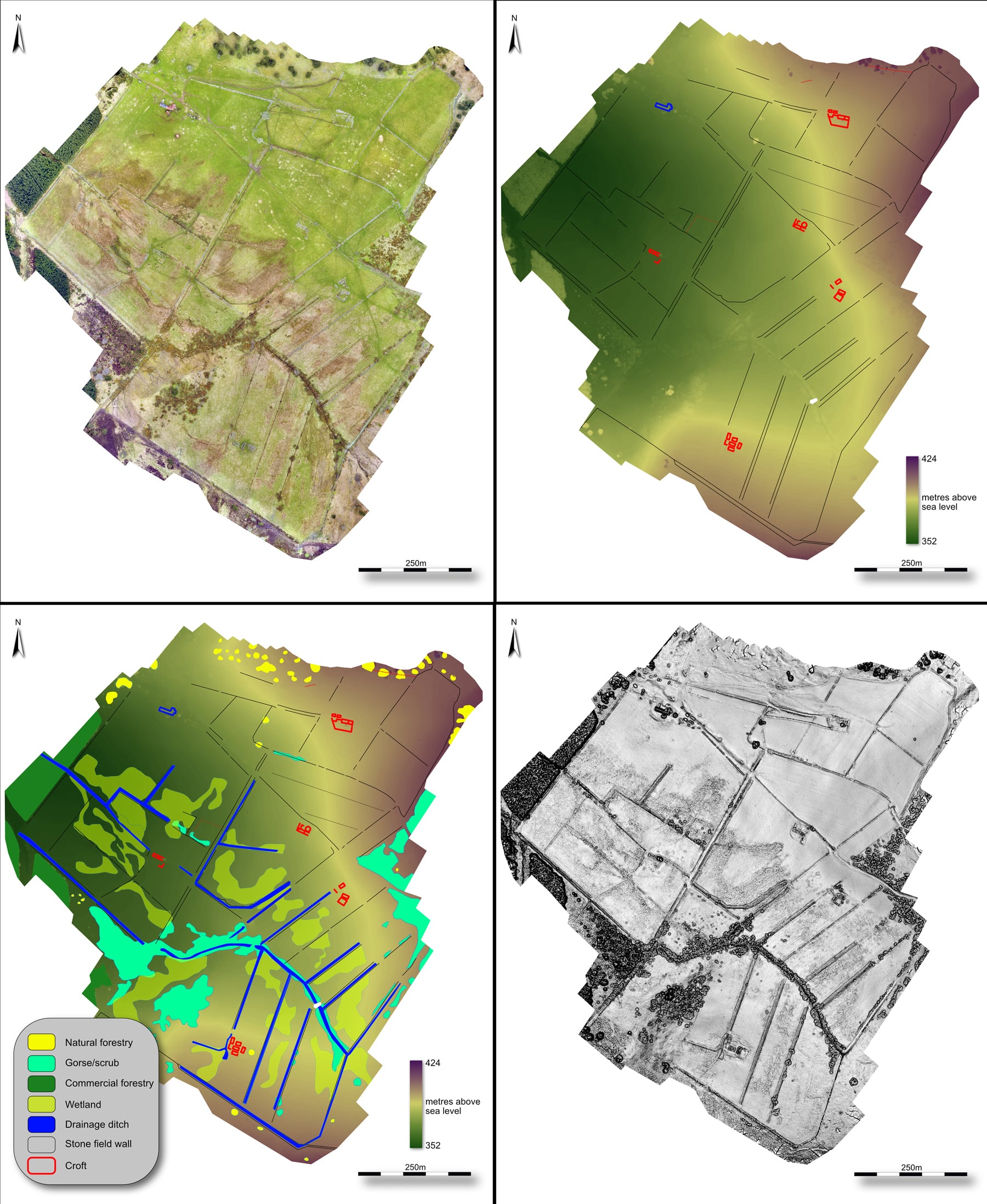
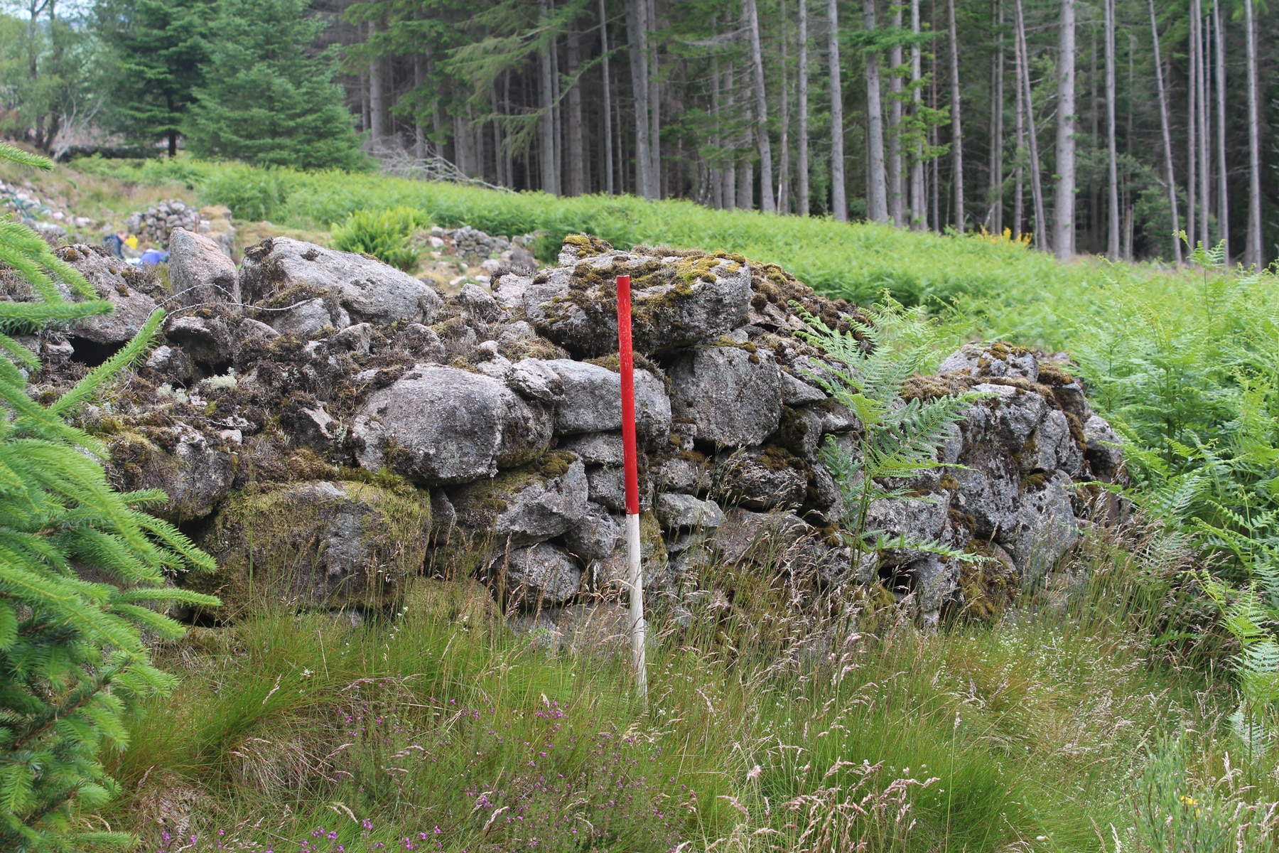
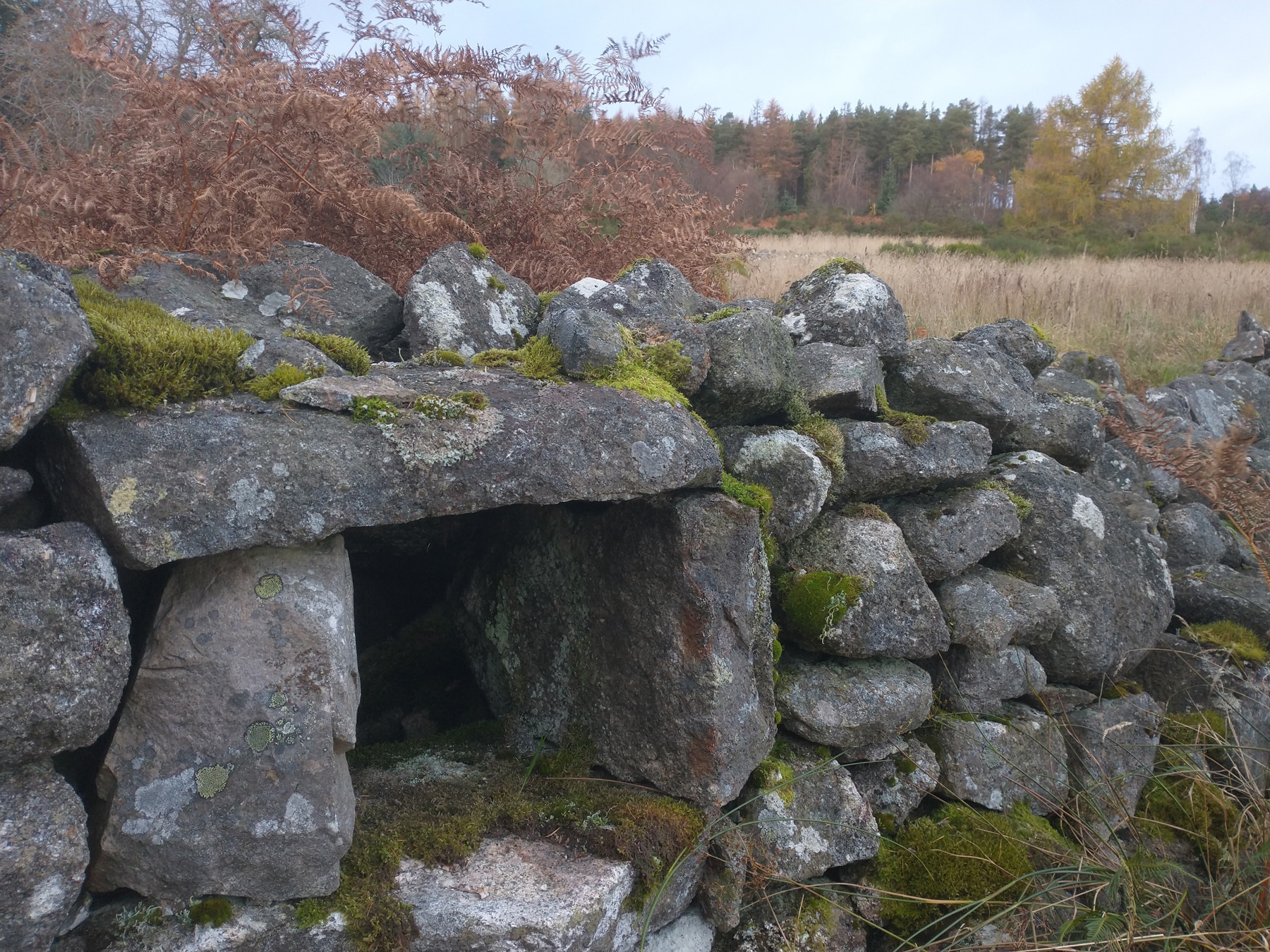
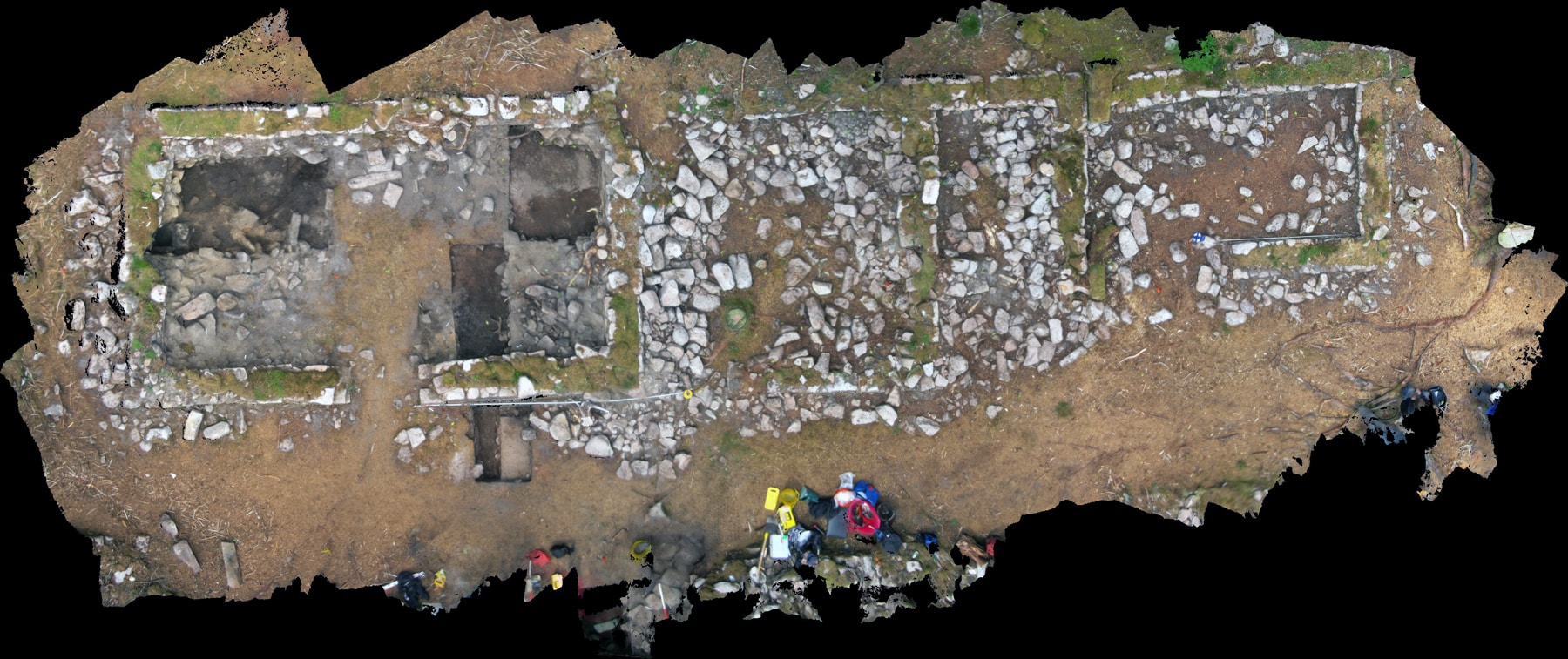
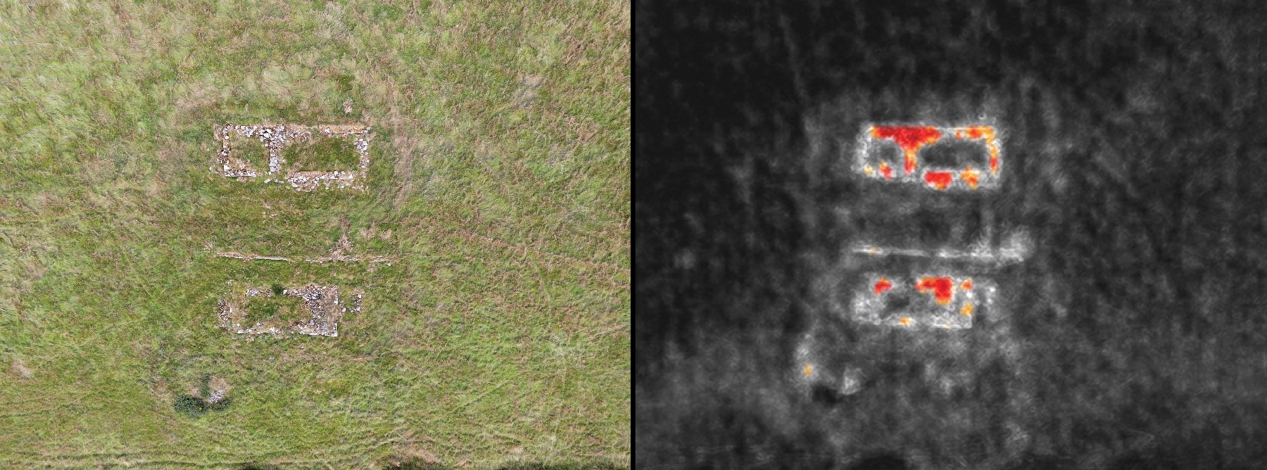
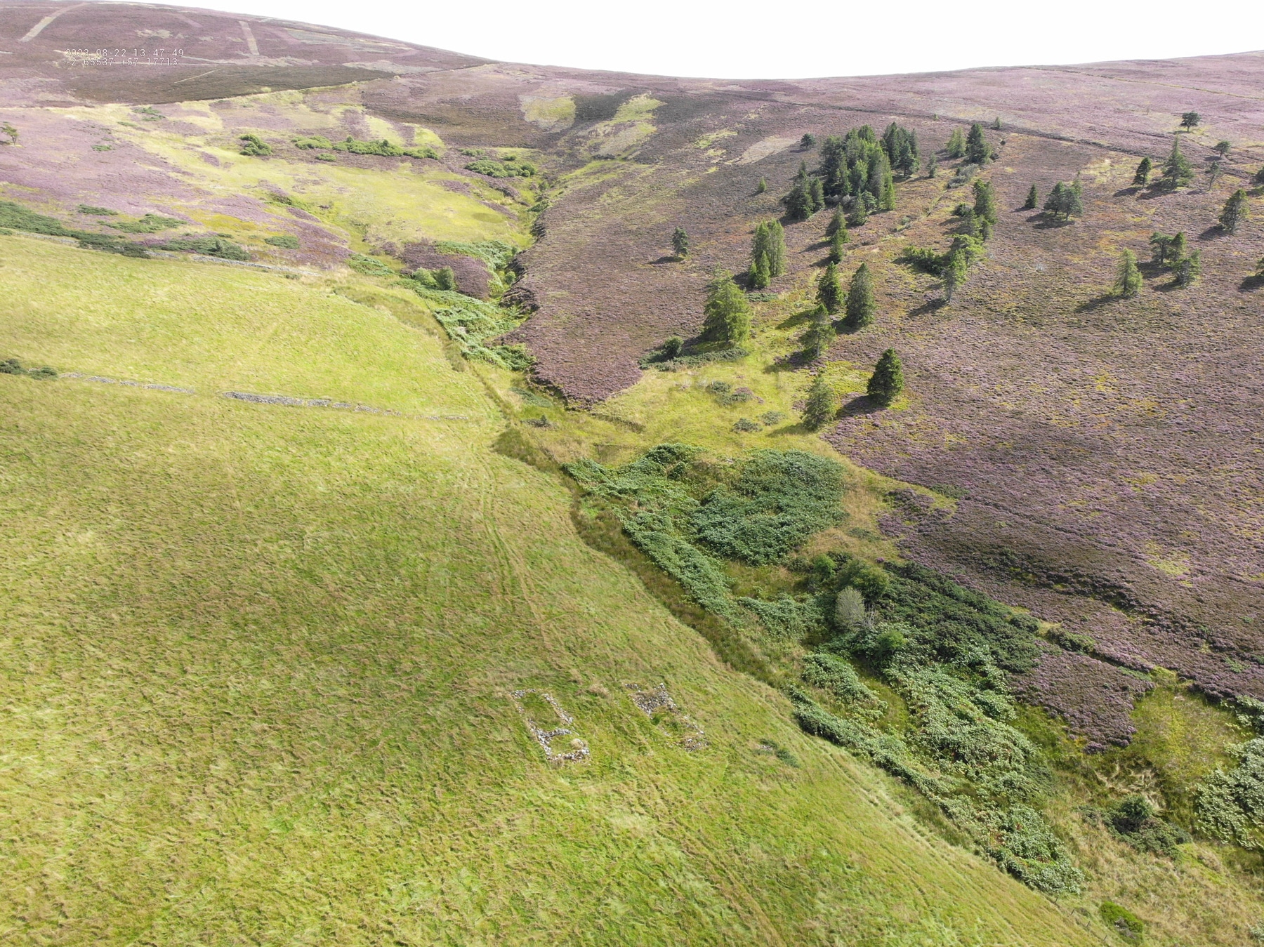
On the west side of Corrennie Moor, at a place known as Tillyfour Hill, we’ve identified a number of conspicuous features — enclosure walls and other lumps and bumps cloaked in vegetation — that appear to be good candidates for the remains of squatter encroachment. Our initial field observations over alternately stony and boggy ground, aided by satellite imagery, have helped to confirm that the sites still exist as standing archaeology. Learning to read the coursing in stone walls can help with basic dating: the relations of abutting walls tell us which structures came first and which were added later. But it is low-level drone photography that is bringing details of these cultural landscapes into the sharpest relief.
If we don’t go to look, no one will know what these settlements were like, what remains of them, or even that they existed. Their social history will vanish.
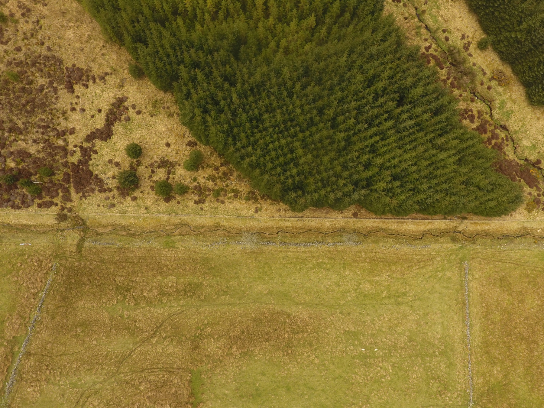
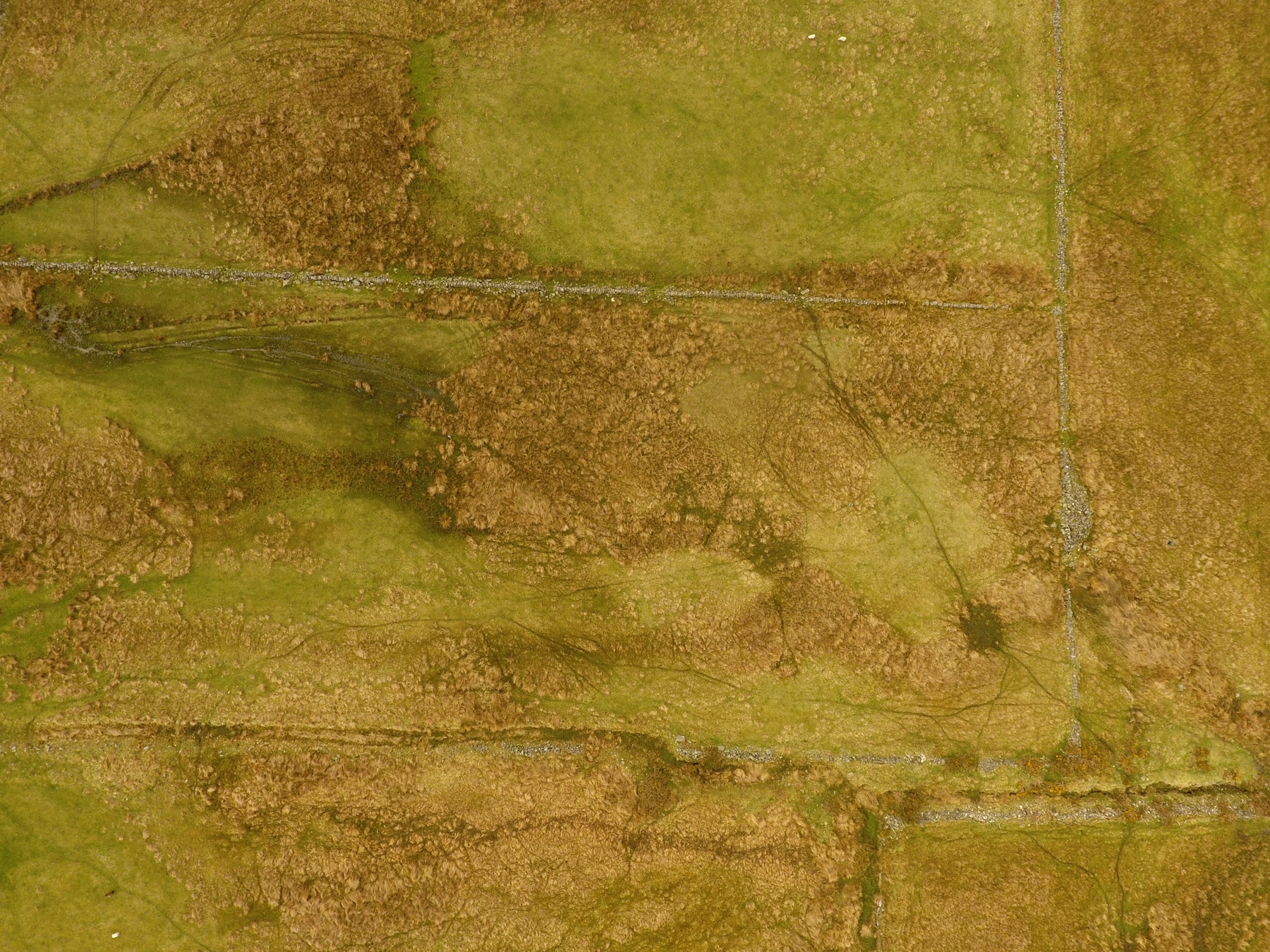
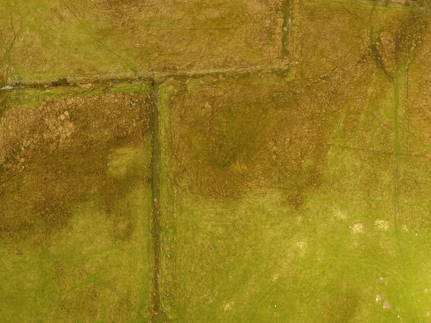
Drone photography not only allows us a bird’s eye view, but enables us to inspect and interpret details and distinctions difficult to discern on the ground. Conspicuous vegetation patterns, for instance, are good indicators of human intervention. In kitchen gardens and fields, where settlers enriched their soil with peat and organic waste, luxuriant growth still follows the contours of these improvements to the growing matrix. With the use of thermal cameras, we can also see structures no longer visible on the surface, such as walls where all but the foundation stones have been robbed for other purposes. The contours of old trackways and ditches can be discerned in the ways in which they encourage or inhibit the growth of grasses.
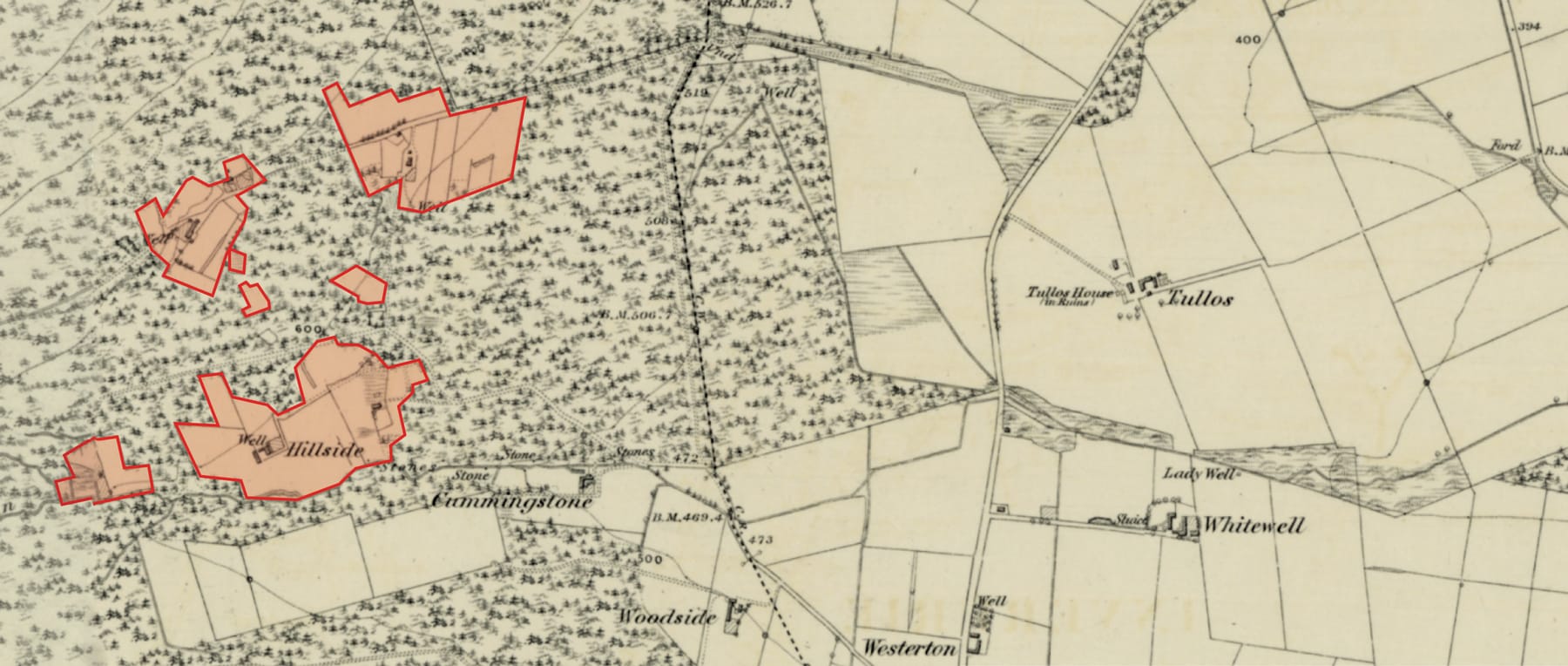
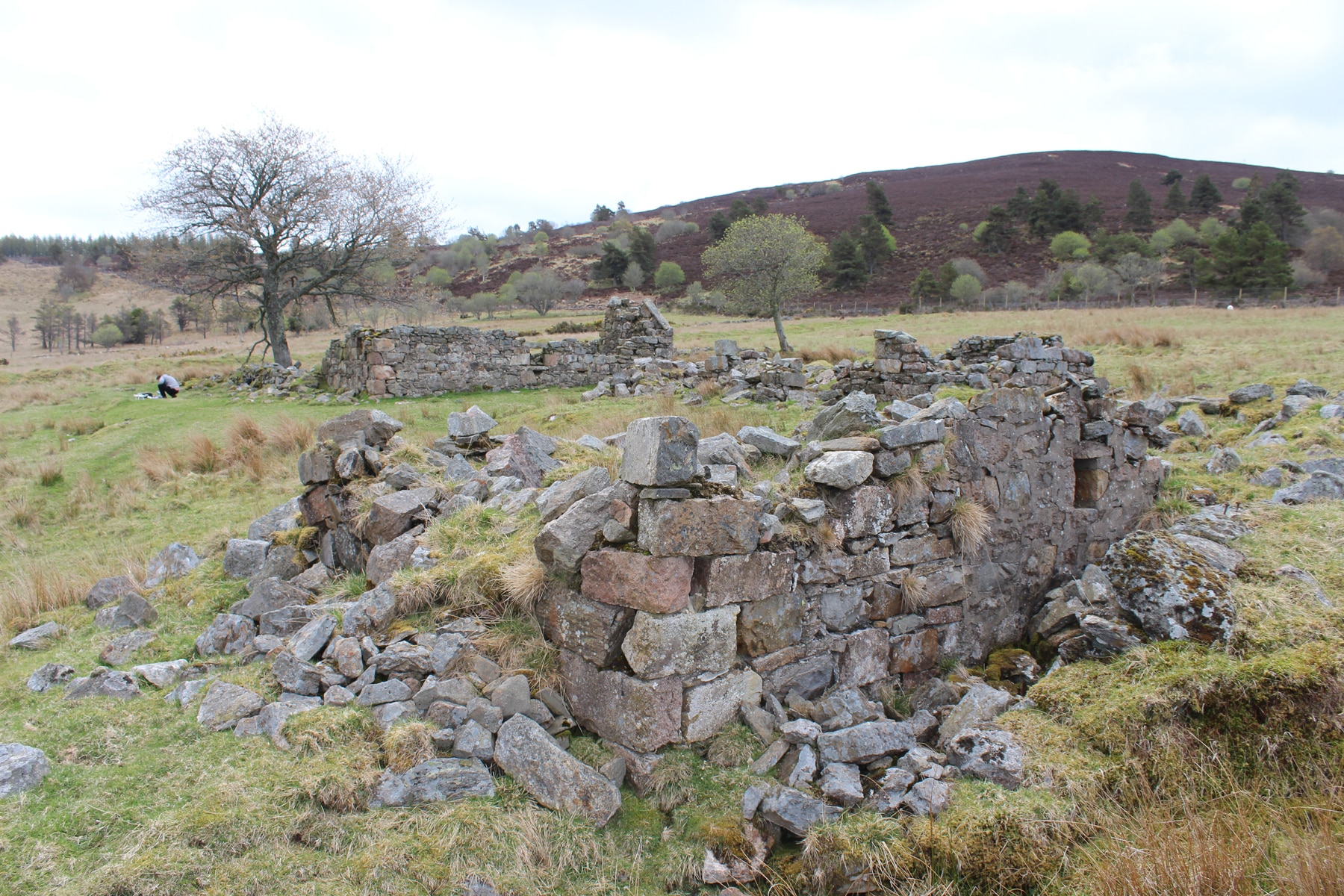
North of Corrennie Moor lies the whaleback hill of Bennachie, with a granitic tor or outcrop at its summit, known as Mither Tap, visible for miles around. At the Bennachie Colony, the best documented settlement in the region, census records combine with the remains of stone-built cottages to hint at the conditions in which crofters found themselves. The colony is doubly interesting because it preserves both a “squatter phase” and a later period when residents were tenants of the Balquhain estate. A croft known as Shepherd’s Lodge, for instance, began as a two-room cottage when it was settled by the Littlejohns in the 1830s, although a storage room and a cart shed were added as the family expanded; as many as twelve souls called this cottage home.
A stone’s throw down the slope, Hillside croft was occupied by the McDonald family from 1860, after the division of the commonty — and Hillside tells a completely different story. The cottage housed just three people. It was a larger, more regular structure, and may have been influenced by the improved designs made available in pattern books that were found throughout the northeast in the period. What is more, the croft featured a U-shaped steading around the back of the cottage — effectively a set of outbuildings — that were themselves built up from an older cottage, animal pens, and the rear wall of the family dwelling. These upgraded buildings served to separate the “business end” of the farm, with its animals and muck, from the hygienic space of the house, which faced the kailyard and the valley below. If the settlement pattern at Shepherd’s lodge evokes a life of rural poverty and a dwelling heaving with bodies, Hillside tells a story of improvement and the spatial distinctions that went with it. 13
The Legacy of Land Use
Significant tracts of land once subject to the improving zeal of smallholders and lairds alike now lie hidden under the canopies of plantation monoculture, bioturbated by the roots of conifers like larch, spruce, and fir. While most present-day plantations in this country contain trees planted during the second half of the 20th century, the history of plantations here goes back to the end of the 18th century. 14 Renewed planting efforts were spurred by WWI, when much of this land came into the possession of the Forestry Commission and its successor, Forestry and Land Scotland.
Where piecemeal colonization managed to reclaim hillsides for agriculture or stock rearing, smallholders could be victims of their own success.
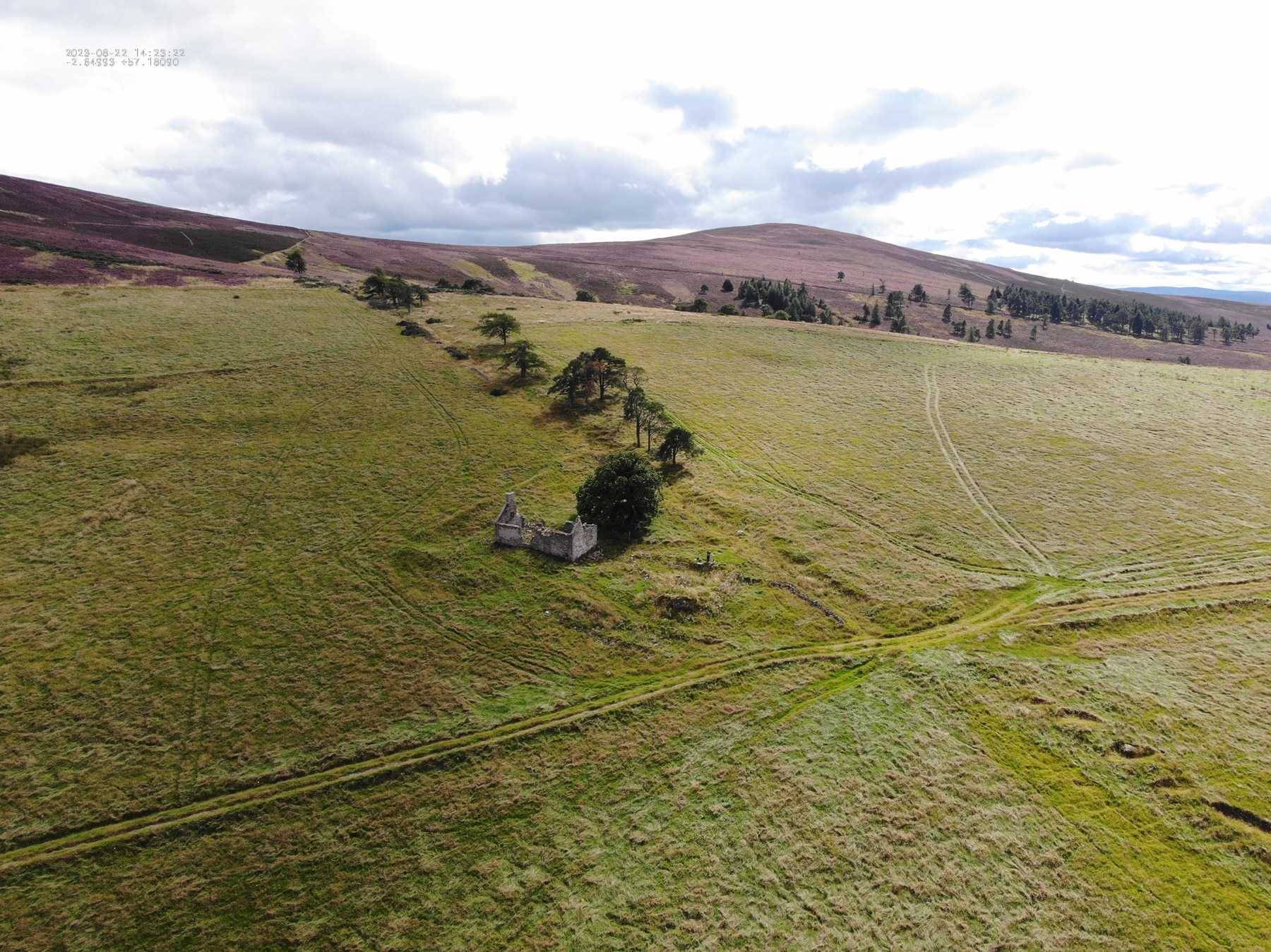
If forestry shrouds a good proportion of the former upland communities, the legacy of fully commoditized hill farming has obscured an equal or larger portion. Where piecemeal crofter colonization did manage to reclaim hillsides for agriculture or stock rearing, smallholders could be victims of their own success. Nascent communities — illegal or legitimate — could be upended when landlords evicted crofters altogether, in favor of amalgamating tiny crofts into larger, more productive units. Several locations illustrate this evolution of landscape from piecemeal squatter encroachment and crofter colonization to the formation of regularized capitalist farms. Corrennie Moor preserves a particularly fine example at the headwaters of Culthibert Burn, on the north side of the moor. Here, the remains of a loosely organized pattern of rectangular and sub-rectangular dry-stone enclosures, some with parallel drainage ditches, testify to almost a century of “rivin in,” established by squatters, expanded and tidied by crofters, and finalized by capitalist farmers. Near these enclosure walls stand the ruins of cottages, many with outbuildings fitted out in ways that tell us about their functions: a mill for grinding cereal crops, byres for pasture animals, small barns for storing produce.
The Ordnance Survey confirms the pattern of slow transformation suggested at Culthibert Burn, in which less successful crofts were emptied, and their fields subsumed in neighboring farms. The process was completed at some point early in the 20th century, by which time a single cottage and associated steadings, located at the lowest point of the hill, formed the focal point of a much larger farm that included all the surrounding enclosures. In the present day, these walls, long abandoned, have largely fallen in. Only the ongoing upkeep of a dry-stone dike marking the edge of the whole improved area testifies to the unity of this enlarged farm. Not even the surviving roofed cottage is lived in, although our visits to the hillside suggest that the ruin is used as temporary shelter for farm workers who manage livestock across an extensive system of upland pasture connected with a much larger commercial farm located elsewhere.
It’s a narrative that begins with the extinction of common lands, and the formalization of private property as the foundation of self-interest.
The history of crofters’ arrival, habitation, and abandonment, still legible at places like Corrennie Moor and the Bennachie Colony, represents the last chapter in a narrative of colonization in Scotland’s wild places that began at least as far back as the feudal period. On one level, the work of documenting such changes in land tenure and land use is a process of giving voice to a history from below that has, at best, been undervalued, and at worst silenced within grand narratives of progress. On a still deeper level, the story tells of the emergence of private property, and the role of the landless in the vanguard of that process.
It’s a narrative that, in rural Scotland and other parts of Britain, begins with the history of enclosure, the extinction of common lands, and the formalization of private property as the foundation of self-interest. And it’s a narrative that continues here and elsewhere, through centuries of colonialism and imperialism. It connects colonists in 18th-century Maine — where a backcountry culture of squatting emerged in resistance to an absentee landowning elite — to the informal settlements of 20th century Harare, Zimbabwe, demolished by city planners, and to precarious tenants in the Downtown Eastside neighborhood in Vancouver, recently displaced by developers. 15 In all these instances, the labor of people with insecure tenure, without capital and without power, have prepared the ground for capital-owning, propertied classes.
Of course, this narrative arc results in different outcomes. In places like Vancouver, gentrification has created a retail and entertainment landscape. In rural northeast Scotland, the irony is that, although today’s land values can be linked to the abandonment of these uplands and the and silencing of their history, the narrow commercial potential of these hillsides has actually helped to preserve this built landscape, giving rise to our own interventions.


If you would like to comment on this article, or anything else on Places Journal, visit our Facebook page or send us a message on Twitter.